How Rainfall Data Predicts Drainage Problems Before They Start
Every drainage failure begins with rain. That statement sounds obvious, but the deeper truth is that most homeowners don't realize their drainage problems are entirely predictable — often years before the first puddle appears in their basement. By analyzing historical rainfall data, precipitation frequency estimates, and site-specific topography, it's possible to conduct a rainfall runoff analysis that reveals exactly where water will go, how fast it will get there, and whether your property's drainage infrastructure can handle the load.
The science behind this isn't new. Civil engineers, hydrologists, and municipal planners have used precipitation data to design stormwater systems for decades. What is new is the accessibility of this data and the tools available to apply it at the residential scale. At Low Point Labs, we believe every homeowner deserves the same level of drainage intelligence that a commercial developer gets — and it all starts with understanding what the rain is telling you.
This article breaks down how rainfall data works as a predictive tool for drainage problems, how to interpret precipitation patterns for your specific property, and what you can do with that knowledge to protect your home.
Understanding Rainfall Data: More Than Just Inches Per Year
When most people think about rainfall, they think about annual totals — "We get about 40 inches of rain a year." But annual totals tell you almost nothing about drainage risk. What matters for precipitation drainage impact is the intensity, duration, and frequency of individual storm events. A property that receives 40 inches spread evenly across 200 gentle rain events faces a completely different drainage reality than one that receives the same 40 inches concentrated in 30 intense storms.
Rainfall data is typically organized into what hydrologists call Intensity-Duration-Frequency (IDF) curves. These curves answer a critical question: for a given location, how intense can rainfall be over a specific duration, and how often can you expect that intensity to recur? For example, an IDF curve might tell you that in Atlanta, Georgia, a 1-hour storm producing 3.2 inches of rain has a 1% chance of occurring in any given year — that's the so-called "100-year storm."
The gold standard for this data in the United States is NOAA Atlas 14, which provides precipitation frequency estimates for every location in the country. Atlas 14 data is what engineers use to design culverts, detention basins, and storm sewer systems. It's also what should inform the design of your residential drainage — though it rarely does.
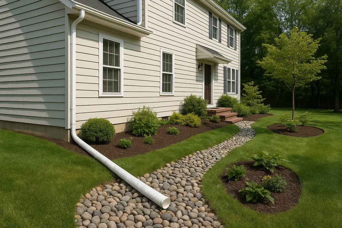
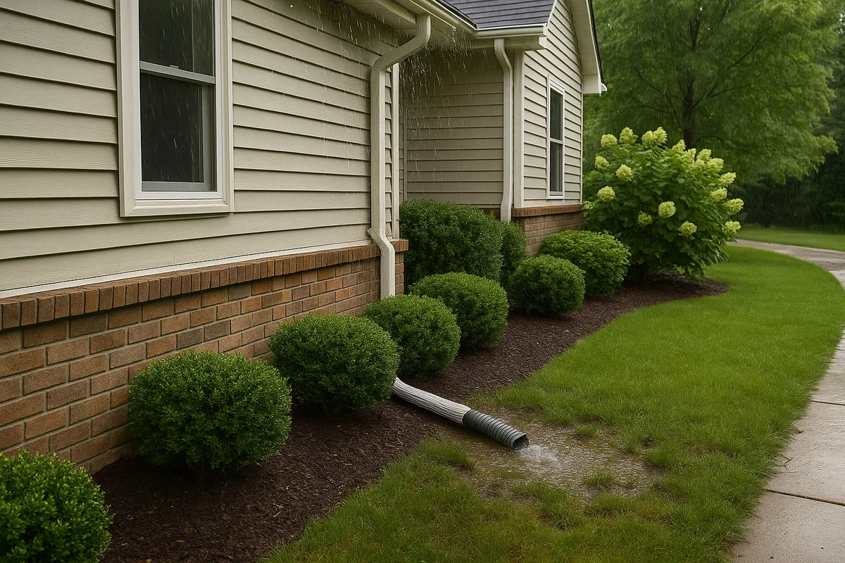
The reason this matters at the property level is straightforward: your gutters, downspouts, French drains, swales, and grading were all designed (or should have been designed) to handle a specific volume of water over a specific time period. If you don't know what storms your system was designed for, you can't know when it will fail. And when drainage systems fail, the consequences range from soggy lawns to catastrophic foundation damage.
Get Your Drainage Intelligence Report™
Start a free trial and generate reports on demand.
How Rainfall Runoff Analysis Works at the Residential Scale
A rainfall runoff analysis is the process of calculating how much stormwater a given area of land will generate during a specific storm event, and where that water will flow. At its core, it combines three variables: how much rain falls, how much of that rain becomes runoff (versus soaking into the ground), and the topographic path that runoff follows.
The most widely used method for small-site hydrology is the Rational Method, expressed as Q = CiA, where Q is the peak runoff rate, C is the runoff coefficient (a value between 0 and 1 representing how much rainfall becomes runoff), i is the rainfall intensity, and A is the drainage area. For a typical residential lot, this calculation can be done for each sub-area of the property — the roof, the driveway, the lawn, the patio — and the results combined to determine total peak flow.
Consider a practical example. A 2,000-square-foot roof with a runoff coefficient of 0.95 (nearly all rain becomes runoff on a roof) during a 1-hour storm with 2 inches of rainfall intensity generates approximately 2,375 gallons of runoff. That water has to go somewhere — through gutters, into downspout extensions, across the yard, and eventually off the property or into the ground. If any link in that chain can't handle the volume, you get ponding, erosion, or infiltration into your foundation.
What makes residential rainfall runoff analysis particularly revealing is that it often exposes a mismatch between the original drainage design and current conditions. A property that was properly graded when it was built 20 years ago may now have settled soil, added impervious surfaces (patios, driveways, sheds), or altered landscaping that fundamentally changes how water moves. The rainfall hasn't changed — but the property's response to it has.
Runoff Coefficients: Why Your Surfaces Matter
The runoff coefficient is one of the most important variables in any drainage analysis, and it varies dramatically by surface type. Asphalt and concrete have coefficients of 0.85–0.95, meaning 85–95% of rainfall becomes runoff. A well-maintained lawn on flat ground might have a coefficient of 0.10–0.20, meaning most rainfall infiltrates. Compacted clay soil with sparse vegetation might be 0.40–0.65.
This is why the trend toward increased impervious coverage on residential lots has such a profound effect on drainage. Every square foot of lawn that gets replaced by a patio, driveway extension, or pool deck increases the total runoff volume from the property. A property that was originally 30% impervious and is now 55% impervious might generate nearly double the stormwater runoff during the same storm event — without a single change to the drainage infrastructure.
Time of Concentration: The Speed Factor
Another critical concept in rainfall runoff analysis is the time of concentration (Tc), which is the time it takes for water to travel from the most hydraulically remote point of a drainage area to the outlet. On a residential property, this might be the time it takes for rain falling on the far corner of the backyard to reach the street gutter or storm drain.
Time of concentration matters because shorter Tc values mean higher peak flows. A steep, smooth, impervious surface delivers water quickly, creating sharp spikes in runoff. A long, gently sloped, vegetated surface slows water down, spreading the flow over time. When you pave over a section of yard or remove vegetation from a slope, you're not just increasing the volume of runoff — you're accelerating it, which can overwhelm downstream drainage components that were sized for a slower delivery rate.
Reading Rainfall Drainage Patterns on Your Property
Historical rainfall data tells you what to expect from the sky. But understanding rainfall drainage patterns requires connecting that data to your specific landscape. This is where topographic analysis becomes essential — and where most homeowners are flying blind.
Every property has a drainage pattern that's dictated by its topography. Water follows gravity, flowing from high points to low points along the path of least resistance. On a well-designed residential lot, these flow paths are intentional: the yard slopes away from the foundation at a minimum of 2% grade (about 1/4 inch per foot), swales direct water to the street or a designated outlet, and low points are located away from structures.
But many properties have unintentional drainage patterns that only become apparent during significant rain events. A subtle depression in the backyard that collects water from three neighboring properties. A grading reversal near the foundation caused by years of soil settlement. A retaining wall that redirects sheet flow toward the garage. These patterns are invisible during dry weather but become critical failure points during storms.
The most effective way to map rainfall drainage patterns is through a combination of topographic survey data and hydrologic modeling. High-resolution elevation data — whether from a professional survey, LiDAR data, or advanced analysis tools — can reveal flow paths, accumulation points, and watershed boundaries that aren't visible to the naked eye. When you overlay this topographic intelligence with local rainfall data, you get a comprehensive picture of how your property performs under stress.
Identifying Contributing Drainage Areas
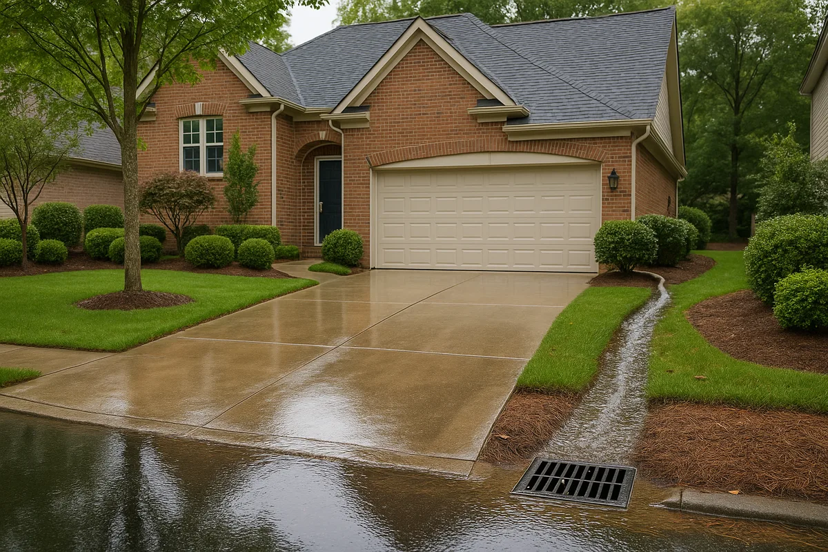
One of the most common surprises homeowners face is discovering that their drainage problem isn't caused by rain falling on their property — it's caused by rain falling on their neighbors' properties and flowing onto theirs. In hydrology, this is called the contributing drainage area or watershed, and it can extend well beyond your property lines.
A property at the bottom of a gentle slope might have a contributing drainage area five to ten times larger than its own lot. During a moderate storm, it's not just managing its own runoff — it's managing runoff from the entire uphill area. This is why two adjacent properties with identical grading and drainage infrastructure can have completely different outcomes: the one at the low point of the neighborhood receives far more water.
Understanding your contributing drainage area is fundamental to predicting drainage problems. If you know the total area draining to your property, the runoff coefficients of the surfaces in that area, and the rainfall intensity for your design storm, you can calculate the total volume of water your property must handle. That number often shocks homeowners — and explains why their existing drainage systems are overwhelmed.
The Role of Soil in Rainfall-Driven Drainage Problems
Rainfall data and topography tell you how much water arrives and where it goes on the surface. But soil determines what happens next. The infiltration capacity of your soil — how quickly it can absorb water — is the critical variable that determines whether rainfall becomes surface runoff, subsurface flow, or standing water.
The USDA Natural Resources Conservation Service (NRCS) classifies soils into four Hydrologic Soil Groups (HSGs) based on their infiltration characteristics. Group A soils (sands and gravels) have high infiltration rates and generate little runoff. Group D soils (heavy clays, soils with high water tables, or shallow bedrock) have very low infiltration rates and generate the most runoff. Groups B and C fall in between.
You can look up the soil types on your property using the NRCS Web Soil Survey, which provides detailed soil maps and data for any location in the United States. This free tool will tell you your soil's hydrologic group, depth to water table, depth to restrictive layers, and other characteristics that directly affect drainage performance.
The precipitation drainage impact on properties with Group C and D soils is dramatically different from those with Group A and B soils. During a 2-inch-per-hour rainfall event, a sandy Group A soil might infiltrate 1.5 inches per hour, leaving only 0.5 inches as surface runoff. A clay Group D soil might infiltrate only 0.1 inches per hour, sending 1.9 inches — nearly all of it — across the surface. For a 10,000-square-foot lot, that's the difference between 312 gallons and 1,184 gallons of surface runoff per hour.
Antecedent Moisture Conditions
Soil infiltration capacity isn't a fixed number — it varies based on how wet the soil already is. Hydrologists call this the antecedent moisture condition (AMC), and it has a profound effect on drainage outcomes. Soil that's been dry for two weeks might absorb the first inch of rainfall with no runoff at all. The same soil after three days of steady rain might be saturated, generating runoff from the very first drop.
This is why back-to-back storm events are so much more damaging than isolated ones. The first storm saturates the soil, and the second storm — even if it's less intense — produces far more runoff because the ground can't absorb any more water. Rainfall data that includes storm sequencing and seasonal patterns is therefore more valuable than data that only looks at individual events.
In practice, this means that drainage systems designed for a single storm event may fail during wet seasons when the soil never fully dries out between storms. A well-designed drainage system accounts for worst-case antecedent moisture conditions, not just worst-case rainfall intensity.
Design Storms: The Benchmarks That Drive Drainage Engineering
When engineers design drainage systems, they don't design for every possible storm — they design for a specific "design storm" that represents an acceptable level of risk. Understanding design storms is essential for homeowners who want to evaluate whether their drainage infrastructure is adequate.
Design storms are defined by their recurrence interval, which is the average time between storms of a given intensity. Common design storms include:
- 2-year storm: A relatively frequent event with a 50% chance of occurring in any given year. Residential gutters and downspouts are typically sized for this level.
- 10-year storm: A moderate event with a 10% annual probability. Many residential drainage systems, including yard grading and swales, are designed to this standard.
- 25-year storm: A less frequent but significant event. Municipal storm sewers in residential areas are often designed to this level.
- 100-year storm: A severe event with a 1% annual probability. Floodplain regulations and major infrastructure are designed to this standard.
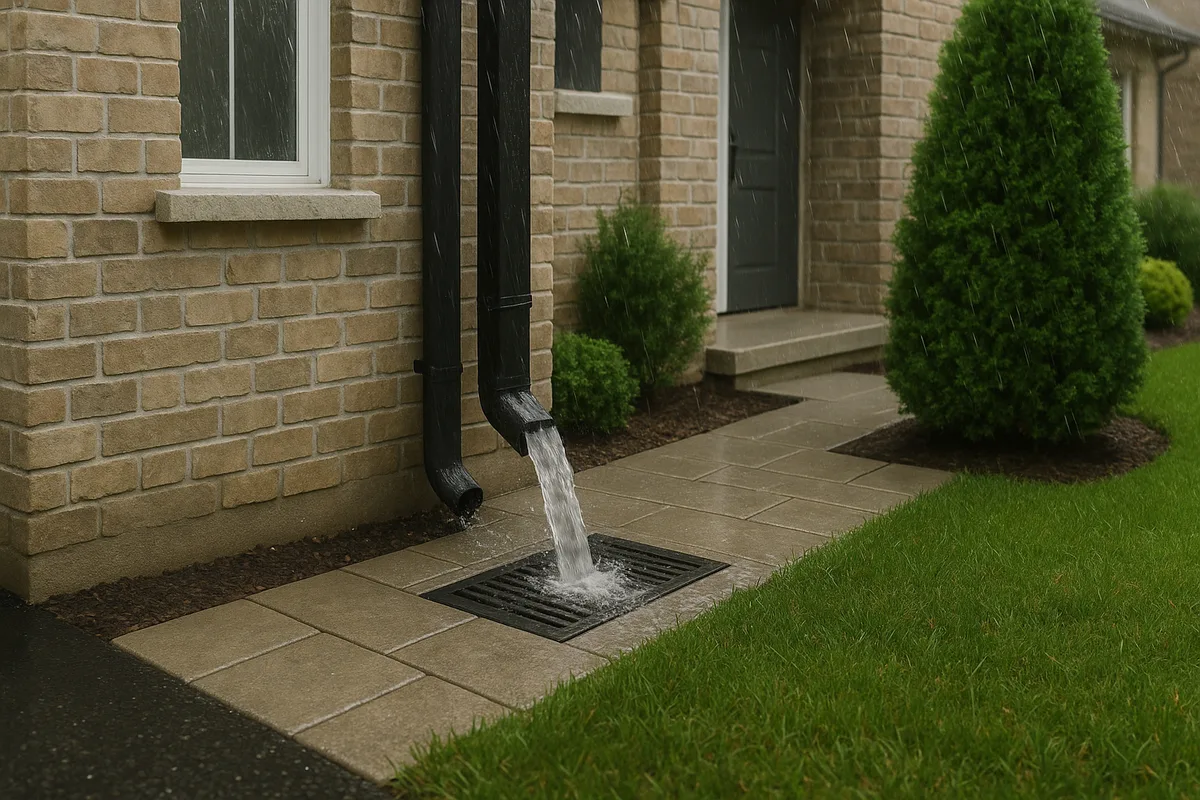
The critical insight for homeowners is that most residential drainage components are designed for relatively frequent storms — the 2-year or 10-year event. This means they are expected to be overwhelmed during larger storms. The question is: when they're overwhelmed, where does the excess water go? If the overflow path leads away from your home, the system is performing as intended even during failure. If the overflow path leads to your foundation, crawl space, or basement, you have a serious vulnerability.
Rainfall data allows you to quantify this vulnerability. By comparing the capacity of your drainage system (based on pipe sizes, swale dimensions, and grading) to the runoff generated by storms of increasing intensity, you can identify the exact storm recurrence interval at which your system fails. If your system fails at the 5-year storm but was designed for the 10-year storm, something has changed — and you need to find out what.
Climate Trends and Changing Rainfall Drainage Patterns
Historical rainfall data is invaluable, but it's important to recognize that rainfall drainage patterns are not static. Across much of the United States, precipitation patterns have shifted measurably over the past several decades, and these shifts have direct implications for residential drainage.
The most significant trend is the increase in heavy precipitation events. According to data from NOAA and the National Climate Assessment, the amount of precipitation falling in the heaviest 1% of events has increased by more than 30% in the Northeast and Midwest since 1958. This means that while total annual rainfall may not have changed dramatically, the intensity of individual storms has increased — which is exactly the variable that drives drainage failures.
This trend matters because drainage infrastructure designed using historical IDF curves may be undersized for current and future conditions. A system designed in 1995 using Atlas 14 data from that era may have been perfectly adequate at the time, but the same location may now experience storm intensities that exceed the original design parameters. NOAA has been updating Atlas 14 data to reflect these changes, and the updated values often show significant increases in design storm intensities.
For homeowners, the practical implication is clear: drainage systems that worked fine for the first 15 years of a home's life may begin to fail as storm intensities increase. If you're experiencing new drainage problems in an area that never had them before, changing rainfall patterns may be a contributing factor — and the solution requires understanding the updated rainfall data, not just patching the symptoms.
Urban Heat Islands and Localized Precipitation Effects
In suburban and urban areas, local development patterns can also affect precipitation. Urban heat islands — areas where concentrated development creates higher temperatures — can influence local convective storm activity, potentially increasing rainfall intensity in and around developed areas. While this effect is more pronounced at the metropolitan scale, it's another reminder that rainfall data from a regional weather station may not perfectly represent conditions at your specific property.
Additionally, the expansion of impervious surfaces across a neighborhood or watershed has cumulative effects that go beyond individual properties. As more homes add driveways, patios, and other hard surfaces, the total watershed runoff increases, potentially overwhelming downstream infrastructure that was designed for a less-developed landscape. Your property's drainage problem may not be caused by what's happening on your lot — it may be caused by what's happening upstream in your watershed.
Practical Steps: Using Rainfall Data to Protect Your Property
Understanding the theory behind rainfall runoff analysis is valuable, but homeowners need actionable steps they can take to apply this knowledge. Here's a practical framework for using rainfall data to predict and prevent drainage problems on your property.
Step 1: Know Your Local Rainfall Statistics
Start by looking up the precipitation frequency estimates for your location using NOAA Atlas 14. Enter your coordinates or address, and you'll get a table showing rainfall depths for various durations (5 minutes to 60 days) and recurrence intervals (1-year to 1,000-year). Pay particular attention to the 1-hour and 24-hour values for the 10-year and 25-year storms — these are the events most relevant to residential drainage design.
For example, if your location shows a 10-year, 1-hour rainfall of 2.5 inches, that means your drainage system should be able to handle 2.5 inches of rain falling in a single hour without causing problems. If it can't, you know you have a gap.
Step 2: Inventory Your Drainage Infrastructure
Walk your property during a moderate to heavy rain event and observe what happens. Where does water flow? Where does it pond? How quickly do gutters fill and overflow? Where do downspouts discharge, and does the water move away from the foundation or back toward it? Document everything with photos and notes.
Then, during dry weather, measure the key components of your drainage system:
- Gutter capacity: Standard 5-inch K-style gutters can handle approximately 1.2 gallons per minute per linear foot of gutter. Measure your gutter runs and calculate total capacity.
- Downspout capacity: A standard 2x3-inch downspout can handle about 600 square feet of roof area during a moderate storm. Count your downspouts and compare to your roof area.
- Grading slopes: Use a 4-foot level and tape measure to check the slope away from your foundation. You need a minimum of 6 inches of fall over the first 10 feet (about 5% grade) according to most building codes, though 2% is often cited as the functional minimum for drainage swales.
- Swale dimensions: If you have drainage swales, measure their depth, width, and slope. These dimensions determine flow capacity.
Step 3: Calculate Your Runoff Volume
Using the Rational Method or a simplified version of it, estimate the peak runoff from your property during your design storm. Break your property into areas by surface type, assign runoff coefficients, and multiply by the rainfall intensity and area. Sum the results to get total peak flow.
Here are typical runoff coefficients for residential surfaces:
- Rooftops: 0.90–0.95
- Concrete/asphalt driveways: 0.85–0.95
- Gravel surfaces: 0.35–0.70
- Lawns (sandy soil, flat): 0.05–0.10
- Lawns (clay soil, steep): 0.25–0.45
- Gardens and mulched beds: 0.10–0.25
Step 4: Compare Capacity to Demand
The final step is comparing your drainage system's capacity to the runoff volume you calculated. If the runoff from a 10-year storm exceeds your system's capacity, you have a predictable failure point. The question then becomes: where does the excess water go, and does it cause damage?
This comparison often reveals specific bottlenecks — a section of yard where grading is too flat, a downspout that discharges too close to the foundation, a swale that's too shallow to carry the required flow, or an area where neighboring runoff overwhelms your property's capacity. Each of these is a targeted problem with a targeted solution, rather than a vague "drainage issue" that's hard to address.
When Professional Drainage Intelligence Makes the Difference
While homeowners can do a lot with publicly available rainfall data and basic observation, there are limits to what manual analysis can achieve. Professional drainage assessment combines high-resolution topographic data, soil analysis, rainfall modeling, and engineering judgment to create a complete picture of a property's drainage performance.
The most valuable aspect of professional analysis is the integration of multiple data sources. Rainfall data alone doesn't predict drainage problems — it's rainfall data combined with precise elevation models, soil infiltration rates, impervious surface mapping, and infrastructure capacity analysis that produces actionable intelligence. A 2-inch depression in your backyard that's invisible to the eye but clearly visible in LiDAR data might be the exact point where three flow paths converge during a 10-year storm, creating a ponding area that threatens your foundation.
Professional analysis also accounts for the dynamic nature of drainage. Properties change over time — soil settles, roots redirect flow, new construction alters watershed boundaries, and climate patterns shift. A drainage assessment that was accurate five years ago may not reflect current conditions. Regular reassessment, informed by updated rainfall data and current site conditions, is the most reliable way to stay ahead of problems.
At Low Point Labs, our approach to drainage intelligence is built on the principle that every property has a story written in its topography, and rainfall data is the key to reading it. By combining precise elevation analysis with local precipitation data and soil characteristics, we help homeowners understand not just where water goes today, but where it will go during the storms that haven't happened yet. If you're concerned about drainage on your property — or if you want to understand your risk before problems appear — explore our drainage assessment services and let the data guide your decisions.
The rain is going to fall. The only question is whether you'll be ready for it.
Get Your Drainage Intelligence Report™
Start a free trial and generate reports on demand.
Frequently Asked Questions
Related Articles
Understanding Precipitation Intensity and Its Impact on Drainage Design
Runoff Calculations Using the Rational Method: A Complete Guide