Know the Terrain &
Understand Site Drainage
Before You Arrive.
Terrain-based drainage insights for contractors, inspectors, and realty pros — generated from USGS LiDAR before your first site visit.
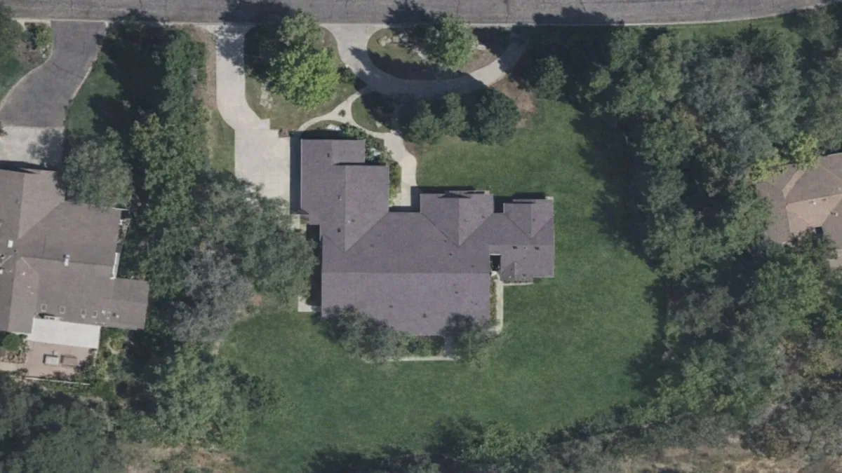
Drag the slider or use arrow keys to compare views. Actual property analysis shown.
Pre-visit Intelligence — Know Before You Go
Diagnosing existing or potential drainage issues can be a complicated process. A thorough inspection is essential, but can be difficult to achieve when balancing time constraints and client expectations — all while searching for forensic clues after the storm has passed. Low Point Labs has developed the platform you need to optimize your inspection process and develop better solutions faster.
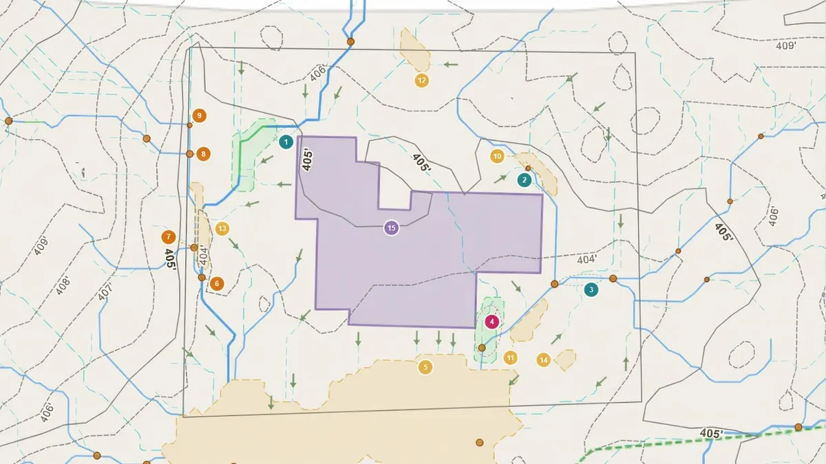
Using the LPCA methodology, the Drainage Intelligence screening platform reveals detailed hydrologic patterns written into the micro-topography of a site — patterns that can be extremely difficult to identify through visual inspection alone. Using high-resolution LiDAR elevation data, Drainage Intelligence predicts flow path propagation across a site, flow path convergence points, potential accumulation and concentration areas, subtle depressions, and dispersed and sheet flow development. Whether you compile Drainage Intelligence Reports at your office or run analyses on a tablet in the field, we promise you'll never look at a project site the same way again.
Low Point Convergence Analysis™ is the proprietary methodology developed by Low Point Labs to map drainage pathways, convergence zones, and likely accumulation areas on residential properties.
The Professionals Who Win Are the Ones Who Show Up Prepared
Terrain tells a story that most professionals never see until they're on site. Get the full drainage picture before your boots hit the ground.
Contractors who include terrain-based drainage data in proposals demonstrate deeper property understanding — leading to more informed solutions and stronger bids.
Know where water flows, collects, and concentrates before you arrive. Pre-visit terrain data eliminates guesswork and helps you show up knowing exactly where to look.
Most contractors and inspectors don't offer terrain-based analysis. Adding drainage intelligence to your services sets you apart in competitive markets.
"The best professionals don't guess about drainage — they show up with the data. The terrain tells the story. We help you read it first."
What is Low Point Convergence Analysis™?
Low Point Convergence Analysis™ (LPCA™) is the terrain analysis methodology developed by Low Point Labs to model how water naturally moves across residential landscapes. By analyzing elevation patterns, drainage convergence, watershed behavior, and structure proximity, LPCA™ helps screen for where runoff is likely to travel, collect, and interact with the property.
Terrain Slope Modeling
Models how water flows downhill across the property based on surface elevation.
Drainage Convergence Mapping
Maps areas where runoff paths come together and intensify.
Watershed Pattern Analysis
Shows how surrounding terrain influences water movement onto and across the site.
Structure Proximity Review
Highlights drainage behavior that may affect areas near the home and nearby structures.
Four Steps to Drainage Clarity
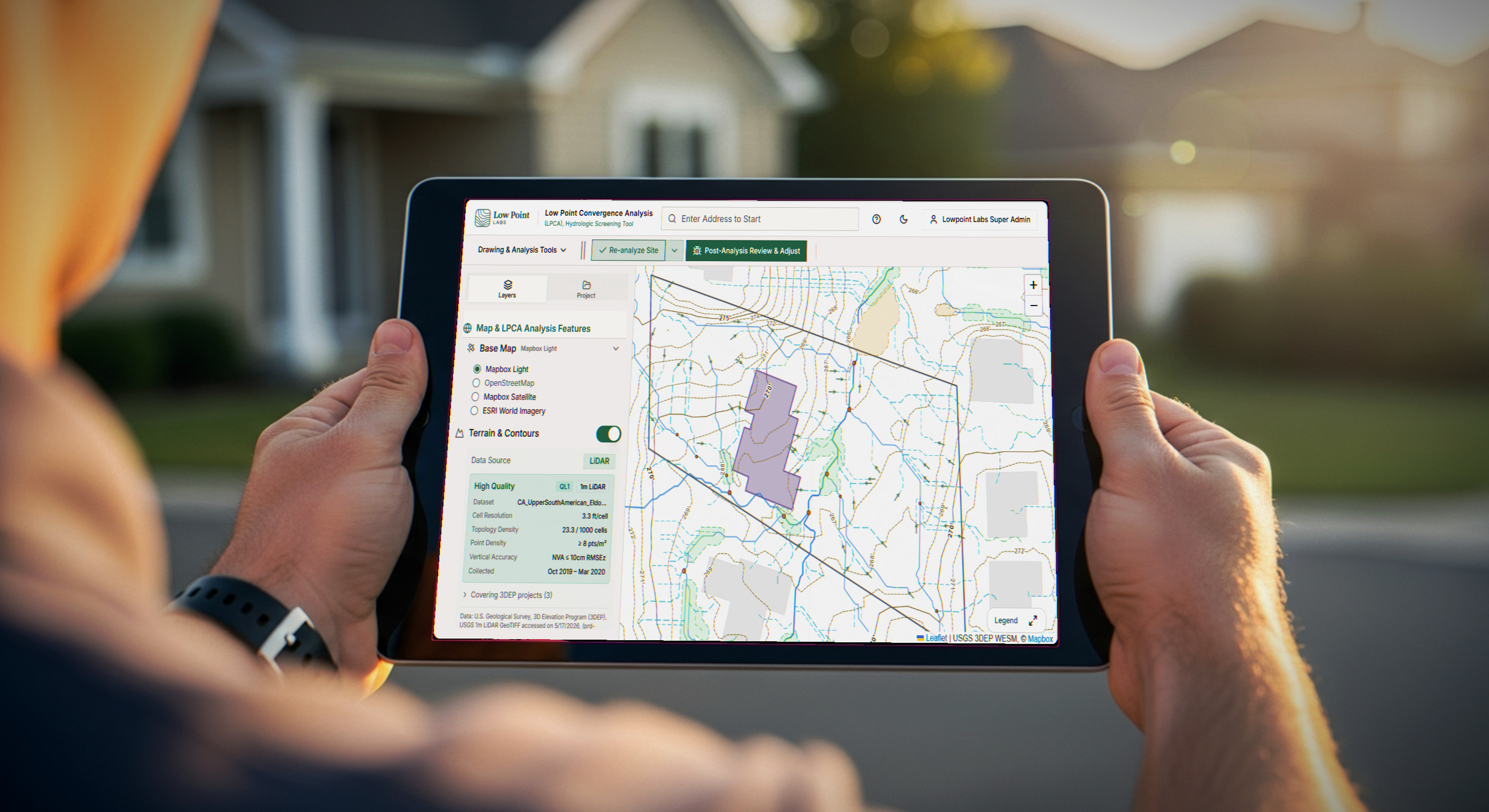
No preliminary site visit required. No scheduling delays. Enter an address and get actionable drainage intelligence derived from the same elevation data used by civil engineers.
Enter the address
Log into your subscription and input any property address. No field visit needed to generate the report.
LPCA screens the terrain
1-meter LiDAR data is processed to model flow paths, convergence zones, depressions, and contributing drainage areas.
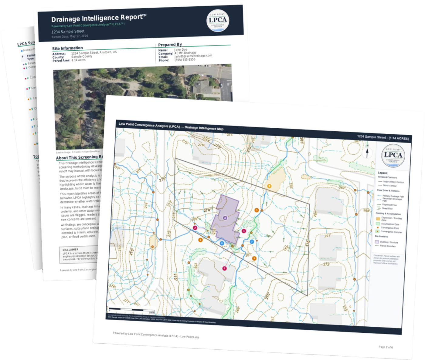
Receive your report
A professional, branded PDF with annotated maps, drainage feature data, soils context, and prioritized inspection points.
Inspect with focus
Use the report to guide your site visit — confirming and applying your professional judgment to field conditions.
What the Report Shows
Each report delivers a multi-layered drainage screening based on the actual topography of your specific property — not generic neighborhood data.
Surface Flow Direction
Mapped water runoff paths across the property based on steepest-descent analysis of the terrain surface.
Ponding Potential Zones
Topographic depressions and low-lying areas where water is likely to collect after rainfall events.
Drainage Pattern Assessment
Full watershed delineation with classified drainage channels showing primary and secondary flow networks.
Contour Analysis
High-resolution contour mapping that shows grading patterns, slope transitions, and terrain irregularities.
Building Proximity Review
Analysis of flow paths and accumulation zones relative to building footprints on the property.
Annotated Site Exhibit
Professional map exhibit with labeled features, annotations, and clear visual indicators for each identified area.
An Added Layer of Review — Not a Replacement
This is a screening tool designed for early awareness. It highlights where terrain may direct water — not where problems definitively exist. Many flagged areas may already have drainage solutions in place. This report helps you know where to look closer and what questions to ask during inspections. It does not replace professional engineering assessments, soil analysis, or on-site evaluations.
Drainage Intelligence for the Professionals Who Need It Most
Drainage & Waterproofing Experts
Pre-visit drainage intelligence for better bids, smarter project planning, and more professional proposals. Know the site before you arrive.
Learn moreHome Inspectors
Add drainage analysis to your inspection toolkit. Differentiate your services, cover the gap most inspectors miss, and arrive more prepared.
Learn moreReal Estate Agents
Data-driven drainage insights for property transactions. Help your clients ask the right questions and make informed decisions.
Learn moreHomeowners & Buyers
Planning improvements or buying a property? Understand how terrain directs water across the site before making your next move.
Learn moreData-Driven Confidence for Property Decisions
Federal elevation data source
LiDAR resolution
Flow accumulation algorithms
Hydrologic screening
Common Questions From Professionals
"I already do site visits — why do I need this?"
You'll still visit. This gives you the full topographic picture before you arrive, so you show up knowing where to focus. Subtle grade changes of 2–3 inches can redirect hundreds of gallons — LiDAR data shows what the eye cannot.
"My clients don't ask for this."
The best professionals don't wait to be asked. Including terrain-based drainage data in your proposal sets you apart before the client knows to ask for it. It demonstrates expertise and builds immediate credibility.
"How does this help me win more work?"
Show up with annotated terrain maps and flow analysis in your proposal. Clients hire the professional who demonstrates they understand the property — not the one who says "I'll take a look and get back to you."
"What about volume pricing?"
Subscription tiers scale with your workload — 10 reports per month on Starter, 20 on Pro, 40 on Scale. The per-report value improves as you move up, so professionals running more sites get more analysis for every dollar.
Simple, Transparent Pricing
Every report includes full LPCA™ terrain analysis and on-demand generation. Higher tiers unlock more reports per month for professionals who run multiple sites.
10 reports — $19.90 each
- Full app access
- Unlimited topographic address lookups (no credits)
- Generate on demand
- Customize reports
- Cancel anytime
20 reports — $14.95 each
- Full app access
- Unlimited topographic address lookups (no credits)
- Generate on demand
- Customize reports
- Cancel anytime
40 reports — $12.48 each
- Full app access
- Unlimited topographic address lookups (no credits)
- Generate on demand
- Customize reports
- Cancel anytime
Subscription plans renew monthly and can be cancelled anytime from your dashboard.
Run a Report Before Your Next Site Visit
Start a free trial and generate your first Drainage Intelligence Report™ from the dashboard — show up to your next inspection with the terrain already mapped.
Frequently Asked Questions
Show Up to Every Job With the Data
Start a subscription and pull a Drainage Intelligence Report™ for any property, any time, straight from the dashboard — terrain already mapped, surface flow already analyzed.
Subscribe to generate reports on demand. Cancel anytime.