How to Calculate Runoff for Residential Drainage Projects
Every drainage project begins with a single, deceptively simple question: How much water do I need to move? Whether you're sizing a French drain, designing a backyard swale, or selecting the right diameter pipe for a downspout collection system, the answer to that question determines whether your project succeeds or fails. Residential runoff calculation is the foundational skill that separates a drainage system that works flawlessly for decades from one that overflows during the first serious storm.
At Low Point Labs, we analyze topographic and drainage data for residential properties every day. We've seen firsthand what happens when drainage projects are designed by guesswork instead of calculation: undersized pipes, overwhelmed rain gardens, flooded basements, and thousands of dollars in rework. The good news is that the math behind runoff estimation isn't rocket science. With the right inputs and a systematic approach, any homeowner or contractor can produce reliable estimates that lead to properly sized, code-compliant drainage solutions.
This guide walks you through the entire process — from understanding the core concepts to applying the Rational Method for drainage design, gathering your site-specific data, and translating your results into real-world pipe sizes and system capacities.
Understanding Stormwater Runoff: Why Calculation Matters
Stormwater runoff is the portion of rainfall that doesn't soak into the ground, evaporate, or get intercepted by vegetation. Instead, it flows across the surface, following the path of least resistance — which, on a residential property, often means toward your foundation, garage, or neighbor's yard. The volume and rate of this runoff depend on a handful of measurable factors: how much rain falls, how fast it falls, how large the contributing area is, and how permeable the surfaces are.
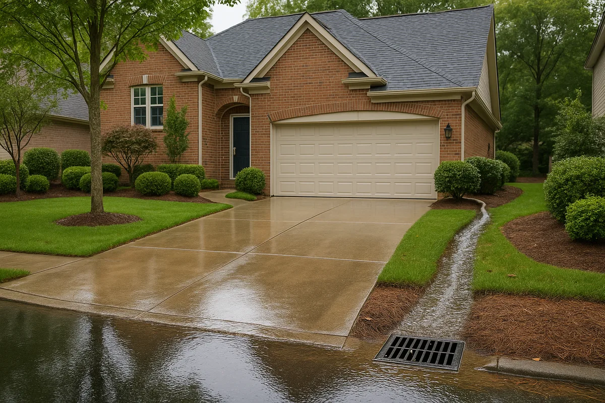
For natural, undeveloped land, runoff is typically a small fraction of total rainfall. Forests, meadows, and undisturbed soils absorb the vast majority of precipitation. But residential development dramatically changes this equation. A typical suburban lot with a house, driveway, sidewalks, and compacted lawn can generate three to five times more runoff than the same area in its natural state. Every square foot of roof, concrete, or asphalt is a square foot that contributes nearly 100% of the rain it receives directly to surface flow.
This is why residential runoff calculation isn't optional — it's essential. Without it, you're designing blind. An undersized drainage system doesn't just underperform; it can actively make problems worse by concentrating flow in ways that cause erosion, foundation damage, or flooding at downstream low points. Conversely, a dramatically oversized system wastes money on materials and excavation that weren't necessary. Proper calculation finds the sweet spot: a system that handles the design storm efficiently without excessive cost.
Municipal codes and building departments increasingly require runoff calculations as part of drainage permit applications. Even for projects that don't require a permit, performing the calculation gives you a defensible basis for your design decisions — something that matters if you ever need to demonstrate to a neighbor, an HOA, or an insurance adjuster that your drainage system was designed to professional standards.
Get Your Drainage Intelligence Report™
Start a free trial and generate reports on demand.
The Rational Method: The Gold Standard for Small Drainage Areas
The Rational Method is the most widely used technique for estimating peak runoff from small drainage areas, and it's the method most relevant to residential projects. Developed in the mid-19th century and refined over decades of engineering practice, it remains the standard approach recommended by municipal stormwater manuals, the American Society of Civil Engineers, and most local building departments for catchment areas under 200 acres — well within the range of any residential property.
The Rational Method is expressed by a beautifully simple formula:
Q = C × i × A
Where:
- Q = Peak runoff rate (cubic feet per second, or cfs)
- C = Runoff coefficient (dimensionless, ranging from 0 to 1)
- i = Rainfall intensity (inches per hour)
- A = Drainage area (acres)
The elegance of this formula is that it distills a complex hydrological process into three measurable inputs. The runoff coefficient captures how much rain becomes runoff versus how much is absorbed. The rainfall intensity captures how hard it rains during the critical period. And the drainage area captures how large a surface is contributing flow to your point of interest.
It's important to understand what the Rational Method gives you: a peak flow rate, not a total volume. It tells you the maximum rate at which water will arrive at a given point during a storm of a specific intensity and duration. This is exactly what you need for sizing pipes, channels, and inlets, because those elements must be designed to handle the worst-case instantaneous flow. For volume-based designs — like detention ponds or rain barrels — you'll need supplementary calculations, which we'll cover later in this article.
The Rational Method assumes that the peak flow occurs when the entire drainage area is contributing runoff simultaneously, which happens when the storm duration equals or exceeds the time of concentration — the time it takes water from the most distant point in the drainage area to reach the outlet. This assumption is reasonable for small, relatively uniform residential lots, which is why the method is so well-suited to this scale of work.
Step 1: Determine Your Drainage Area (A)
The first input to the Rational Method is the drainage area — the total land surface that contributes runoff to the point where you're designing your drainage feature. This is not necessarily your entire property. It's the specific area whose runoff flows to the location in question, which could be a low point in your yard, a drain inlet, or the entry point of a French drain.
Delineating Your Watershed
To determine your drainage area, you need to understand the topography of your property and identify the ridgelines (high points) that separate flow in one direction from flow in another. Water always flows perpendicular to contour lines, from high elevation to low. The boundary of your drainage area follows the ridgelines and high points that encircle the area draining to your point of interest.
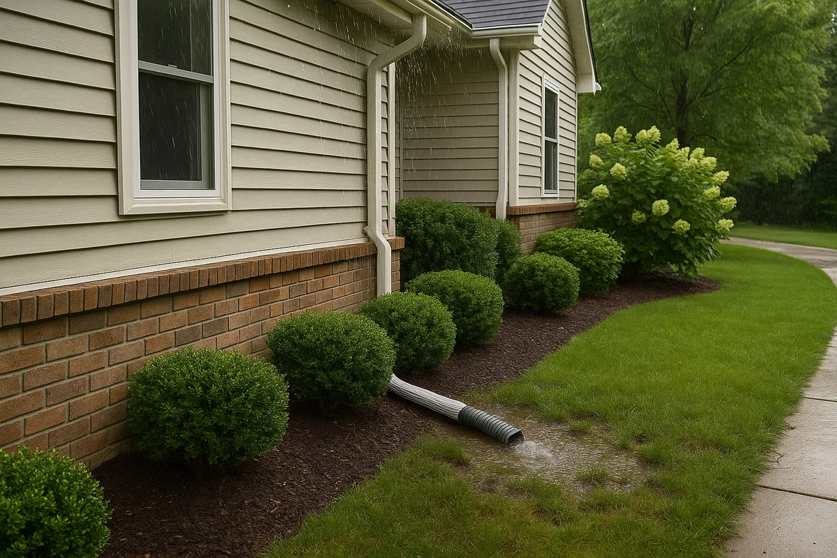
For a simple example: if you're sizing a drain at a low point in your backyard, the drainage area includes every part of your yard (and potentially your neighbors' yards) that slopes toward that low point. It includes your roof area if downspouts discharge into the same zone. It does not include areas on the other side of a ridge or crown that drain away from your target point.
You can delineate drainage areas using several methods:
- Site survey with a transit or laser level: The most accurate method. A surveyor or experienced contractor takes elevation readings across the property and maps the flow directions.
- Topographic maps and LiDAR data: The USGS 3D Elevation Program (3DEP) provides high-resolution elevation data for most of the United States. This data can be used to generate detailed contour maps and identify drainage boundaries.
- Visual observation during rain: Watch where water flows during a moderate rain event. This empirical approach can reveal drainage patterns that aren't obvious from elevation data alone, especially on properties with subtle grading.
- Measuring and calculating from a site plan: If you have a site plan or plat map with elevation contours, you can trace the drainage boundary directly on the map and calculate the enclosed area.
Measuring the Area
Once you've delineated the boundary, measure the area in acres. For residential projects, you'll often be working in square feet, so remember that 1 acre = 43,560 square feet. A typical suburban lot of 10,000 square feet is approximately 0.23 acres. Don't forget to include roof areas, driveways, and any off-site areas that drain onto your property.
For irregularly shaped areas, break them into rectangles and triangles, calculate each sub-area, and sum them. Or use a digital mapping tool to trace the boundary and compute the area automatically.
Step 2: Select the Runoff Coefficient (C)
The runoff coefficient is the ratio of runoff to rainfall. A C value of 0.90 means that 90% of the rain that falls on that surface becomes runoff, while only 10% is absorbed or retained. A C value of 0.20 means only 20% becomes runoff. This single number encapsulates the combined effects of surface type, soil permeability, slope, and antecedent moisture conditions.
Common Runoff Coefficients for Residential Surfaces
Here are widely accepted C values used in residential drainage design:
| Surface Type | Runoff Coefficient (C) |
|---|---|
| Asphalt or concrete pavement | 0.85 – 0.95 |
| Rooftops (conventional) | 0.85 – 0.95 |
| Gravel driveways or paths | 0.50 – 0.70 |
| Bare, compacted soil | 0.60 – 0.80 |
| Lawns (sandy soil, flat <2%) | 0.05 – 0.10 |
| Lawns (sandy soil, steep >7%) | 0.15 – 0.20 |
| Lawns (clay soil, flat <2%) | 0.13 – 0.17 |
| Lawns (clay soil, steep >7%) | 0.25 – 0.35 |
| Wooded areas (flat) | 0.05 – 0.15 |
| Wooded areas (steep) | 0.15 – 0.25 |
Calculating a Composite Runoff Coefficient
Most residential drainage areas contain a mix of surfaces — some roof, some driveway, some lawn. You need a weighted composite C value that reflects the proportional contribution of each surface type.
The formula is:
C_composite = (C₁A₁ + C₂A₂ + C₃A₃ + ...) / A_total
For example, consider a drainage area of 8,000 square feet consisting of:
- 1,500 sq ft of roof (C = 0.90)
- 800 sq ft of driveway (C = 0.90)
- 5,700 sq ft of lawn on clay soil, moderate slope (C = 0.22)
C_composite = (0.90 × 1,500 + 0.90 × 800 + 0.22 × 5,700) / 8,000 C_composite = (1,350 + 720 + 1,254) / 8,000 C_composite = 3,324 / 8,000 C_composite = 0.42
This tells you that approximately 42% of the rainfall on this area will become runoff. Notice how the impervious surfaces (roof and driveway), despite being only 29% of the total area, significantly increase the composite coefficient. This is the fundamental dynamic that makes residential drainage design so important — developed properties generate far more runoff than their size alone would suggest.
Understanding your soil type is critical for selecting accurate lawn and landscape C values. The NRCS Web Soil Survey allows you to look up the specific soil types on your property, including their hydrologic soil group classification (A through D), which directly correlates with infiltration capacity and runoff potential.
Step 3: Determine Rainfall Intensity (i)
Rainfall intensity is the rate of rainfall, measured in inches per hour, for a storm of a specific duration and return period (also called recurrence interval). This is where the Rational Method connects to real-world weather data, and it's the input that requires the most careful selection.
Understanding Return Periods
The return period is the statistical average interval between storms of a given intensity. Common design standards for residential drainage include:
- 2-year storm: A relatively modest rain event that has a 50% chance of occurring in any given year. Often used for minor yard drainage and gutter sizing.
- 10-year storm: A more significant event with a 10% annual probability. This is the most common design standard for residential storm drains, culverts, and French drains in many jurisdictions.
- 25-year storm: Used for more critical drainage infrastructure or in areas with higher risk tolerance requirements.
- 100-year storm: Typically reserved for floodplain analysis and major infrastructure, not routine residential drainage. However, some municipalities now require 100-year analysis for detention design.
Your local building code or stormwater ordinance will specify which return period to use. If no specific standard applies, the 10-year storm is the most common default for residential drainage projects.
Finding Rainfall Intensity Data
Rainfall intensity varies dramatically by location. A 10-year, 15-minute storm in Miami might produce rainfall at 8 inches per hour, while the same statistical storm in Denver might only produce 3 inches per hour. You must use data specific to your geographic area.
The primary source for this data in the United States is NOAA Atlas 14, the Precipitation Frequency Data Server maintained by the National Oceanic and Atmospheric Administration. This tool allows you to enter any location in the country and retrieve Intensity-Duration-Frequency (IDF) curves that give you the rainfall intensity for any combination of storm duration and return period.
Matching Duration to Time of Concentration
The critical insight of the Rational Method is that you don't just pick any storm duration — you use the duration that equals your drainage area's time of concentration (Tc). The time of concentration is the time it takes for runoff from the hydraulically most distant point in your drainage area to reach the outlet.
Why does this matter? If you use a storm duration shorter than Tc, not all of your drainage area is contributing simultaneously, and you'll underestimate the peak flow. If you use a duration longer than Tc, the rainfall intensity will be lower (longer storms are less intense), and you'll also underestimate peak flow. The maximum peak flow occurs when the storm duration exactly matches Tc.
Estimating Time of Concentration
For residential properties, Tc is typically short — often between 5 and 20 minutes. Several methods exist for estimating it:
Kirpich Formula (for overland flow on bare or lightly vegetated surfaces):
Tc = 0.0078 × L^0.77 × S^(-0.385)
Where L is the flow path length in feet and S is the average slope (ft/ft).
FAA (Federal Aviation Administration) Formula (commonly used for small, developed areas):
Tc = (1.8 × (1.1 - C) × L^0.5) / (S^0.333 × 100)
Where C is the runoff coefficient, L is the flow path length in feet, and S is the slope in percent.
For most residential lots, a conservative Tc of 5 to 15 minutes is typical. Many municipal stormwater manuals specify a minimum Tc of 5 minutes for small developed areas, recognizing that very short concentration times can produce unrealistically high intensity values.
As a practical example: for a property in Atlanta, Georgia, with a Tc of 10 minutes, NOAA Atlas 14 data shows a 10-year, 10-minute rainfall intensity of approximately 6.5 inches per hour. That's the "i" value you'd plug into the Rational Method formula.
Step 4: Run the Calculation and Interpret Results
With all three inputs determined, the calculation itself is straightforward multiplication. Let's work through a complete residential example to demonstrate the process from start to finish.
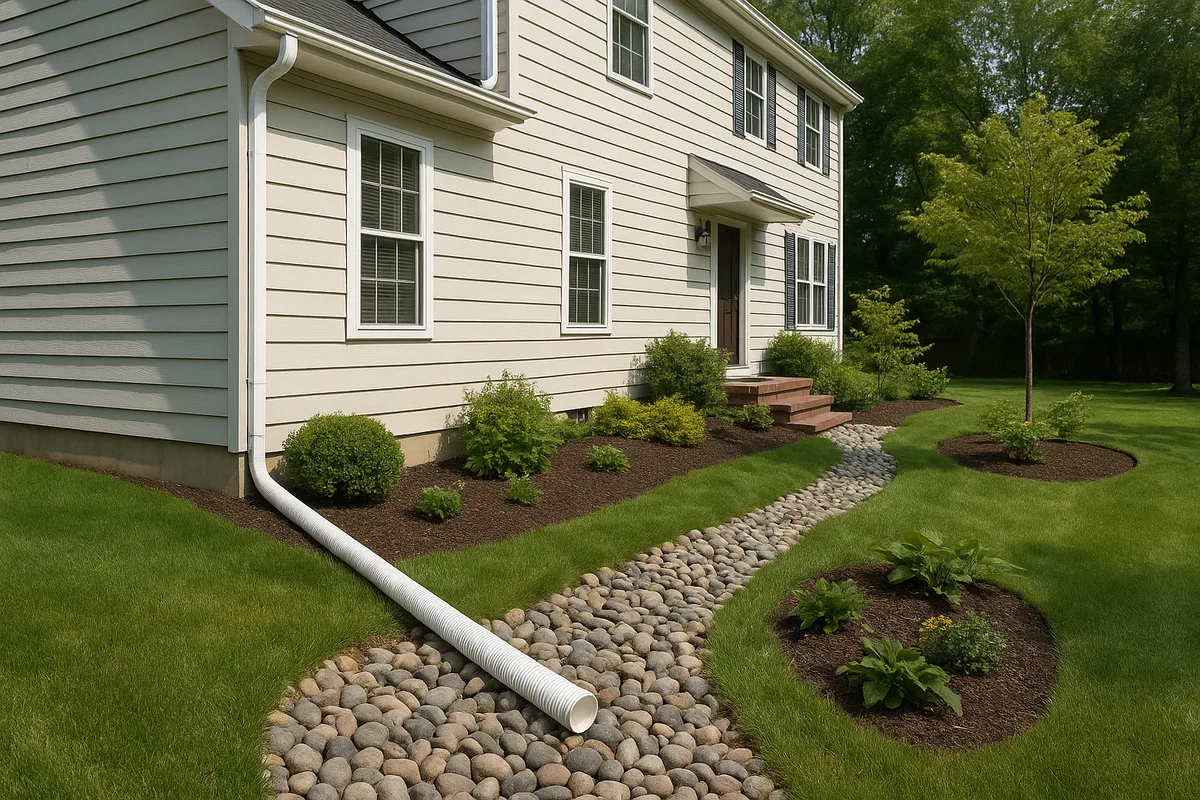
Worked Example: Sizing a French Drain
Scenario: A homeowner in Charlotte, North Carolina has persistent standing water at a low point in their backyard. They want to install a French drain to intercept and redirect the runoff. The drainage area contributing to the low point includes:
- Rear roof section: 900 sq ft (C = 0.90) — downspouts discharge into the yard
- Concrete patio: 200 sq ft (C = 0.90)
- Lawn area (clay soil, 4% slope): 3,500 sq ft (C = 0.22)
- Neighbor's lawn that slopes toward the property line: 1,400 sq ft (C = 0.20)
Step 1: Total drainage area
A_total = 900 + 200 + 3,500 + 1,400 = 6,000 sq ft = 0.138 acres
Step 2: Composite runoff coefficient
C = (0.90 × 900 + 0.90 × 200 + 0.22 × 3,500 + 0.20 × 1,400) / 6,000 C = (810 + 180 + 770 + 280) / 6,000 C = 2,040 / 6,000 C = 0.34
Step 3: Rainfall intensity
The longest flow path is approximately 150 feet from the far edge of the neighbor's lawn to the low point, with an average slope of about 3%. Using the Kirpich formula:
Tc = 0.0078 × 150^0.77 × 0.03^(-0.385) ≈ 8.7 minutes
Rounding to 10 minutes for conservatism, and using NOAA Atlas 14 data for Charlotte (10-year, 10-minute storm): i ≈ 6.3 inches per hour.
Step 4: Calculate peak runoff
Q = C × i × A Q = 0.34 × 6.3 × 0.138 Q = 0.295 cfs
Converting to gallons per minute (1 cfs = 448.8 GPM):
Q = 0.295 × 448.8 ≈ 132 GPM
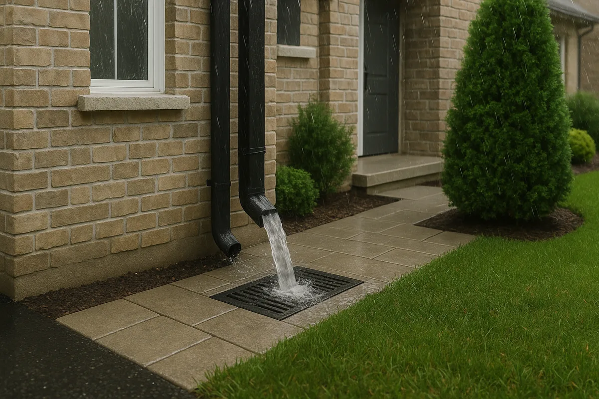
Translating Flow Rate to Pipe Size
Now that you know the peak flow rate, you can select an appropriate pipe size. Using Manning's equation or standard pipe capacity charts (which are based on Manning's equation), you can determine the flow capacity of various pipe diameters at a given slope:
| Pipe Diameter | Capacity at 1% Slope (cfs) | Capacity at 1% Slope (GPM) |
|---|---|---|
| 4 inch | 0.10 | 45 |
| 6 inch | 0.30 | 135 |
| 8 inch | 0.65 | 292 |
| 10 inch | 1.17 | 525 |
| 12 inch | 1.90 | 853 |
Note: Values assume smooth-wall pipe (n = 0.012) flowing full. Corrugated pipe has lower capacity due to higher friction.
For our example with Q = 0.295 cfs (132 GPM), a 6-inch smooth-wall pipe at 1% slope would be just barely adequate. A prudent designer would select an 8-inch pipe to provide a safety factor and accommodate potential debris or sediment accumulation. If using corrugated pipe, you'd definitely want to upsize to 8 inches, as the corrugations reduce effective capacity by 20-30%.
This is the power of residential runoff calculation — instead of guessing that a 4-inch pipe "should be fine," you now have quantitative evidence that a 4-inch pipe would handle only about one-third of the required flow, virtually guaranteeing overflow during any significant storm.
Beyond Peak Flow: Estimating Runoff Volume
While the Rational Method gives you peak flow rate, some drainage features are designed based on total runoff volume rather than instantaneous flow. Rain gardens, dry wells, detention basins, and rain barrels all need to store a certain volume of water, so you need a different calculation approach.
The Simple Volumetric Method
For small residential projects, the simplest volume estimate uses this formula:
V = C × P × A
Where:
- V = Runoff volume (cubic feet)
- C = Runoff coefficient (same as Rational Method)
- P = Total rainfall depth for the design storm (feet)
- A = Drainage area (square feet)
Note that here, P is the total depth of rain for the entire storm event, not the intensity. For example, if your design standard calls for managing the first 1 inch of rainfall (a common water quality standard), P = 1/12 = 0.0833 feet.
Using our Charlotte example:
V = 0.34 × 0.0833 × 6,000 = 170 cubic feet ≈ 1,272 gallons
So a rain garden or dry well designed to capture the first inch of runoff from this drainage area would need approximately 170 cubic feet of effective storage volume. For a rain garden with 6 inches of ponding depth, that translates to a surface area of about 340 square feet (170 / 0.5).
The NRCS Curve Number Method
For larger or more complex residential projects — especially those involving detention or retention requirements — the NRCS (Natural Resources Conservation Service) Curve Number method provides more detailed volume and hydrograph estimates. This method uses a Curve Number (CN) that accounts for soil type, land cover, and antecedent moisture conditions to calculate total runoff depth from a given rainfall depth.
The basic equation is:
Q = (P - 0.2S)² / (P + 0.8S)
Where S = (1000/CN) - 10, P is rainfall in inches, and Q is runoff in inches.
Curve Numbers range from about 30 (highly permeable forest on sandy soil) to 98 (impervious surfaces). A typical suburban residential lot with 1/4-acre lots and clay soil might have a CN of 83-87. The NRCS method is more complex than the Rational Method but provides better results for volume-based designs and for drainage areas larger than a few acres.
Common Mistakes in Residential Runoff Calculations
Even with a solid understanding of the methodology, several common errors can lead to inaccurate results and poorly designed drainage systems.
Ignoring Off-Site Contributions
One of the most frequent mistakes is calculating runoff only from your own property while ignoring water that flows onto your property from uphill neighbors, adjacent streets, or common areas. Topography doesn't respect property lines. If 2,000 square feet of your neighbor's yard drains toward your low point, that area must be included in your drainage area calculation. Failing to account for off-site contributions can undersize your system by 30% or more.
Using the Wrong Rainfall Data
Using national averages, data from a different city, or outdated rainfall statistics can significantly skew your results. Rainfall patterns vary enormously over short distances, especially in areas with complex terrain. Always use location-specific data from NOAA Atlas 14 or your local stormwater manual. Additionally, be aware that many regions are updating their rainfall statistics to reflect changing precipitation patterns — data from the 1960s may significantly underestimate current storm intensities.
Underestimating Impervious Area
Homeowners frequently undercount their impervious surfaces. Don't forget to include:
- Sheds, detached garages, and accessory structures
- Sidewalks, stepping stones, and pathways
- Compacted gravel areas that function as near-impervious surfaces
- Patios, decks over impervious surfaces, and sport courts
- Areas under dense tree canopy during leaf-on season (these reduce but don't eliminate runoff)
Neglecting Slope Effects
The runoff coefficient for pervious surfaces increases significantly with slope. A lawn on a 10% slope generates roughly twice the runoff of the same lawn on a 2% slope. If your property has variable terrain, calculate composite C values that reflect the actual slopes in each sub-area rather than using a single flat-terrain value for all lawn areas.
Forgetting the Safety Factor
Engineering practice typically includes a safety factor of 10-25% above the calculated peak flow when sizing drainage infrastructure. This accounts for uncertainties in the input data, potential future changes to the drainage area (e.g., a neighbor adds a patio), debris accumulation in pipes, and the inherent limitations of any simplified model. If your calculation says you need a 6-inch pipe, seriously consider installing an 8-inch pipe.
Putting It All Together: From Calculation to Construction
A runoff calculation is only valuable if it translates into a well-designed, properly constructed drainage system. Here's how to bridge the gap between numbers on paper and pipes in the ground.
Document Your Assumptions
Record every input and assumption in your calculation: the drainage area boundaries, the surface types and their C values, the rainfall data source, the return period, the time of concentration estimate, and the resulting peak flow. This documentation is essential for permit applications, but it's equally valuable for your own reference if you need to modify or expand the system in the future.
Design for the Entire Flow Path
Your drainage system must handle the calculated flow at every point along its length, not just at the inlet. If a French drain collects additional runoff along its length, the pipe capacity at the downstream end must accommodate the cumulative flow from all contributing areas. This often means increasing pipe diameter as you move downstream, or starting with a larger pipe than the upstream calculation alone would suggest.
Verify Your Outlet
Every drainage system needs a discharge point, and that outlet must be able to handle the flow you're delivering to it. Discharging concentrated runoff onto a neighbor's property, into a wetland, or into an undersized municipal system can create legal liability and environmental violations. Verify that your outlet connects to an adequate receiving system — a municipal storm drain, a drainage easement, a properly sized ditch, or a dispersal area with sufficient capacity.
Consider Climate Resilience
Rainfall intensities in many parts of the United States have increased measurably over the past several decades, and this trend is projected to continue. If you're installing drainage infrastructure that you expect to last 20-30 years, consider designing to a higher return period than the minimum code requirement. Designing for a 25-year storm instead of a 10-year storm typically increases pipe size by only one increment but provides substantially greater resilience against future conditions.
Leverage Technology
Modern tools make residential runoff calculation faster and more accurate than ever. GIS platforms, LiDAR-derived elevation models, and online soil databases allow you to gather precise input data without expensive field surveys. At Low Point Labs, we use high-resolution topographic data to identify drainage patterns, delineate contributing areas, and pinpoint low points that are invisible to the naked eye — giving our clients the precise inputs they need for accurate runoff calculations.
Accurate residential runoff calculation is the difference between a drainage project that solves your problem and one that merely relocates it. Whether you're a homeowner tackling a weekend French drain project or a contractor designing a comprehensive stormwater management system, the Rational Method gives you a proven, straightforward framework for determining how much water you need to move — and the confidence that your system can handle it.
Ready to get precise drainage data for your property? Low Point Labs' topographic drainage assessments provide the detailed elevation data, drainage area delineation, and low point identification you need to perform accurate runoff calculations and design drainage systems that work. Explore our services and take the guesswork out of your next drainage project.
Get Your Drainage Intelligence Report™
Start a free trial and generate reports on demand.
Frequently Asked Questions
Related Articles
Runoff Calculations Using the Rational Method: A Complete Guide
Understanding Precipitation Intensity and Its Impact on Drainage Design