
SAFCA Sacramento: What Homeowners Must Know About Flood Control & Property
Sacramento sits at the confluence of two major rivers — the Sacramento and the American — in a broad, low-lying valley that has experienced catastrophic flooding throughout its recorded history. The Sacramento Area Flood Control Agency, commonly known as SAFCA, is the regional entity charged with reducing that flood risk through levee improvements, floodplain management, and coordinated infrastructure investments. For homeowners, understanding SAFCA Sacramento operations is not optional — it directly influences property values, insurance costs, development regulations, and the long-term safety of your most significant financial asset.
Whether you recently purchased a home behind the American River levees, are considering buying in the Natomas Basin, or have lived in the Sacramento region for decades, this guide breaks down everything you need to know about how the Sacramento Area Flood Control Agency shapes the landscape — literally and financially — around your property.
The History and Mission of SAFCA Sacramento
The Sacramento Area Flood Control Agency was established in 1989 as a joint powers authority, bringing together Sacramento County, the City of Sacramento, the City of Folsom, the City of West Sacramento (which joined later through coordinated efforts), the American River Flood Control District, and Reclamation District 1000. Its creation was a direct response to the recognition that Sacramento's flood risk was among the highest of any major city in the United States — a reality that became painfully clear during the flood events of 1986, when the American River came dangerously close to overtopping levees that protected hundreds of thousands of residents.
SAFCA's core mission is to provide the Sacramento metropolitan area with at least a 200-year level of flood protection — meaning the infrastructure should withstand a flood event that has a 0.5% chance of occurring in any given year. This standard was mandated by California Senate Bill 5 (SB 5), passed in 2007, which required urban areas with populations exceeding 10,000 to achieve this level of protection. For context, many of Sacramento's levees historically provided only a fraction of that protection, with some areas rated at roughly 100-year levels or even less.
The agency does not operate in isolation. SAFCA coordinates with the U.S. Army Corps of Engineers, the California Department of Water Resources (DWR), the Central Valley Flood Protection Board, and local reclamation districts. This multi-layered governance structure means that levee improvements, bypass expansions, and floodplain remapping involve federal, state, and local funding streams — and timelines that can stretch across decades. For homeowners, this means that the flood protection status of your neighborhood may be in active transition, with implications for insurance requirements and property disclosures.
Get Your Drainage Intelligence Report™
Start a free trial and generate reports on demand.
How the Sacramento Levee System Affects Property Values
The relationship between the Sacramento levee system and property values is one of the most consequential — and least understood — dynamics in the regional real estate market. Levees are not static structures; they are engineered earthen embankments that require continuous maintenance, periodic upgrades, and ongoing certification to meet federal and state standards. When a levee is certified by the Army Corps of Engineers and accredited by FEMA, the properties behind it may be remapped out of Special Flood Hazard Areas (SFHAs), which eliminates the federal requirement for flood insurance on mortgages backed by federally regulated lenders.
This reclassification has an enormous impact on the Sacramento Area Flood Control Agency real estate landscape. Properties in FEMA-designated AE zones (high-risk flood areas) typically carry mandatory flood insurance premiums that can range from $1,500 to over $5,000 annually, depending on the structure's elevation, construction type, and proximity to the floodway. When SAFCA-funded levee improvements lead to FEMA remapping a neighborhood from an AE zone to an X zone (moderate-to-low risk), homeowners may see immediate relief from those premiums — and a corresponding increase in property desirability and market value.
Research consistently shows that proximity to certified, well-maintained levees positively influences property values, while proximity to decertified or under-performing levees depresses them. A study published in the Journal of Real Estate Finance and Economics found that properties remapped into high-risk flood zones experienced value declines of 4% to 12%, while properties remapped out of those zones saw corresponding gains. In Sacramento specifically, the Natomas Basin provides a dramatic case study: when FEMA remapped the basin into the AE flood zone in 2008 after levee decertification, new development was effectively halted, property values stagnated, and existing homeowners faced sudden insurance mandates. SAFCA's subsequent Natomas Levee Improvement Program (NLIP) has been systematically upgrading those levees to restore 200-year protection and enable FEMA remapping — a process that has taken well over a decade and cost hundreds of millions of dollars.
For anyone involved in Sacramento Area Flood Control Agency real estate transactions, the lesson is clear: the certification status of the nearest levee is not a footnote in a disclosure packet — it is a primary driver of long-term value.
American River Levee Improvements and Real Estate Impacts
The American River levee system is the backbone of flood protection for much of central Sacramento. The American River flows westward from Folsom Dam through the heart of the metropolitan area before joining the Sacramento River, and the levees along its banks protect neighborhoods including Arden-Arcade, Campus Commons, East Sacramento, and the Pocket-Greenhaven area downstream. These levees have been the focus of some of SAFCA's most ambitious and expensive improvement projects.
The American River Common Features (ARCF) project, a joint effort between SAFCA, the Army Corps of Engineers, and the State of California, represents a multi-billion-dollar investment in levee strengthening, seepage remediation, and erosion protection along approximately 22 miles of levees. The project addresses critical vulnerabilities including underseepage (where water percolates through permeable soils beneath the levee), through-seepage (where water moves through the levee embankment itself), and slope instability. These are not theoretical concerns — geotechnical investigations have identified sections of the American River levees where the factor of safety against failure during a major flood event was alarmingly low.
For homeowners living behind the American River levee, these improvements translate into tangible benefits. As levee segments are improved and re-evaluated, FEMA can issue Letters of Map Revision (LOMRs) that reclassify the protected areas. This process directly affects mortgage requirements, insurance costs, and the ease with which properties can be bought and sold. Real estate agents working in the Sacramento market increasingly recognize that understanding the status of nearby SAFCA projects is essential for accurately advising clients.
The ARCF project also includes improvements to Folsom Dam itself, specifically the auxiliary spillway (sometimes called the "Joint Federal Project"), which was completed in recent years to allow dam operators to release water earlier during storm events, reducing peak flows on the American River and decreasing the hydraulic load on downstream levees. This operational change has a cascading positive effect on flood risk for every property along the American River corridor.
Homeowners should be aware that levee improvement construction can cause temporary disruptions — construction easements, heavy equipment traffic, tree removal along levee corridors, and temporary trail closures are common during active project phases. SAFCA typically conducts public outreach and notifies affected property owners, but the scale of these projects means that construction activity can persist for months or even years in a given area.
SAFCA Assessment Fees: What Homeowners Pay and Why
One of the most direct ways homeowners interact with SAFCA is through the assessment fees that appear on their property tax bills. SAFCA has historically funded its share of flood control projects through voter-approved assessments levied on properties within its service area. These assessments are not uniform — they vary based on the specific benefit zone in which a property is located, the level of flood risk reduction provided by SAFCA projects, and the type of property (residential, commercial, agricultural).
The most significant assessment in recent history was Measure A, approved by Sacramento County voters, which authorized SAFCA to levy assessments to fund the local cost share of the Natomas Levee Improvement Program and other critical projects. The annual assessment for a typical single-family residential parcel has historically ranged from roughly $30 to $60 per year, though this can vary. While this may seem modest, it represents a dedicated, long-term funding stream that leverages far larger federal and state investments — in many cases, every dollar of local assessment generates multiple dollars in matching funds from the Army Corps of Engineers and California DWR.
Homeowners sometimes question why they are paying an assessment when they may not perceive themselves as being at direct flood risk. The answer lies in the interconnected nature of the Sacramento flood control system. Levees, bypasses, weirs, and pump stations function as a network — a failure at one point can redirect floodwaters and increase risk at other points. The Yolo Bypass and Sacramento Bypass, for example, are designed to divert floodwaters from the Sacramento River away from the urban core, and their capacity and condition affect flood risk for properties miles away. SAFCA's assessment structure reflects this system-wide interdependence.
For prospective buyers, it is important to verify the current SAFCA assessment on any property under consideration. These assessments are typically listed as line items on the annual property tax bill and can be confirmed through the Sacramento County Assessor's office. While the amounts are generally modest compared to overall property tax obligations, they are a permanent feature of owning property within SAFCA's jurisdiction and should be factored into long-term ownership cost calculations.
Flood Insurance, FEMA Maps, and Sacramento Flood Protection
The intersection of Sacramento flood protection, FEMA flood mapping, and insurance requirements is where SAFCA's work has the most immediate financial impact on homeowners. FEMA's Flood Insurance Rate Maps (FIRMs) determine which properties are located in Special Flood Hazard Areas and therefore subject to mandatory flood insurance purchase requirements for federally backed mortgages. These maps are based on hydrologic and hydraulic modeling that accounts for the capacity and condition of the existing flood control infrastructure — including levees.
When SAFCA completes a levee improvement project and the improved levee meets FEMA's certification criteria (44 CFR 65.10), the agency can submit technical data to FEMA requesting a map revision. If FEMA concurs that the improved levee provides protection against the 1% annual chance flood (the 100-year flood), the agency issues a LOMR that reclassifies the area behind the levee from a high-risk zone (typically AE) to a moderate-risk zone (typically X, shaded or unshaded). This reclassification removes the mandatory flood insurance purchase requirement.
However, homeowners should understand several critical nuances:
- Levee certification is not permanent. Levees must be periodically re-evaluated, and changes in hydrology, land use, or levee condition can lead to decertification and remapping back into high-risk zones.
- FEMA's 100-year standard is a minimum. California's SB 5 requires 200-year protection for urban areas, which is a higher standard than FEMA's mapping threshold. A property can be mapped out of the SFHA under FEMA rules while still being in an area that does not meet the state's 200-year standard.
- Flood insurance is always advisable. Even properties in X zones can flood. According to FEMA, more than 25% of all flood insurance claims come from properties outside high-risk flood zones. The Sacramento Valley's geography — flat terrain, clay soils, aging infrastructure, and atmospheric river storms — means that localized flooding from inadequate drainage, pump station failures, or interior ponding can affect properties that are technically "protected" by levees.
- Risk Rating 2.0 changes the calculus. FEMA's Risk Rating 2.0 methodology, which has been phasing in since 2021, calculates flood insurance premiums based on individual property characteristics — including distance to the flood source, property elevation, and the cost to rebuild — rather than relying solely on zone designations. This means that even within an X zone, properties closer to the river or at lower elevations may see higher premiums than properties farther away or at higher elevations.
Homeowners can review their property's current flood zone designation using the FEMA National Flood Map Service Center, which provides access to the most current FIRMs for any address in the country. Understanding your flood zone is the first step in making informed decisions about insurance, property improvements, and long-term risk management.
The Natomas Basin: A Case Study in SAFCA's Impact on Property
No discussion of SAFCA Sacramento and real estate is complete without examining the Natomas Basin, which has served as both a cautionary tale and a success story for regional flood control. The Natomas Basin is a low-lying area north of downtown Sacramento, bounded by the Sacramento River to the west, the American River to the south, and the Natomas Cross Canal to the north. It is home to tens of thousands of residents, major commercial developments, and Sacramento's international airport.
The basin's flood history is sobering. Much of Natomas sits below the river levels during major flood events, meaning that the area is entirely dependent on levees and pump stations for its safety. In the early 2000s, the Army Corps of Engineers determined that the Natomas levees did not meet federal certification standards. In 2008, FEMA remapped the entire basin into the AE flood zone, triggering mandatory flood insurance requirements for all properties with federally backed mortgages and imposing a moratorium on new development.
The economic impact was severe. Home values in Natomas declined significantly relative to comparable properties in non-flood-zone areas. Homeowners who had purchased without anticipating flood insurance costs suddenly faced annual premiums of $2,000 or more. New construction — which had been booming in the early 2000s — came to a virtual standstill.
SAFCA's response was the Natomas Levee Improvement Program, a phased, multi-year effort to upgrade approximately 42 miles of levees surrounding the basin to meet the 200-year protection standard required by SB 5. The program has included raising and widening levee embankments, installing seepage cutoff walls (deep soil-cement-bentonite walls that block underseepage), constructing erosion protection, and improving pump stations that remove interior drainage from the basin during high-water events.
As phases of the NLIP have been completed, SAFCA has worked with FEMA to pursue incremental map revisions. The process is painstaking — each levee segment must be individually certified, and the entire ring of protection must be complete before the basin can be fully remapped. As of early 2026, significant progress has been made, with multiple levee segments meeting certification standards and the overall project advancing toward completion.
For current Natomas homeowners, the trajectory is positive: as the levee system is certified and FEMA maps are revised, mandatory insurance requirements will be lifted, and property values are expected to recover and potentially exceed pre-remapping levels, reflecting both the improved protection and the pent-up demand for housing in the area. For prospective buyers, Natomas represents an opportunity — but one that requires careful due diligence on the current status of levee certification and flood zone designations for specific parcels.
Understanding Your Property's Drainage and Flood Risk Beyond Levees
While SAFCA's levee and bypass improvements address the macro-level flood risk from river overflows, homeowners must also understand the micro-level drainage conditions on and around their individual properties. Sacramento's flat topography, expansive clay soils (many areas feature Group D hydrologic soils with very low infiltration rates), and aging stormwater infrastructure create conditions where localized flooding and poor drainage can cause significant property damage — even in areas with excellent levee protection.
Interior drainage is a critical concept. Behind the levees, stormwater that falls on developed land must be collected by storm drain systems and conveyed to pump stations, which lift the water over the levees and discharge it into the rivers. If these systems are undersized, poorly maintained, or overwhelmed by intense rainfall, water ponds in low-lying areas and can inundate homes, garages, and yards. The Sacramento region's increasing exposure to atmospheric river events — long, narrow corridors of concentrated moisture that can deliver extraordinary rainfall totals over short periods — amplifies this risk.
Homeowners should evaluate several property-level drainage factors:
- Lot grading and slope. The ground surface around your home should slope away from the foundation at a minimum of 2% (approximately 1/4 inch per foot) for at least the first 6 to 10 feet. Negative grading — where the ground slopes toward the foundation — is one of the most common causes of basement and crawl space water intrusion in Sacramento homes.
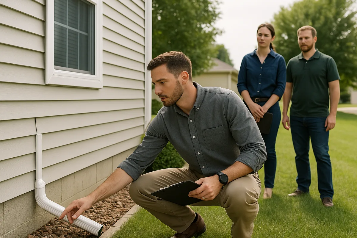
- Gutter and downspout discharge. Roof runoff should be directed away from the foundation through properly sized gutters and downspouts that discharge at least 4 to 6 feet from the structure, or into an underground drainage system that conveys water to the street or a designated drainage facility.
- Low points and ponding areas. Every property has topographic low points where water naturally collects. Identifying these areas — through visual observation during rain events or through a professional drainage assessment — is essential for preventing chronic moisture problems.
- Soil conditions. Sacramento's clay-rich soils expand when wet and contract when dry, creating a cycle that can damage foundations, crack slabs, and impede surface drainage. Understanding your soil type through resources like the NRCS Web Soil Survey can inform decisions about grading, landscaping, and drainage improvements.
- Proximity to drainage channels and detention basins. Properties adjacent to or near regional drainage channels, retention basins, or pump stations may be subject to easements, maintenance access requirements, or periodic inundation during design storm events.
The distinction between regional flood protection (SAFCA's domain) and property-level drainage management (the homeowner's responsibility) is important. SAFCA can protect your neighborhood from the American River overtopping its banks, but it cannot prevent water from pooling against your foundation because your yard is graded incorrectly. Both levels of protection are necessary for a truly resilient property.
What Sacramento Homeowners Should Do Now
Living in the Sacramento region means living with flood risk — it is an inherent characteristic of the geography. But that risk is manageable, and homeowners who take proactive steps can protect both their safety and their financial investment. Here is a practical action plan:
Know Your Flood Zone
Look up your property on FEMA's flood map service and understand your current zone designation. If you are in an AE zone, determine whether SAFCA projects are underway that may lead to future remapping. If you are in an X zone, do not assume you are immune from flooding — consider purchasing a Preferred Risk Policy, which offers flood insurance at significantly reduced premiums for properties in moderate-to-low-risk zones.
Understand SAFCA Projects Near Your Property
SAFCA publishes project updates, maps, and timelines on its website. Identify which levee segments protect your property and determine their current certification status. If a major improvement project is underway, understand the projected completion timeline and the implications for FEMA mapping.
Evaluate Your Property's Drainage
Conduct a thorough assessment of your lot's grading, drainage pathways, and stormwater management. Look for signs of poor drainage: standing water after rain, efflorescence (white mineral deposits) on foundation walls, musty odors in crawl spaces, or erosion channels in the yard. Consider engaging a professional drainage assessment service to identify vulnerabilities and recommend improvements.
Maintain Your Property's Drainage Infrastructure
Clean gutters and downspouts at least twice per year. Ensure that French drains, catch basins, and subsurface drainage lines are clear and functional. Re-grade areas where soil has settled against the foundation. These are low-cost, high-impact maintenance tasks that can prevent thousands of dollars in water damage.
Factor Flood Risk Into Real Estate Decisions
If you are buying or selling property in the Sacramento region, treat flood risk as a first-order consideration — not an afterthought. Review the Natural Hazard Disclosure (NHD) report carefully, verify the FEMA flood zone, confirm the SAFCA assessment on the tax bill, and investigate the status of nearby levee improvement projects. Properties in areas with recently completed or imminent SAFCA improvements may represent strong value opportunities, while properties in areas with unresolved levee deficiencies may carry hidden costs.
Stay Informed and Engaged
SAFCA holds public meetings, conducts community outreach, and provides regular updates on its projects. Attending these meetings or reviewing the published materials keeps you informed about decisions that directly affect your property. Flood control policy is shaped by public input, and homeowners who engage with the process are better positioned to advocate for their interests.
Sacramento's flood control infrastructure is undergoing a generational transformation, driven by SAFCA's leadership and funded by a combination of local assessments, state bonds, and federal appropriations. The outcome of this transformation will define the safety and economic vitality of the region for decades to come. Homeowners who understand the system — from the macro-level levee improvements to the micro-level drainage on their own lot — are the ones best equipped to protect their families and their investments.
At Low Point Labs, we specialize in helping homeowners understand the topographic and drainage conditions that affect their properties. Our drainage intelligence assessments provide detailed, data-driven insights into lot grading, water flow patterns, and flood vulnerability — the property-level factors that complement SAFCA's regional protection. If you want to understand how water moves across your property and what you can do to manage it, explore our assessment services and take the first step toward comprehensive flood resilience.
Get Your Drainage Intelligence Report™
Start a free trial and generate reports on demand.
Frequently Asked Questions
Related Articles

Flood Zones and Drainage in Sacramento: A Neighborhood-by-Neighborhood Guide
How to Train Teams to Assess Drainage Sites Consistently Every Time