What Causes Water to Pool in a Yard? 8 Common Drainage Issues Explained
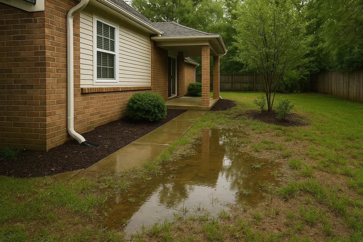
Few things frustrate homeowners more than walking outside after a rainstorm to find large sections of their lawn submerged under inches of murky, stagnant water. Water pooling in a yard is more than a cosmetic nuisance — it's a symptom of underlying drainage dysfunction that, left unaddressed, can damage your foundation, destroy your landscaping, breed mosquitoes, and reduce your property value. Understanding the root causes of standing water is the critical first step toward solving the problem permanently.
At Low Point Labs, we analyze thousands of residential properties each year using high-resolution topographic data, and the patterns are remarkably consistent. Most yard drainage problems trace back to a handful of identifiable causes — and nearly all of them are fixable once you understand the mechanics at play. In this guide, we'll walk through the eight most common standing water in yard causes, explain the science behind each one, and give you actionable steps to diagnose what's happening on your property.
Improper Yard Grading and Slope Deficiencies
The single most common cause of water pooling in a yard is improper grading — the slope and contour of the land surface that should be directing water away from structures and toward designated drainage outlets. When a yard is graded correctly, the terrain creates a subtle but effective gravity-driven pathway for stormwater. The International Residential Code (IRC) specifies that the ground should slope away from foundation walls at a minimum grade of 6 inches over the first 10 feet (approximately a 5% slope). Beyond that initial zone, a minimum 2% slope — roughly a quarter-inch drop per foot — is generally considered adequate to keep surface water moving.
When grading is insufficient, flat, or — worst of all — sloped back toward the home, water has nowhere to go. It collects in the lowest available point on the terrain, and that low point becomes your puddle. This is especially common in newer construction where builders have backfilled around the foundation. Over time, that backfill soil settles, sometimes dramatically, reversing the original grade and creating depressions that trap water against the very structure they were supposed to protect.
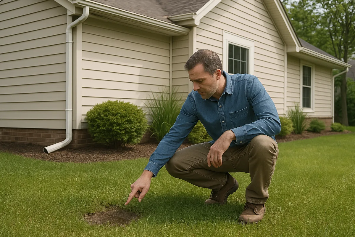
Grading issues can also develop gradually on established properties. Decades of foot traffic, landscaping projects, and natural soil movement can alter surface contours in ways that are nearly invisible to the naked eye but profoundly impactful to drainage. A depression of just two inches across a 20-foot span is enough to create persistent pooling after moderate rainfall. This is precisely why topographic analysis — rather than visual inspection alone — is so valuable for diagnosing yard drainage problems.
How to Spot Grading Problems
You don't need a surveyor's transit to perform a basic grading check. After a heavy rain, walk your property and observe where water is flowing — and where it's sitting. Pay particular attention to areas within 10 feet of your foundation. If water is moving toward your home rather than away from it, you have a grading deficiency that demands attention. You can also use a simple line level and string stretched between two stakes to measure the slope across any section of your yard. If the ground is level or slopes toward a structure, that's a red flag.
Get Your Drainage Intelligence Report™
Start a free trial and generate reports on demand.
Soil Compaction and Hardpan Formation
Even with perfect grading, water can pool on the surface if the soil underneath has become too compacted to absorb it. Soil compaction is one of the most underappreciated standing water in yard causes, and it's extraordinarily common in residential settings. Every time heavy equipment drives across your lot during construction, every year your kids play in the same section of the yard, and every season your riding mower follows the same path, the soil particles are being pressed closer together, squeezing out the air pockets and pore spaces that allow water to infiltrate.
Healthy, uncompacted topsoil can absorb between 1 and 6 inches of rainfall per hour, depending on its composition. Severely compacted soil may absorb less than 0.1 inches per hour — essentially becoming an impervious surface not much different from a parking lot. When infiltration rates drop this low, even a light rain event produces surface runoff and pooling because the water simply cannot penetrate the ground fast enough.
A related phenomenon is hardpan formation, where a dense, nearly impenetrable layer of soil develops several inches below the surface. Hardpan can form naturally through mineral deposition (particularly in soils with high calcium or iron content) or artificially through repeated tillage at the same depth. Water percolates through the topsoil but then hits the hardpan layer and stops, creating a perched water table that saturates the root zone and eventually wells up to the surface.
Testing for Compaction
A simple percolation test can reveal compaction issues. Dig a hole approximately 12 inches deep and 12 inches in diameter, fill it with water, and let it drain completely. Then fill it again and time how long it takes to drain. If the water takes more than four hours to drain, your soil has significant permeability problems. You can also try pushing a screwdriver into the ground — if it won't penetrate more than a few inches without significant force, compaction is likely a contributing factor to your water pooling in yard issues.
Clay-Heavy and Poorly Draining Soil Types
Soil composition plays a fundamental role in how quickly your yard can process rainfall. Soils are broadly classified by their particle size distribution — sand (large particles), silt (medium particles), and clay (very fine particles). Each type has dramatically different drainage characteristics, and the soil on your property may not be what you assume it is.
Clay soils are the primary culprit in drainage-related yard problems across much of the United States. Clay particles are less than 0.002 millimeters in diameter and pack together so tightly that they leave almost no space for water to pass through. When dry, clay soil can be rock-hard; when wet, it becomes a sticky, waterlogged mass that holds moisture for days or even weeks. The USDA Natural Resources Conservation Service (NRCS) classifies soils into four hydrologic groups (A through D), with Group D soils — predominantly heavy clays — having the highest runoff potential and lowest infiltration rates, often below 0.05 inches per hour.
If your property sits on Group C or Group D soils, surface pooling after rain events is almost inevitable without engineered drainage interventions. The soil simply cannot absorb water fast enough to prevent accumulation. This doesn't mean the situation is hopeless — it means your drainage strategy needs to account for the reality of your soil rather than fighting against it. Solutions for clay-heavy properties typically involve a combination of surface grading improvements, subsurface drainage systems (like French drains), and soil amendments in targeted areas.
The Soil Map Shortcut
Before you start digging test holes, check your property's soil type using the USDA's free Web Soil Survey tool. Enter your address and you'll get a detailed breakdown of the soil series on your lot, including drainage class, permeability estimates, and hydrologic group. This information is invaluable for understanding why water behaves the way it does on your property and for selecting appropriate remediation strategies.
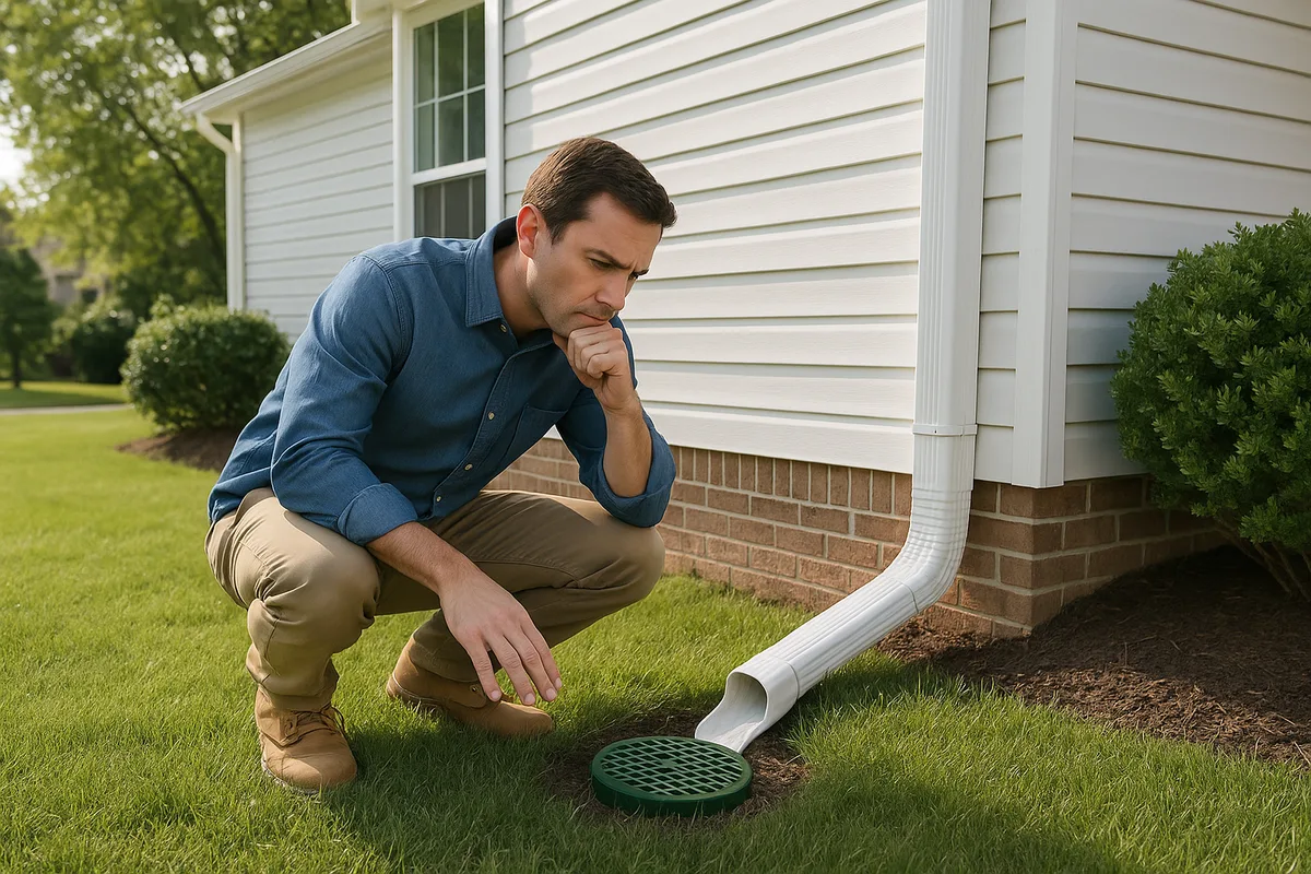
Insufficient or Failing Drainage Infrastructure
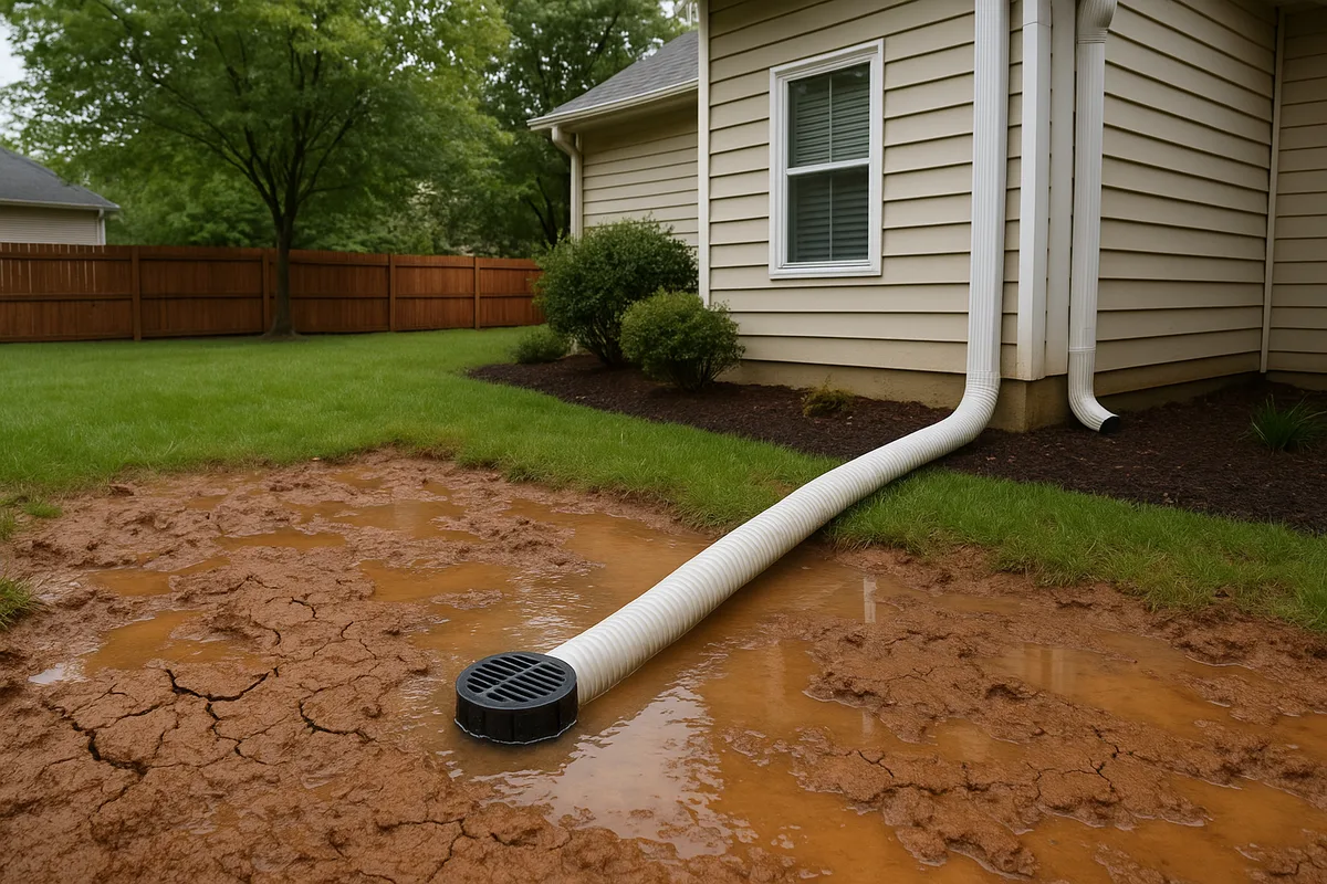
Many properties were built with drainage systems — downspout extensions, catch basins, French drains, curtain drains, or subsurface drain tiles — that were either undersized from the beginning or have deteriorated over time. When these systems fail, the consequences show up as standing water in areas that previously drained well.
French drains are particularly prone to failure. A properly constructed French drain consists of a perforated pipe surrounded by clean, washed gravel and wrapped in filter fabric, installed in a trench with adequate slope (typically 1% minimum) toward a discharge point. In practice, many French drains are installed with insufficient gravel, no filter fabric, inadequate slope, or improper pipe — and even well-built systems can clog over time as fine soil particles migrate through the gravel and accumulate in the pipe perforations. The average lifespan of a French drain is 5 to 20 years depending on soil conditions and construction quality.
Downspout discharge is another critical infrastructure element. Each downspout on a typical home handles runoff from 300 to 600 square feet of roof area. During a 1-inch-per-hour rainfall event, a single downspout can discharge 3 to 6 gallons of water per minute. If that water is dumped directly at the foundation — or even just a few feet from it — it concentrates an enormous volume of water in a small area, overwhelming the soil's absorption capacity and creating persistent pooling. Downspouts should discharge at least 6 feet from the foundation, and ideally 10 feet or more, with the discharge area graded to carry water away from the home.
Signs Your Drainage System Is Failing
Watch for water surfacing along the path of buried drain lines — this often indicates a pipe collapse or blockage. Catch basins that fill but don't drain suggest a downstream obstruction. If areas that used to drain well are now holding water, the change almost certainly points to infrastructure failure rather than a new grading problem. Inspect accessible cleanouts and outlets during rain events to verify water is flowing through the system as designed.
High Water Table Conditions
Sometimes the problem isn't that water can't drain through the soil — it's that the soil is already saturated from below. A high water table occurs when the zone of saturated groundwater sits close to the surface, leaving little or no capacity for the soil to absorb additional rainfall from above. In these conditions, water pools on the surface not because of poor grading or compacted soil, but because the ground is literally full.
Water table depth fluctuates seasonally and is influenced by regional precipitation patterns, proximity to bodies of water, local geology, and land use changes in the surrounding area. In many parts of the country, the water table rises significantly during spring snowmelt and fall rainy seasons, creating temporary but recurring pooling problems. Properties near rivers, lakes, wetlands, or coastal areas are particularly susceptible, as are properties in low-lying areas of a watershed.
New development upstream or adjacent to your property can also raise the local water table. When forests or agricultural land are converted to impervious surfaces (roofs, driveways, parking lots), the additional stormwater runoff that enters the ground in surrounding areas can elevate groundwater levels significantly. If your yard suddenly developed standing water problems after a new subdivision was built nearby, increased groundwater from redirected stormwater is a plausible explanation.
Living With a High Water Table
You can't lower the regional water table, but you can manage its effects on your property. Subsurface drainage systems — particularly curtain drains installed at the perimeter of problem areas — can intercept shallow groundwater and redirect it to an appropriate outlet. In severe cases, a sump pump system may be necessary. Landscaping choices also matter: selecting water-tolerant plant species and creating deliberate rain garden areas can turn a drainage liability into an attractive landscape feature.
Obstructed Natural Drainage Pathways
Water follows the path of least resistance, and every property has natural drainage pathways — subtle swales, low channels, and flow routes that carry surface water from higher ground to lower ground and eventually off the property. When these pathways are obstructed, water backs up behind the obstruction and pools.
The most common obstructions are human-made. A new fence installed across a natural swale can act as a dam, trapping water on the uphill side. A raised garden bed, a patio, a retaining wall, or even a thick row of mulch can redirect or block natural flow paths. Driveways and walkways are particularly problematic because they create long, continuous barriers that intercept sheet flow across the yard. Without gaps, channels, or drains to allow water to cross these hardscaped surfaces, pooling on the uphill side is inevitable.
Natural obstructions also play a role. Tree roots can divert subsurface flow and create surface depressions where water collects. Accumulated leaf litter and organic debris can clog natural channels and swales. Sediment deposition over time can fill in low areas that previously served as conveyance routes, flattening the grade and eliminating the slope that kept water moving.
Tracing Flow Paths
The best time to observe your property's natural drainage pathways is during an active rainstorm. Put on rain gear and walk the yard, noting where water is flowing, where it's being blocked, and where it's accumulating. Take photos and videos — this real-time documentation is far more valuable than any dry-weather inspection. Look for evidence of erosion (exposed soil, small channels) as indicators of concentrated flow paths, and note any structures or landscape features that appear to be interrupting those paths.
Excessive Impervious Surface Coverage
Every square foot of impervious surface on your property — roof, driveway, patio, walkway, pool deck — generates stormwater runoff that must go somewhere. Unlike permeable ground, which absorbs a significant portion of rainfall, impervious surfaces shed nearly 100% of the water that falls on them. As impervious coverage increases, the total volume of runoff your yard must manage increases proportionally, and eventually the permeable areas that remain simply cannot handle the load.
The math is straightforward and sobering. A 2,000-square-foot roof receiving 1 inch of rain produces approximately 1,250 gallons of runoff. Add a 600-square-foot driveway (375 gallons), a 400-square-foot patio (250 gallons), and 200 square feet of walkways (125 gallons), and a single 1-inch rain event dumps roughly 2,000 gallons of concentrated runoff onto your yard. If your lot is 8,000 square feet and 40% is covered by impervious surfaces, the remaining 4,800 square feet of lawn and landscaping must absorb not only the rain falling directly on it but also all the runoff from the impervious areas.
This problem is intensifying as homeowners add more hardscaping, expand driveways, build additions, and install accessory structures. Many municipalities now regulate impervious surface coverage through lot coverage limits and stormwater management ordinances, but older properties are often grandfathered in with coverage ratios that far exceed current standards. The Environmental Protection Agency (EPA) has extensively documented the relationship between impervious coverage and stormwater problems, noting that water quality and drainage issues begin to emerge when impervious coverage exceeds 10% of a watershed — a threshold that most residential lots surpass by a wide margin.
Reducing Effective Impervious Coverage
You don't necessarily need to remove hardscaping to reduce runoff. Permeable pavers, porous asphalt, and gravel systems can replace traditional impervious materials while maintaining functionality. Rain barrels and cisterns can capture roof runoff for later use in irrigation. Rain gardens and bioswales can be designed to receive and infiltrate concentrated runoff from downspouts and driveway edges. Even disconnecting downspouts from direct discharge pipes and allowing them to flow across vegetated areas can significantly reduce the volume of water that contributes to water pooling in yard situations.
Thatch Buildup and Lawn Health Issues
Not all causes of standing water are geological or structural — sometimes the problem is biological. Thatch, the layer of dead grass stems, roots, and organic debris that accumulates between the soil surface and the green grass blades, can become a surprisingly effective water barrier when it builds up beyond a half-inch in thickness.
A thick thatch layer acts like a sponge initially, absorbing water, but once saturated it becomes hydrophobic — actually repelling water rather than allowing it to pass through to the soil below. This creates a paradoxical situation where the lawn appears to be waterlogged on the surface while the soil underneath may be relatively dry. Homeowners often misdiagnose this as a grading or soil problem when the real issue is lawn maintenance.
Thatch buildup is most common in lawns that are over-fertilized (promoting rapid growth that outpaces decomposition), watered too frequently in shallow cycles (encouraging shallow root systems), or maintained with mulching mowers without periodic dethatching. Kentucky bluegrass, Bermuda grass, and zoysiagrass are particularly prone to thatch accumulation. A simple test is to cut a small wedge out of the lawn with a knife and measure the brown, spongy layer between the soil and the green grass. If it's more than three-quarters of an inch thick, thatch is likely contributing to your surface water problems.
Addressing Thatch and Lawn Compaction Together
Core aeration — the process of mechanically removing small plugs of soil from the lawn — addresses both thatch buildup and soil compaction simultaneously. The cores create channels for water infiltration and introduce soil microorganisms into the thatch layer, accelerating decomposition. For severe thatch problems (over 1 inch), power dethatching with a vertical mower may be necessary before aeration will be effective. The best time to aerate and dethatch is during the active growing season for your grass type — early fall for cool-season grasses, late spring for warm-season varieties.
How Multiple Causes Compound the Problem
In our experience at Low Point Labs, the most persistent and frustrating yard drainage problems are rarely caused by a single factor. Instead, they result from the compounding effect of multiple contributing causes. A property might have marginally adequate grading that would function acceptably on sandy soil — but the soil is clay. The clay soil might still drain slowly enough to prevent pooling if the impervious coverage were lower — but the homeowner added a large patio three years ago. The additional runoff from the patio might still be manageable if the existing French drain were functioning — but it clogged five years ago and was never maintained.
Each individual factor might not be severe enough to cause standing water on its own, but together they create a drainage deficit that overwhelms the property's capacity to manage stormwater. This is why single-solution approaches so often fail. A homeowner installs a French drain to address pooling in one area, but because the underlying grading deficiency wasn't corrected, the drain is overwhelmed during heavy events. Or they regrade a section of the yard but don't address the compacted soil, so water still can't infiltrate and simply pools in a new location.
Effective drainage remediation requires a holistic assessment that identifies all contributing factors and addresses them in a coordinated strategy. This means understanding the topography of the entire property (not just the problem area), the soil conditions, the existing infrastructure, the impervious coverage, and the relationship between your property and adjacent properties. A depression that pools water might be receiving runoff from a neighbor's regraded yard — a problem you can't solve by modifying your own grading alone.
The Value of Topographic Data
Traditional drainage assessments rely heavily on visual observation and manual measurements, which are inherently limited in their ability to capture the subtle elevation differences that drive surface water movement. A two-inch depression across a 30-foot span is virtually invisible to the eye but clearly apparent in high-resolution topographic data. At Low Point Labs, we use advanced elevation modeling to create detailed drainage maps that reveal every low point, flow path, and accumulation zone on a property. This data-driven approach eliminates guesswork and ensures that remediation efforts are targeted at the actual causes of pooling rather than symptoms.
Taking Action: From Diagnosis to Solution
If you're dealing with water pooling in your yard, the path forward starts with accurate diagnosis. Before spending money on drainage solutions, invest the time to understand exactly what's causing the problem — and recognize that the answer may involve multiple contributing factors.
Begin with observation. Watch your yard during and after rain events of different intensities. Note where water appears first, how it flows, where it accumulates, and how long it takes to dissipate. Document everything with photos, videos, and notes. Check your downspout discharge locations, inspect any existing drainage infrastructure, and test your soil's permeability with a simple percolation test.
Next, gather data about your property's topography, soil type, and drainage history. The USDA Web Soil Survey can tell you about your soil. County GIS systems often provide topographic and floodplain data. Your home's original grading plan (if available from the builder or local building department) can reveal how the property was intended to drain and where deviations may have occurred.
Finally, consider a professional drainage assessment. The complexity of drainage systems — where multiple interacting variables determine outcomes — makes them notoriously difficult to diagnose through casual observation alone. A comprehensive assessment that combines topographic analysis, soil evaluation, and infrastructure inspection can identify the specific combination of factors causing your problem and guide you toward solutions that actually work.
Low Point Labs specializes in exactly this kind of analysis. Our topographic drainage intelligence platform provides homeowners, contractors, and inspectors with the detailed elevation and flow data needed to understand why water behaves the way it does on any given property — and what it takes to fix it. If standing water has become a recurring problem on your property, explore our drainage assessment services and take the first step toward a permanently dry yard.
Get Your Drainage Intelligence Report™
Start a free trial and generate reports on demand.
Frequently Asked Questions
Related Articles
How to Spot Undersized Drainage Systems Before They Fail
How to Diagnose Yard Drainage Problems on a Site Walk