Flood Zones and Drainage in Sacramento: A Neighborhood-by-Neighborhood Guide
Sacramento sits at the confluence of two major rivers in a broad, low-lying valley — a geographic reality that has shaped the city's development, infrastructure, and real estate market for more than 170 years. Understanding the Sacramento flood zone map and how drainage conditions vary from neighborhood to neighborhood isn't just an academic exercise. It directly affects property values, insurance costs, foundation longevity, and the day-to-day livability of your home.
Whether you're buying a home in Natomas, dealing with standing water in Elk Grove, or trying to understand what a FEMA Special Flood Hazard Area designation means for your property in the Pocket, this guide breaks down Sacramento's flood and drainage landscape one neighborhood at a time. We'll cover the infrastructure that protects the region, the federal flood designations that govern insurance requirements, and — most importantly — what you can do at the property level to manage water intelligently.
Sacramento's Flood History and Why It Matters Today
Sacramento earned the nickname "City of Floods" in the 19th century, and for good reason. The city experienced catastrophic flooding in 1850, 1861–62, 1878, 1907, 1955, 1986, and 1997. The Great Flood of 1861–62 turned the entire Sacramento Valley into an inland sea stretching 300 miles long and 20 miles wide. That event prompted the city to literally raise its streets and buildings by as much as 10 to 15 feet — a massive engineering effort whose remnants you can still tour in Old Sacramento's underground passages.
The 1986 and 1997 floods were more recent reminders of the region's vulnerability. In February 1986, levee breaches along the American River's Folsom South Canal sent floodwaters into neighborhoods east of the city. In January 1997, multiple levee failures across the Sacramento River system caused over $2 billion in damage statewide, with Sacramento County among the hardest-hit areas. These events catalyzed the modern era of flood protection investment, including the formation and expansion of SAFCA (Sacramento Area Flood Control Agency).
Today, Sacramento is widely considered the most flood-vulnerable major city in the United States — a designation based on the sheer volume of population and property sitting behind levees in designated floodplains. The U.S. Army Corps of Engineers has estimated that a catastrophic levee failure during a major storm event could inundate portions of the city under 10 to 20 feet of water. That sobering reality drives everything from FEMA mapping to local building codes to the billions of dollars SAFCA and the state have invested in levee improvements since the late 1990s.
The Role of SAFCA Sacramento
SAFCA Sacramento (Sacramento Area Flood Control Agency) is the regional agency responsible for coordinating and funding major flood protection projects across the Sacramento metropolitan area. Established in 1989, SAFCA works in partnership with the U.S. Army Corps of Engineers, the California Department of Water Resources (DWR), and local reclamation districts to upgrade levees, expand flood bypass capacity, and improve the overall system resilience.
Key SAFCA projects include the Natomas Basin levee improvements (a multi-billion-dollar effort to bring Natomas levees to 200-year flood protection), the American River Common Features project (strengthening levees along the American River from Folsom Dam to the confluence with the Sacramento River), and improvements to the Sacramento Weir and Yolo Bypass system. SAFCA's work has been instrumental in changing FEMA flood designations for several Sacramento neighborhoods — most notably Natomas, where levee upgrades have gradually shifted portions of the basin from high-risk AE zones toward moderate-risk designations.
For homeowners, SAFCA's work has direct financial implications. When a neighborhood's levee system achieves accreditation from FEMA (typically requiring certification to the 100-year flood standard with freeboard), properties behind those levees can be reclassified out of Special Flood Hazard Areas. This can eliminate mandatory flood insurance requirements and significantly reduce annual costs for homeowners with federally backed mortgages.
Get Your Drainage Intelligence Report™
Start a free trial and generate reports on demand.
Understanding FEMA Flood Zone Designations in Sacramento
Before diving into specific neighborhoods, it's essential to understand the FEMA flood zone classification system that governs insurance requirements and real estate disclosures across Sacramento. The FEMA National Flood Map Service Center provides the official Flood Insurance Rate Maps (FIRMs) that lenders, insurers, and local governments rely on.
High-Risk Zones (Special Flood Hazard Areas)
Zone AE is the most common high-risk designation in Sacramento. Properties in Zone AE have a 1% annual chance of flooding (often called the "100-year floodplain"), and Base Flood Elevations (BFEs) have been determined. If you have a federally backed mortgage on a property in Zone AE, you are required to carry flood insurance. In Sacramento, Zone AE designations are found in portions of Natomas, the Pocket, parts of South Sacramento, and areas along the American and Sacramento River corridors.
Zone A is similar to AE but without detailed BFE data. This zone appears in some less-studied areas of Sacramento County, particularly in unincorporated areas and along smaller tributaries.
Zone AH designates areas of shallow flooding (typically 1 to 3 feet) with determined BFEs. Some low-lying areas in South Sacramento and Elk Grove carry this designation where ponding is the primary flood mechanism rather than riverine overflow.
Moderate-to-Low Risk Zones
Zone X (shaded) represents the 500-year floodplain — areas with a 0.2% annual chance of flooding. Flood insurance is not federally required in this zone but is recommended. Many Sacramento neighborhoods that have benefited from SAFCA levee improvements now fall into this category.
Zone X (unshaded) represents areas of minimal flood hazard, outside both the 100-year and 500-year floodplains. Properties in this zone have the lowest flood risk according to FEMA mapping, though localized drainage issues can still cause problems.
What Sacramento FEMA Flood Zone Designations Mean for Real Estate
The Sacramento FEMA flood zone real estate implications are significant. A Zone AE designation can add $1,500 to $4,000 or more per year in flood insurance premiums, depending on the property's elevation relative to the BFE, the building's construction type, and the coverage amounts selected. Under FEMA's Risk Rating 2.0 methodology (implemented in 2023), premiums are now calculated using a more granular approach that considers distance to water source, flood frequency, and multiple flood types — meaning two properties in the same FEMA zone can have very different premiums.
For Sacramento real estate transactions, California's Natural Hazard Disclosure (NHD) report is required and will flag whether a property sits within a FEMA Special Flood Hazard Area, a dam inundation zone, or other hazard areas. Buyers should review these disclosures carefully, but they should also understand that FEMA maps represent riverine and levee-related flood risk — they don't capture localized drainage problems, poor lot grading, or neighborhood-level stormwater management deficiencies that can cause just as much damage to a home.
North Natomas and South Natomas: The Basin Behind the Levees
North Natomas
No discussion of Sacramento flood risk is complete without addressing Natomas flood risk. The Natomas Basin is a low-lying area bounded by the Sacramento River to the west, the American River to the south, and the Natomas Cross Canal to the north. Virtually the entire basin sits below the flood stage of the surrounding rivers, meaning it is entirely dependent on the levee system for protection.
North Natomas experienced explosive residential growth in the late 1990s and 2000s, with tens of thousands of homes built in what was then (and in some areas still is) a FEMA-designated Special Flood Hazard Area. In 2008, FEMA officially remapped much of Natomas into Zone AE, requiring flood insurance for most homeowners — a move that temporarily froze new development and sent shockwaves through the local real estate market.
Since then, SAFCA Sacramento has invested over $1 billion in Natomas Basin levee improvements, including raising and strengthening levees along the Sacramento River and Natomas Cross Canal, constructing new seepage berms, and improving pump stations. These improvements have been phased, and as sections achieve FEMA accreditation, portions of the basin have been or are in the process of being reclassified to Zone X (shaded) or Zone X (unshaded).
From a drainage perspective, North Natomas faces a fundamental challenge: the basin is essentially a bowl. All stormwater must be collected and mechanically pumped out of the basin via a network of drainage canals and pump stations managed by Reclamation District 1000 (RD 1000). When pump stations are operating normally and the drainage canal system is maintained, the system works well. But during extreme rainfall events — particularly when high river stages prevent gravity discharge — the system can be overwhelmed, leading to localized street flooding and, in some cases, water intrusion into homes with inadequate lot grading.
Homeowners in North Natomas should pay particular attention to their property's finished floor elevation relative to the surrounding street and drainage infrastructure. Homes built on pad-raised lots (common in newer Natomas subdivisions) generally perform better than those at or near street grade. Ensuring that the lot slopes away from the foundation at a minimum of 2% grade (approximately ¼ inch per foot) for at least the first 6 to 10 feet is critical in a basin where every inch of elevation matters.
South Natomas
South Natomas occupies the southern portion of the basin, closer to the American River and generally featuring older housing stock from the 1970s through 1990s. South Natomas shares the same fundamental levee-dependent flood risk as North Natomas, but its older infrastructure presents additional drainage challenges.
Many South Natomas neighborhoods were built before modern stormwater management standards were adopted. Storm drain systems may be undersized by current standards, and decades of deferred maintenance on some drainage channels have reduced capacity. Standing water in yards, slow-draining streets, and soggy foundations are common complaints, particularly in neighborhoods near the Garden Highway and along the Natomas East Main Drainage Canal.
South Natomas properties should be evaluated carefully for both macro-level flood risk (levee-dependent basin flooding) and micro-level drainage performance (lot grading, foundation drainage, gutter discharge patterns, and the condition of nearby storm drain inlets).
The Pocket and Greenhaven: River-Bounded Neighborhoods
The Pocket (also known as Pocket-Greenhaven) is a residential enclave in south Sacramento bounded by the Sacramento River on three sides — west, south, and east. This geography creates a distinctive flood risk profile: the neighborhood is essentially a peninsula of developed land surrounded by levees.
Much of the Pocket falls within FEMA Zone AE, making it one of the most significant concentrations of Sacramento floodplain homes in the city. The levees protecting the Pocket are maintained by local reclamation districts and have been the subject of ongoing improvement efforts, but the neighborhood's river-surrounded geography means that a levee breach on any of three sides could result in deep, fast-moving floodwater.
Drainage within the Pocket is managed through a combination of gravity-fed storm drains and pump stations that discharge into the Sacramento River. During periods of high river stage, the pump stations become critical — if river levels rise above the storm drain outfall elevations, gravity discharge stops and only mechanical pumping prevents interior flooding.
For Pocket homeowners, the drainage implications extend beyond the macro flood scenario. The neighborhood's flat topography (typical elevations of 10 to 15 feet above sea level) and clay-heavy soils create conditions where surface water moves slowly and infiltration is limited. Properties with inadequate grading, clogged gutters, or poorly directed downspouts frequently experience foundation moisture problems, crawl space flooding, and landscape saturation.
Key drainage actions for Pocket homeowners include:
- Verifying that all downspouts discharge at least 4 to 6 feet from the foundation, directed toward the street or a designated drainage swale
- Maintaining positive grade away from the foundation on all sides of the home
- Inspecting crawl spaces annually for signs of standing water or moisture intrusion
- Keeping neighborhood storm drain inlets clear of leaves and debris, particularly during fall and winter months
- Considering a sump pump system for crawl spaces or basements in low-lying areas of the neighborhood
Elk Grove: Suburban Growth Meets Drainage Challenges
Elk Grove drainage issues are a frequent topic of concern among homeowners in this rapidly growing suburban city south of Sacramento. Elk Grove's drainage challenges stem from a combination of factors: rapid conversion of agricultural land to residential development, flat topography, clay-rich soils with poor permeability, and a drainage system that must convey stormwater across miles of low-gradient terrain to reach the Cosumnes River and its tributaries.
Elk Grove's newer subdivisions (built from the early 2000s onward) generally include modern stormwater detention basins designed to capture and slowly release runoff, reducing peak flows in downstream channels. These basins are typically maintained by the Cosumnes Community Services District or homeowner associations, and their effectiveness depends heavily on regular maintenance — sediment removal, vegetation management, and inlet/outlet structure upkeep.
Older Elk Grove neighborhoods, particularly those in the central and eastern portions of the city built in the 1980s and 1990s, may lack detention basin infrastructure and rely on conventional storm drain systems that were designed for the rainfall patterns and impervious surface ratios of their era. As climate patterns shift and bring more intense storm events, these systems can be overwhelmed.
Common Elk Grove drainage problems at the property level include:
- Backyard ponding: Flat lots with clay soils and minimal grade often develop standing water during the rainy season. Water may persist for days or weeks, damaging turf, promoting mosquito breeding, and saturating the soil near foundations.
- Slab-on-grade moisture intrusion: Many Elk Grove homes are built on concrete slabs. When the surrounding grade settles or was improperly established at construction, water can pool against the slab edge and wick moisture into the home through expansion joints or cracks.
- Side yard flooding: Narrow side yards between homes often become de facto drainage channels, concentrating runoff from roofs and hardscape. Without proper grading and drainage infrastructure (such as a French drain or channel drain), these areas can funnel water directly toward foundations.
- Detention basin maintenance failures: When HOA-managed detention basins are not properly maintained, they can fail to perform their stormwater management function, leading to increased flooding in surrounding streets and properties.
From a FEMA perspective, most of Elk Grove falls within Zone X (unshaded), meaning it is outside the 100-year and 500-year floodplains. However, portions of the city near the Cosumnes River, Laguna Creek, and Deer Creek corridors are designated Zone AE or Zone AH. Properties in these areas face both the riverine flood risk reflected in FEMA mapping and the localized drainage challenges common throughout the city.
Homeowners in Elk Grove should not assume that a Zone X designation means they are immune to water problems. Some of the most persistent and damaging drainage issues we see in the Sacramento region occur on properties that are technically outside FEMA flood zones but suffer from poor lot grading, inadequate stormwater conveyance, or soil conditions that prevent natural infiltration.
Land Park, Curtis Park, and East Sacramento: Older Neighborhoods, Unique Drainage Profiles
Land Park and Curtis Park
Land Park and Curtis Park are established Sacramento neighborhoods with housing stock dating primarily from the 1920s through 1950s. These neighborhoods sit at slightly higher elevations than the river-adjacent areas (typically 20 to 30 feet above sea level) and are generally outside FEMA Special Flood Hazard Areas. However, they face their own set of drainage challenges rooted in aging infrastructure and mature urban landscaping.
The storm drain systems in Land Park and Curtis Park were designed and installed decades ago, often with pipe diameters and inlet spacing that don't meet current standards. During heavy rainfall events, street flooding is common at low points and intersections where drainage capacity is insufficient. The city of Sacramento has undertaken periodic upgrades, but the scope of needed improvements exceeds available funding in any given budget cycle.
At the property level, Land Park and Curtis Park homes frequently feature raised foundations with crawl spaces — a construction style common in the era. While raised foundations provide some protection against surface flooding, they can also create hidden drainage problems. Water that infiltrates the crawl space from poor surface grading, broken downspout connections, or rising groundwater can go undetected for months or years, leading to wood rot, mold growth, and structural damage.
Mature trees, a defining characteristic of these neighborhoods, also affect drainage. Large tree roots can infiltrate and block underground drain lines, and the dense canopy produces significant leaf litter that clogs gutters, downspouts, and street-level storm drain inlets. Homeowners should clean gutters at least twice during the fall season and inspect underground drain lines periodically for root intrusion.
East Sacramento
East Sacramento (including the Fab 40s, East Portal, and River Park neighborhoods) occupies higher ground relative to the Sacramento and American Rivers and is generally mapped in Zone X. River Park, however, sits adjacent to the American River Parkway and is protected by the American River levee system — making it more levee-dependent than the neighborhoods to its west.
East Sacramento's drainage profile is similar to Land Park's: aging storm drain infrastructure, mature landscaping, and older homes with raised foundations. One notable difference is the prevalence of hardscape in East Sacramento's more affluent neighborhoods. Large driveways, patios, and pool decks increase impervious surface area, accelerating runoff and reducing the lot's ability to absorb rainfall naturally. Homeowners adding hardscape should consider permeable paving options or ensure that runoff is directed to landscape areas or drainage infrastructure rather than toward the foundation or neighboring properties.
South Sacramento, Meadowview, and Valley Hi: Low-Lying Challenges
The neighborhoods of South Sacramento — including Meadowview, Valley Hi, Parkway, and portions of the Florin area — occupy some of the lower-elevation terrain in the city, with many areas sitting at 15 to 20 feet above sea level. Portions of these neighborhoods fall within FEMA Zone AE or Zone AH, particularly near Morrison Creek, Elder Creek, and their tributaries.
South Sacramento's flood and drainage challenges are compounded by socioeconomic factors. Many properties in these neighborhoods have deferred maintenance on gutters, downspouts, and lot grading — not due to neglect, but due to the financial constraints faced by homeowners. The cumulative effect of deferred drainage maintenance across many properties in a neighborhood can overwhelm the public storm drain system and create chronic localized flooding.
The Sacramento County Department of Water Resources manages several flood control channels and detention basins in South Sacramento. The Morrison Creek and Elder Creek flood control projects have reduced riverine flood risk in some areas, but localized drainage problems persist, particularly in neighborhoods with:
- Flat or reverse-graded lots where soil settlement has altered the original drainage pattern
- Unpermitted additions or structures that block natural drainage paths
- Deteriorated or undersized storm drain pipes in the public right-of-way
- High groundwater tables during the wet season that reduce soil storage capacity
For homeowners in South Sacramento, understanding your property's micro-topography — the subtle slopes and low points within your lot — is essential. Even a 1-inch depression near a foundation wall can channel hundreds of gallons of water toward the structure during a storm. Low Point Labs' topographic drainage assessments are specifically designed to identify these subtle but consequential drainage patterns.
Arden-Arcade, Carmichael, and Fair Oaks: The American River Corridor
The unincorporated communities along the American River corridor — Arden-Arcade, Carmichael, and Fair Oaks — have a flood risk profile dominated by the American River and its tributaries, including Arcade Creek, Chicken Ranch Slough, and various unnamed streams.
Folsom Dam, located upstream, provides the primary flood control for the American River corridor. The Joint Federal Project (JFP) at Folsom Dam, completed in recent years, added an auxiliary spillway that significantly increased the dam's flood management capacity. This improvement, combined with SAFCA Sacramento's American River Common Features levee upgrades, has substantially reduced the residual flood risk for communities downstream.
However, FEMA flood zone designations in the American River corridor remain complex. Properties directly adjacent to the river and within the levee-protected floodplain may still carry Zone AE designations until levee accreditation is formally completed and FEMA maps are updated — a process that can take years after physical improvements are finished.
Arcade Creek, which flows through Arden-Arcade and into the Natomas East Main Drainage Canal, is a particular drainage concern. The creek's limited channel capacity and the extensive urbanization of its watershed mean that high-intensity storms can produce rapid runoff and localized flooding along the creek corridor. Properties within a few hundred feet of Arcade Creek should be evaluated for both FEMA-mapped flood risk and localized overbank flooding potential.
In Fair Oaks and eastern Carmichael, the terrain transitions from valley floor to foothill topography. While this higher ground reduces riverine flood risk, it introduces hillside drainage challenges: concentrated runoff from slopes, erosion along drainage channels, and the potential for water to accumulate at the base of hills where homes are often sited. Properties on sloped lots should ensure that uphill runoff is intercepted and diverted before it reaches the foundation, using techniques such as swales, French drains, or concrete interceptor channels.
Practical Drainage Assessment for Any Sacramento Neighborhood
Regardless of which Sacramento neighborhood you're in, the principles of property-level drainage assessment are consistent. Here's a framework that applies universally:
Evaluate Your Lot's Surface Grading
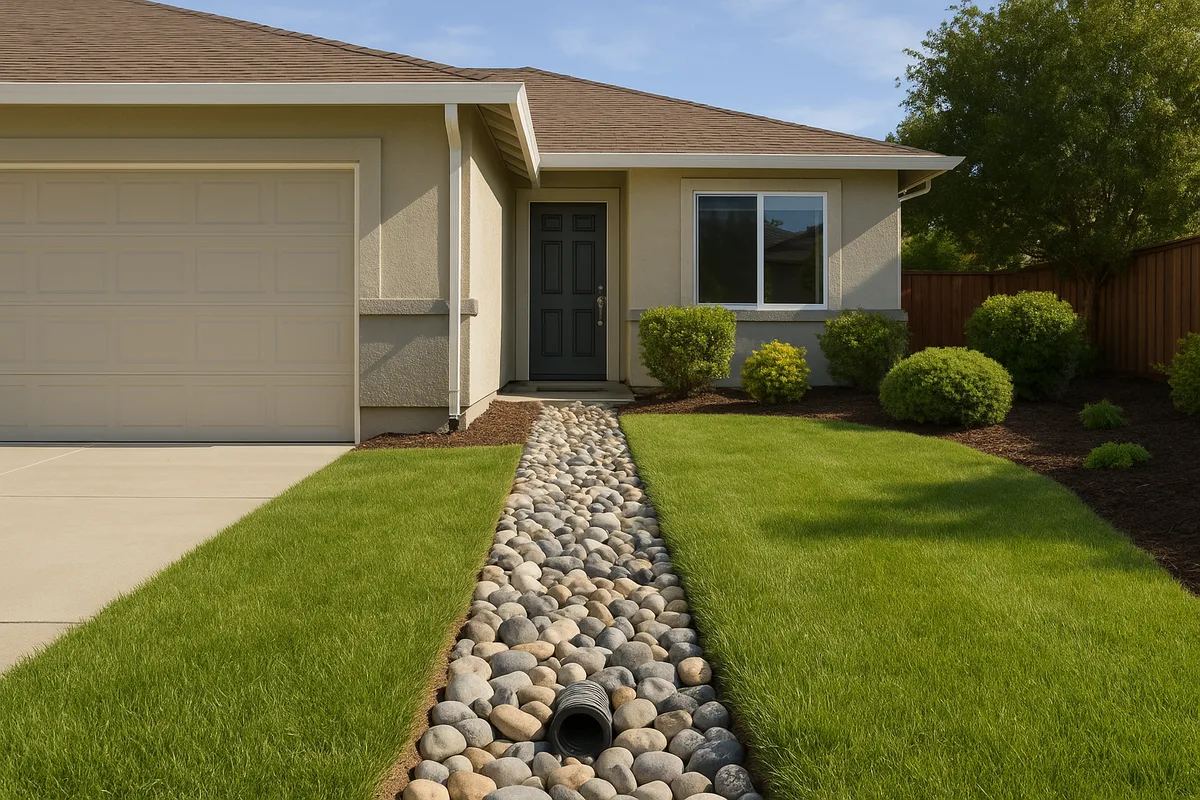
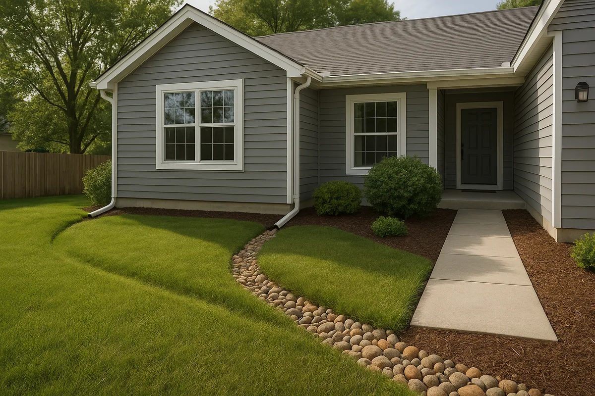
The single most important factor in residential drainage is surface grading — the direction and degree of slope across your property. The standard recommendation is a minimum 2% slope (¼ inch per foot) away from the foundation for the first 6 to 10 feet. In Sacramento's clay-heavy soils, where infiltration is slow, maintaining positive grade is even more critical because surface water that doesn't drain away from the foundation has nowhere to go but against it.
Over time, soil settlement, landscaping changes, and root growth can alter your lot's grading. A property that drained perfectly when it was built 20 years ago may now have reverse-graded areas that funnel water toward the foundation. Visual inspection during a rainstorm is one of the simplest and most revealing diagnostic tools available — watch where water flows and where it pools.
Inspect and Maintain Your Gutter and Downspout System
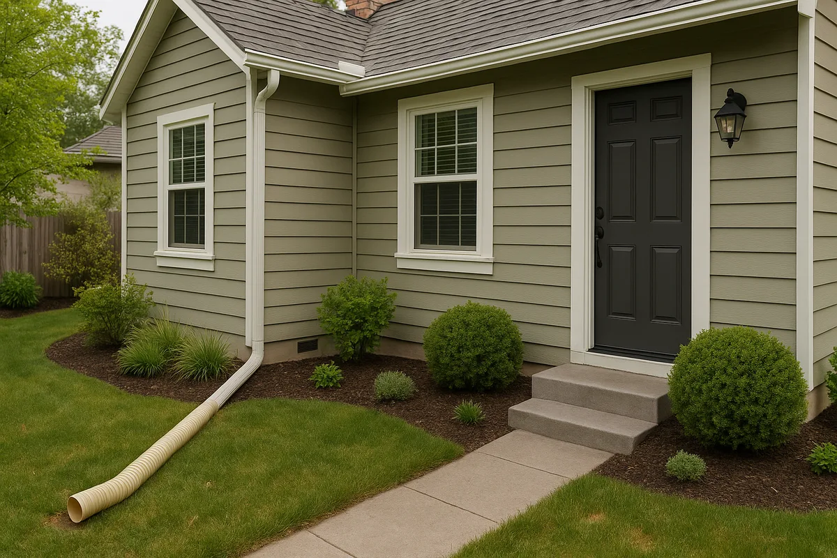
Gutters and downspouts are your home's first line of defense against roof runoff — and in Sacramento, where a typical 2,000-square-foot roof can collect over 1,200 gallons of water from a single inch of rainfall, the stakes are high. Ensure gutters are clean, properly pitched (minimum ⅛ inch per foot toward downspouts), and free of leaks. Downspouts should discharge at least 4 to 6 feet from the foundation via splash blocks, downspout extensions, or underground drain lines that daylight to the street or a suitable discharge point.
Understand Your Soil Type
Sacramento area soils vary significantly by neighborhood. The NRCS Web Soil Survey allows you to look up the specific soil types on your property. Much of the Sacramento Valley floor is underlain by Hydrologic Soil Group D soils — heavy clays with very slow infiltration rates (less than 0.05 inches per hour). These soils are essentially impermeable during sustained rainfall, meaning virtually all precipitation becomes surface runoff. Knowing your soil type helps you design appropriate drainage solutions — for example, French drains in Group D soils need to be designed as conveyance systems (moving water to a discharge point) rather than infiltration systems (allowing water to soak into the ground).
Check for Signs of Drainage Failure
Common indicators of drainage problems on Sacramento properties include:
- Efflorescence (white mineral deposits) on foundation walls or basement/crawl space surfaces
- Musty odors in crawl spaces or lower levels
- Cracks in foundation walls or slabs, particularly horizontal cracks that may indicate hydrostatic pressure
- Erosion channels or soil washout along the foundation perimeter
- Standing water in yards more than 24 hours after rainfall stops
- Water stains on interior walls at or near floor level
- Mold or mildew growth on lower wall surfaces
Leverage Topographic Data
Modern elevation data — including LiDAR-derived digital elevation models — can reveal drainage patterns that are invisible to the naked eye. A 2-inch elevation difference across a 50-foot lot may not be perceptible when you walk the property, but it absolutely determines where water flows during a storm. Low Point Labs specializes in analyzing high-resolution topographic data to identify drainage patterns, low points, and flow accumulation areas on residential properties throughout the Sacramento region.
Making Informed Decisions: Flood Risk, Insurance, and Property Investment
For anyone navigating the Sacramento FEMA flood zone real estate market, flood risk should be a central factor in your decision-making — but it shouldn't be the only factor. Here's how to think about it holistically:
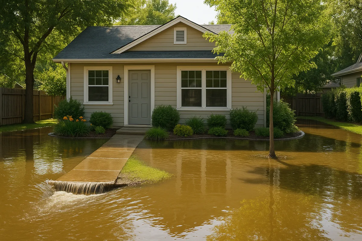
Don't rely solely on FEMA maps. FEMA flood maps are essential tools, but they have limitations. They primarily model riverine and coastal flood risk, not localized drainage, urban flooding from overwhelmed storm drains, or groundwater-related issues. A property in Zone X can still have serious water problems, and a property in Zone AE can be well-protected if it's properly elevated and graded.
Factor in SAFCA improvements. SAFCA Sacramento's ongoing levee improvement projects are systematically reducing flood risk across the region. If you're considering a property in an area where SAFCA improvements are underway or recently completed, investigate the project timeline and its implications for future FEMA map revisions. A property that currently requires flood insurance may be reclassified within a few years, potentially reducing your annual costs by thousands of dollars.
Get a property-level drainage assessment. Neighborhood-level flood risk is important, but property-level drainage performance is what determines whether your specific home stays dry. A professional drainage assessment evaluates lot grading, downspout discharge patterns, soil conditions, nearby drainage infrastructure, and the property's topographic position relative to its surroundings.
Consider flood insurance even if it's not required. Over 25% of flood insurance claims nationally come from properties outside FEMA Special Flood Hazard Areas. In Sacramento, where intense atmospheric river events can overwhelm urban drainage systems regardless of FEMA zone designation, a Preferred Risk Policy (available for properties in Zone X) can provide meaningful coverage at a relatively low cost.
Think long-term about climate trends. Sacramento's precipitation patterns are shifting toward more intense, concentrated storm events interspersed with longer dry periods. This "feast or famine" pattern stresses drainage infrastructure designed for more moderate, evenly distributed rainfall. Properties with robust drainage systems — proper grading, adequate conveyance capacity, and well-maintained infrastructure — will be better positioned to handle these evolving conditions.
Sacramento's relationship with water is complex, layered, and constantly evolving. From the massive levee systems that protect entire neighborhoods to the subtle grade of soil against your foundation wall, every scale of drainage matters. At Low Point Labs, we help Sacramento homeowners understand their property's unique drainage profile through detailed topographic analysis and actionable recommendations. Whether you're buying a new home, troubleshooting persistent water problems, or proactively protecting your investment, our drainage intelligence gives you the clarity to make confident decisions. Explore our Sacramento-area drainage assessment services to see how your property's topography tells the story of where water goes — and whether it's going where it should.
Get Your Drainage Intelligence Report™
Start a free trial and generate reports on demand.
Frequently Asked Questions
Related Articles
SAFCA Sacramento: What Homeowners Must Know About Flood Control & Property
Grading and Lot Drainage: What Sacramento Buyers Should Check Before Closing