Best Landscape Estimating Software for Calculating Complex Site Runoff
Every landscape project that reshapes the ground surface changes how water moves. Whether you're installing a patio, regrading a backyard, or designing a multi-lot subdivision landscape plan, the ability to accurately calculate site runoff is what separates a project that performs from one that floods. The right landscape estimating software transforms this complex hydrological challenge into a manageable, data-driven workflow — giving contractors, designers, and homeowners the confidence that their drainage plan will hold up in real storms.
But the market is crowded. Some tools are built for civil engineers designing municipal infrastructure, while others are tailored for landscape contractors who need quick takeoffs and material estimates. In between, there's a growing category of software that bridges both worlds: platforms that combine landscape design with legitimate hydrological modeling. This article breaks down the landscape, explains the science behind runoff calculations, and helps you choose the right tool for your project's complexity.
Why Accurate Site Runoff Calculations Matter in Landscape Projects
Water doesn't care about your design intent. It follows gravity, and it follows the path of least resistance. When a landscape project changes the topography, surface materials, or vegetation of a site, it fundamentally alters the runoff characteristics. A new driveway that replaces permeable turf with impervious concrete can increase runoff volume from that area by 90% or more. A poorly graded landscape bed can redirect sheet flow toward a foundation instead of away from it.
The consequences of getting runoff calculations wrong range from nuisance ponding to catastrophic foundation damage. Standing water kills plantings, erodes soil, undermines hardscape installations, and creates liability issues for contractors. For homeowners, chronic drainage problems can reduce property values by 10–15% and lead to tens of thousands of dollars in structural repairs. Municipalities are increasingly requiring stormwater management plans even for residential projects, making accurate runoff estimation not just good practice but a regulatory necessity.
Modern landscape estimating software addresses this by integrating runoff calculations directly into the design and bidding workflow. Instead of treating drainage as an afterthought — something to figure out after the pretty plan is drawn — these tools let you model water behavior as you design. This iterative approach catches problems early, when changes are cheap, rather than late, when they require rework.
The fundamental question any runoff calculation answers is: For a given storm event, how much water will leave this site, how fast, and where will it go? Answering that question requires understanding rainfall intensity, soil infiltration rates, surface cover types, slopes, and drainage area boundaries. The best software handles all of these variables with minimal manual input.
Get Your Drainage Intelligence Report™
Start a free trial and generate reports on demand.
The Science Behind Runoff Estimation: Methods Your Software Should Support
Not all runoff calculation methods are created equal, and understanding the underlying hydrology helps you evaluate whether a software tool is doing legitimate science or just generating impressive-looking numbers. There are three primary methods used in landscape and site design, and the best landscape estimating software supports at least two of them.
The Rational Method
The Rational Method is the most widely used approach for small drainage areas (typically under 200 acres, though it's most accurate under 20 acres). It calculates peak runoff flow rate using the formula:
Q = C × i × A
Where Q is the peak discharge (in cubic feet per second), C is the runoff coefficient (a dimensionless number between 0 and 1 representing how much rainfall becomes runoff), i is the rainfall intensity (inches per hour for a given storm frequency and duration), and A is the drainage area (in acres).
The beauty of the Rational Method is its simplicity. A landscape contractor can use it to size a French drain or determine whether a swale has adequate capacity. The challenge is selecting the right runoff coefficient, which varies dramatically by surface type: impervious surfaces like concrete have a C value of 0.90–0.95, while well-maintained lawns on flat ground might be 0.10–0.25. Good software includes built-in coefficient tables and lets you assign different values to different zones within your site plan.
The SCS Curve Number Method
Developed by the USDA Soil Conservation Service (now the Natural Resources Conservation Service), the Curve Number (CN) method is more sophisticated. Instead of just calculating peak flow, it estimates total runoff volume for a given storm event. The CN method accounts for soil type, land use, and antecedent moisture conditions using a curve number between 0 and 100 — higher numbers mean more runoff.
This method is particularly valuable for landscape projects because it directly incorporates hydrologic soil group classifications (A, B, C, and D), which describe how quickly water infiltrates. A sandy loam (Group A) behaves completely differently from a clay soil (Group D), and the CN method captures this. Software that uses the CN method typically lets you import or select soil data for your site, automatically assigning curve numbers based on your design's land cover types.
TR-55 and TR-20
For more complex sites with multiple drainage areas, varying times of concentration, and the need to route flows through a system of channels, pipes, and detention facilities, the NRCS TR-55 (Urban Hydrology for Small Watersheds) and TR-20 methods provide greater accuracy. TR-55 generates runoff hydrographs — graphs showing how flow rate changes over time during a storm — rather than just peak values. This is critical for sizing detention basins, rain gardens, and other stormwater BMPs that depend on volume and timing, not just peak flow.
Professional-grade landscape estimating software increasingly incorporates TR-55 calculations, making this level of analysis accessible to landscape architects and contractors who previously would have needed to hire a civil engineer for anything beyond a simple Rational Method estimate.
Top Landscape Estimating Software for Runoff Calculations
The software landscape (no pun intended) spans a wide range of capabilities and price points. Here's a detailed look at the tools that handle site runoff calculations with varying degrees of sophistication.
Autodesk Civil 3D and Grading Optimization
Autodesk Civil 3D is the industry standard for civil engineering site design, and its grading and hydrology tools are unmatched in depth. It supports surface modeling from survey data or LiDAR imports, automatic watershed delineation, and integration with the EPA's Storm Water Management Model (SWMM) for detailed hydraulic analysis. For landscape projects that involve significant grading — cut-and-fill calculations, retaining walls, complex multi-tier designs — Civil 3D provides the most accurate topographic modeling available.
The trade-off is complexity and cost. Civil 3D has a steep learning curve and an annual subscription price that puts it out of reach for many landscape contractors. It's best suited for landscape architecture firms handling large commercial or institutional projects where the engineering rigor is required by the client or the permitting authority.
Vectorworks Landmark
Vectorworks Landmark is purpose-built for landscape architects and offers a compelling middle ground between design elegance and engineering capability. Its site modeling tools allow you to create existing and proposed terrain models, calculate cut-and-fill volumes, and visualize drainage patterns. While it doesn't have built-in hydrological modeling as robust as Civil 3D, it integrates with third-party analysis tools and exports data in formats compatible with dedicated hydrology software.
Landmark's strength is its design-first workflow. You can sketch a landscape plan, assign surface types and materials, and then evaluate how those choices affect runoff characteristics. For firms that need to present beautiful design documents to clients while also demonstrating drainage competence, Landmark strikes a good balance.
LandFX and Land F/X
LandFX (now part of the Land F/X suite) runs as a plugin for AutoCAD and offers landscape-specific tools including irrigation design, planting plans, and site analysis. Its drainage capabilities are more limited than standalone hydrology software, but it excels at integrating material estimates with site design. For contractors who need to calculate how much drain pipe, gravel, and filter fabric a drainage installation will require — and what it will cost — LandFX streamlines the estimating process.
The runoff calculation capabilities are basic (primarily Rational Method), but for residential and small commercial landscape projects, this is often sufficient. The real value is in connecting the drainage design to a complete material takeoff and cost estimate.
HydroCAD
HydroCAD is a dedicated stormwater modeling tool that many landscape architects and civil engineers use alongside their primary design software. It supports TR-55, TR-20, and Rational Method calculations, models detention ponds and underground storage systems, and generates the engineering reports that permitting agencies require. While it's not a landscape design tool per se, it's the gold standard for the hydrology side of the equation.
For complex sites with multiple drainage areas, existing streams or wetlands, and regulatory requirements for post-development runoff to match pre-development levels, HydroCAD is often the right choice. Many landscape firms use a design tool like Vectorworks or AutoCAD for the visual plan and HydroCAD for the engineering analysis, linking the two through shared site data.
QGIS with Hydrology Plugins
For budget-conscious professionals and technically inclined homeowners, QGIS — a free, open-source geographic information system — offers surprisingly powerful runoff analysis capabilities when paired with the right plugins. Tools like GRASS GIS (integrated into QGIS) can delineate watersheds, calculate flow accumulation, and model surface runoff from digital elevation models. The SWAT (Soil and Water Assessment Tool) plugin adds more sophisticated hydrological modeling.
The learning curve is significant, and there's no hand-holding — you need to understand the hydrology concepts to set up the analysis correctly. But for someone willing to invest the time, QGIS can produce professional-grade runoff analyses at zero software cost. It's particularly useful for analyzing existing conditions before designing a landscape intervention.
Cloud-Based and Mobile Estimating Tools
A newer category of landscape estimating software includes cloud-based platforms like Aspire, LMN, and SingleOps that focus on business management and job costing. These tools typically don't include built-in runoff calculations, but they're evolving rapidly. Some now integrate with aerial imagery and topographic data to help contractors estimate grading and drainage work more accurately.
For contractors who primarily need to estimate the cost of drainage installations — French drains, catch basins, channel drains, dry wells — rather than perform detailed hydrological analysis, these business-focused platforms can be highly effective. The key is understanding that they estimate work and materials, not water behavior. You still need a separate analysis to determine what drainage solution is actually required.
Key Features to Evaluate in Landscape Estimating Software for Drainage
When comparing landscape estimating software options for site runoff work, focus on these critical capabilities that separate tools adequate for simple projects from those that handle complex sites.
Terrain Modeling and Surface Analysis
The foundation of any runoff calculation is an accurate representation of the ground surface. Look for software that can import survey data (point clouds, total station files), LiDAR datasets, or at minimum, allow you to create a terrain model from spot elevations and contour lines. The software should be able to generate slope maps, flow direction arrows, and watershed boundaries from this terrain data.
For residential projects, the ability to model both existing and proposed conditions is essential. You need to compare pre-construction and post-construction runoff to demonstrate that your landscape plan doesn't worsen drainage — and ideally improves it. Software that overlays the proposed grading plan on the existing terrain and automatically calculates the change in runoff characteristics saves enormous time.
Soil Data Integration
Runoff calculations are only as good as the soil data behind them. The best tools integrate with the NRCS Web Soil Survey, allowing you to pull hydrologic soil group data directly for your project site. This eliminates the guesswork in assigning infiltration rates and curve numbers. Some software goes further, letting you input site-specific percolation test results that override the generic NRCS classifications — important for sites with fill soils, compacted subgrades, or other conditions that don't match the mapped soil type.
Rainfall Data and Storm Event Modeling
Accurate runoff estimation requires accurate rainfall data. Software should reference NOAA Atlas 14 precipitation frequency estimates or equivalent regional data to determine design storm intensities. Look for tools that let you select the storm return period (2-year, 10-year, 25-year, 100-year) and duration, automatically pulling the corresponding rainfall intensity for your geographic location.
This matters because a drainage system designed for a 2-year storm (roughly a 50% chance of occurring in any given year) will be overwhelmed by a 25-year event. Most residential drainage designs target the 10-year storm, but local codes vary. Software that makes it easy to run multiple scenarios helps you design for the right level of protection and communicate the trade-offs to clients.
Material Takeoff and Cost Integration
For contractors, the connection between hydrological analysis and job costing is where landscape estimating software earns its keep. Once you've determined that a site needs 150 linear feet of 4-inch perforated pipe in a gravel-filled trench, the software should calculate the quantities of pipe, fittings, filter fabric, drainage gravel, and backfill soil — and apply your unit costs to generate an estimate.
The best tools maintain a database of drainage materials with current pricing, account for waste factors and overlap, and generate professional proposals that explain both the problem (runoff analysis) and the solution (drainage installation) to the client. This combination of engineering credibility and business efficiency is what wins jobs.
Reporting and Regulatory Compliance
If your jurisdiction requires a stormwater management plan for landscape projects that exceed a certain disturbance threshold (often one acre, per EPA NPDES requirements, but sometimes as low as 5,000 square feet in sensitive areas), your software needs to generate reports that satisfy the reviewing engineer or planning department. Look for pre-formatted report templates that include drainage area maps, calculation summaries, BMP sizing, and pre/post development comparisons.
How to Calculate Site Runoff for Complex Residential Properties
Even with excellent software, understanding the workflow for complex site runoff calculation helps you use the tools effectively and catch errors in the output. Here's the process that professionals follow, whether they're using a $10,000 software suite or a spreadsheet.
Step 1: Delineate Drainage Areas
Before you can calculate how much water runs off a site, you need to define where water goes. A drainage area (or subcatchment) is the area of land that drains to a single point — a catch basin inlet, the low point of a swale, or the corner of a building where two roof planes meet. Complex residential sites often have 5–15 distinct drainage areas, each with different slopes, surface types, and outlet points.
Software with automatic watershed delineation uses the terrain model to identify these areas algorithmically. On flat or subtly graded sites, however, the automatic results may not match reality — small features like garden borders, sidewalk edges, and subtle grade breaks can redirect flow in ways that the software's resolution doesn't capture. Always verify automated drainage boundaries against field observations.
Step 2: Characterize Each Drainage Area
For each delineated area, you need to determine the surface cover (impervious vs. pervious, and what type), the soil type, the average slope, and the flow path length. This data feeds directly into the runoff coefficient (Rational Method) or curve number (SCS method) calculations.
A typical residential property might include:
- Roof areas (C = 0.90–0.95)
- Driveway and walkways (C = 0.85–0.95)
- Patio with permeable pavers (C = 0.40–0.60)
- Lawn on clay soil (C = 0.25–0.40)
- Mulched landscape beds (C = 0.15–0.30)
- Wooded area with leaf litter (C = 0.10–0.20)
Good landscape estimating software lets you draw or select these zones on your site plan and automatically applies the appropriate coefficients based on the material assignments in your design.
Step 3: Determine the Design Storm
Select the rainfall intensity or depth for your design storm based on local requirements and project goals. A 10-year, 24-hour storm is a common residential design standard, but check your local stormwater ordinance. In areas with combined sewer systems or sensitive receiving waters, you may need to design for water quality storms (often the 1-year or 2-year event) in addition to the larger flood control storm.
The time of concentration — how long it takes water to travel from the most hydraulically remote point in the drainage area to the outlet — affects the rainfall intensity used in the Rational Method. Shorter times of concentration mean higher intensities and higher peak flows. For most residential lots, the time of concentration is 5–15 minutes.
Step 4: Run the Calculations and Iterate
With drainage areas defined, characterized, and a design storm selected, the software performs the runoff calculations. Review the results critically. Does the peak flow at the site outlet seem reasonable? For a 10,000-square-foot residential lot that's 50% impervious in a moderate rainfall area, you might expect peak flows of 0.5–1.5 cubic feet per second during a 10-year storm. If the software reports 10 cfs, something is wrong with your inputs.
The iterative power of software becomes apparent here. You can test how different design choices affect runoff: What if you use permeable pavers instead of concrete for the patio? What if you add a rain garden at the low point? What if you increase the lawn area by 500 square feet? Each scenario takes minutes to model in software but would take hours by hand.
Step 5: Size Drainage Infrastructure
Once you know the peak flow rates and volumes, you can size the drainage components: pipe diameters (using Manning's equation), swale dimensions, French drain lengths, and detention volumes. Some landscape estimating software handles this automatically; others require you to use the runoff results as inputs to a separate pipe-sizing calculation.
For reference, a 4-inch corrugated drain pipe on a 1% slope can carry approximately 0.15 cfs. A 6-inch pipe on the same slope handles about 0.45 cfs. If your runoff calculation shows 0.60 cfs reaching a collection point, you need an 8-inch pipe or two 6-inch pipes — not the 4-inch pipe that a contractor might install by default.
Common Mistakes When Using Software for Runoff Estimation
Software makes calculations faster, but it doesn't make them correct. The "garbage in, garbage out" principle applies with full force to hydrological modeling. Here are the mistakes we see most often.
Ignoring Offsite Contributing Areas
Your property doesn't exist in isolation. If the neighbor's yard slopes toward your site, that runoff is part of your problem. Software that only models the property within its legal boundaries will underestimate flows if significant offsite drainage enters the site. Always extend your analysis area to include any contributing slopes from adjacent properties, roads, or open spaces.
Using Default Soil Values Without Verification
Mapped soil data from the NRCS Web Soil Survey describes native soil conditions. On developed residential lots, the actual soil may bear little resemblance to the mapped type. Construction activities compact soil, reducing infiltration rates by 70–90%. Fill material imported to a site may be a completely different soil type than what's mapped. Whenever possible, supplement mapped data with field observations — even a simple jar test or hand-texture analysis is better than blind reliance on defaults.
Underestimating Impervious Coverage
It's easy to account for the obvious impervious surfaces: roofs, driveways, sidewalks. But compacted gravel paths, heavily trafficked lawn areas, and even some types of landscape fabric can behave as semi-impervious surfaces. A conservative approach assigns higher runoff coefficients to areas of uncertainty rather than optimistic ones.
Neglecting Maintenance Assumptions
A rain garden designed to infiltrate 500 cubic feet of runoff will only do so if it's maintained. If the garden fills with sediment, the soil compacts, or the plants die and aren't replaced, its infiltration capacity drops dramatically. Software calculates performance based on design conditions. Build in a safety factor — typically 1.25 to 1.5 — to account for real-world degradation.
Over-Relying on Software Without Field Verification
The most sophisticated software model is still a simplification of reality. After installation, verify that water actually flows where the model predicted. Walk the site during a rain event. Check that swales are conveying flow, that inlets aren't overwhelmed, and that discharge points aren't causing erosion. Software is a design tool, not a guarantee.
Emerging Trends in Landscape Runoff Software
The landscape estimating software market is evolving rapidly, driven by advances in remote sensing, cloud computing, and environmental regulation. Several trends are reshaping how professionals approach site runoff calculations.
LiDAR and Drone-Derived Terrain Models
High-resolution topographic data from LiDAR surveys and drone photogrammetry is becoming affordable for individual project sites. Where landscape contractors once relied on a handful of spot elevations taken with a transit, they can now generate terrain models with sub-inch vertical accuracy across an entire property. This data, when imported into landscape estimating software, produces dramatically more accurate drainage area delineations and slope calculations.
The USGS 3D Elevation Program (3DEP) is systematically collecting LiDAR data across the United States, and much of this data is freely available. For preliminary site analysis — before mobilizing a survey crew — this publicly available elevation data can provide a useful starting point for runoff estimation.
AI-Assisted Design Optimization
Some newer platforms are beginning to use machine learning algorithms to suggest grading plans that minimize runoff while meeting other design objectives (aesthetics, accessibility, cost). Rather than the designer manually iterating through options, the software proposes grading solutions that balance drainage performance with earthwork minimization. This technology is still in its early stages for landscape applications, but it's already common in civil engineering site design.
Green Infrastructure Integration
As municipalities adopt stricter stormwater regulations that emphasize infiltration and retention over conveyance, landscape estimating software is incorporating green infrastructure modeling. Rain gardens, bioswales, permeable pavements, green roofs, and rainwater harvesting systems all have specific performance characteristics that affect runoff calculations. Software that models these features as interactive elements — rather than requiring manual adjustments to runoff coefficients — helps designers optimize green infrastructure sizing and placement.
Real-Time Monitoring Integration
The next frontier is connecting design models to real-time monitoring data. Soil moisture sensors, rain gauges, and flow meters installed on completed projects can feed data back into the software model, validating (or correcting) the design assumptions. This feedback loop improves future designs and provides early warning when a drainage system's performance degrades.
Choosing the Right Tool for Your Project Scale
The best landscape estimating software for site runoff depends entirely on the complexity of your projects and the regulatory environment you work in. Here's a decision framework.
For Residential Contractors Doing Standard Drainage Work
If your typical project involves installing French drains, regrading yards for positive drainage, and connecting downspouts to underground outlets, you don't need full hydrological modeling software. A good landscape estimating tool with material takeoff capabilities, combined with a basic understanding of the Rational Method and a rainfall intensity chart for your area, will serve you well. Focus on software that helps you estimate accurately and present professionally.
For Landscape Architects Designing Complex Residential and Commercial Sites
You need software that handles terrain modeling, supports the SCS Curve Number method at minimum, and generates reports suitable for permitting review. Vectorworks Landmark or Civil 3D, potentially paired with HydroCAD for detailed hydrology, gives you the full capability set. The investment in software and training pays for itself in reduced engineering subconsultant costs and faster permitting.
For Homeowners Evaluating Their Own Property
You don't need professional software to understand your property's drainage characteristics. Free tools like QGIS with publicly available LiDAR data can show you where water flows on your lot. The NRCS Web Soil Survey tells you what soil type you're working with. And a simple Rational Method calculation with a hand-drawn drainage area map can give you a reasonable estimate of how much runoff your property generates.
But for anything beyond basic understanding — certainly before investing thousands of dollars in drainage improvements — professional analysis is worth the cost. The difference between a drainage system that works and one that doesn't often comes down to the accuracy of the initial runoff calculations.
Making Smarter Drainage Decisions with Better Data
The evolution of landscape estimating software has democratized access to hydrological analysis that was once the exclusive domain of civil engineers. Today, a landscape contractor with the right software and training can perform site runoff calculations that are accurate, defensible, and actionable. This is good for the industry and good for homeowners, who benefit from drainage solutions that are engineered rather than guessed at.
But software is only as good as the data it works with. Accurate terrain data, verified soil conditions, and correct rainfall statistics are the inputs that drive reliable outputs. And interpreting those outputs — translating a peak flow rate into a pipe size, a runoff volume into a detention basin, or a drainage pattern into a grading plan — still requires professional judgment.
At Low Point Labs, we specialize in the topographic and drainage intelligence that feeds these calculations. Our drainage assessments provide the precise elevation data, slope analysis, and flow path mapping that landscape estimating software needs to produce accurate results. Whether you're a contractor looking to validate your drainage design, a homeowner trying to understand why your yard floods, or a landscape architect preparing a stormwater management plan, our data gives you the foundation for confident decision-making. Explore our drainage assessment services to see how detailed topographic intelligence can transform your next project.
Get Your Drainage Intelligence Report™
Start a free trial and generate reports on demand.
Frequently Asked Questions
QGIS is the best free option for calculating site runoff. It's an open-source GIS platform that, when paired with hydrology plugins like GRASS GIS, can delineate watersheds, calculate flow accumulation, and model surface runoff from digital elevation models. It requires some technical knowledge but produces professional-grade results at no cost.
The most common method for residential properties is the Rational Method, which uses the formula Q = C × i × A (runoff coefficient × rainfall intensity × drainage area). You need to identify your drainage areas, assign runoff coefficients based on surface types (0.90 for roofs, 0.25 for lawns on clay soil, etc.), and look up your local rainfall intensity for the design storm. Landscape estimating software automates this process.
A runoff coefficient (C value) is a number between 0 and 1 that represents the fraction of rainfall that becomes surface runoff. Impervious surfaces like concrete have high coefficients (0.90–0.95), while vegetated areas on sandy soil have low coefficients (0.10–0.20). Higher coefficients mean more runoff, requiring larger drainage infrastructure.
For standard residential drainage work like French drains and yard regrading, general landscape estimating tools with material takeoff capabilities are usually sufficient when combined with basic Rational Method calculations. However, for projects requiring stormwater management plans, permitting, or complex multi-area drainage designs, dedicated hydrology software like HydroCAD provides the engineering rigor needed.
Software calculations are typically within 10–25% of actual field measurements when accurate input data is used — including verified soil types, correct impervious area measurements, and appropriate rainfall data. The biggest sources of error are inaccurate terrain models, use of default soil values without field verification, and failure to account for offsite contributing drainage areas.
Most residential drainage designs use NOAA Atlas 14 precipitation frequency estimates, targeting a 10-year return period storm. This means the drainage system is designed to handle a storm that has a 10% chance of occurring in any given year. Check your local stormwater ordinance, as some jurisdictions require design for 25-year or even 100-year storms in certain situations.
Related Articles
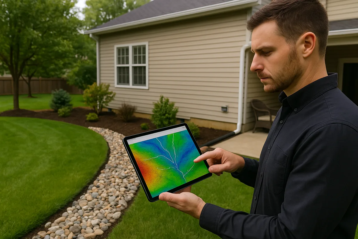
The Automated Watershed Map: The Tool Drainage Contractors Didn't Know They Needed
How to Automate the Rational Method Formula for Residential Drainage Design