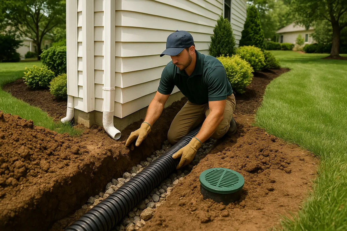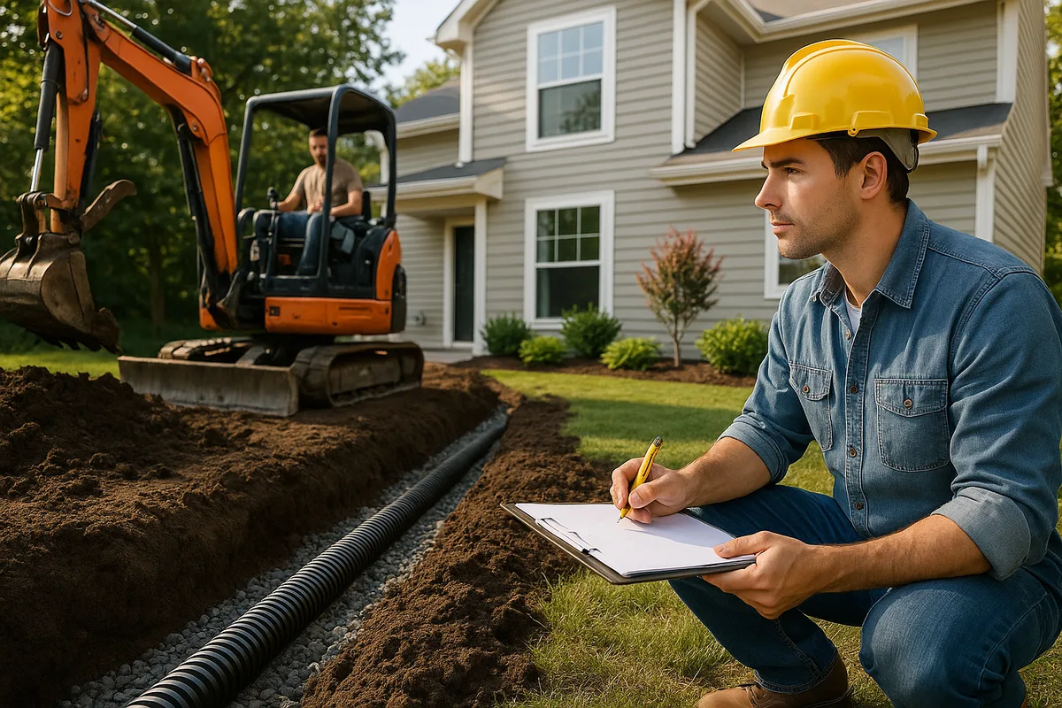
Building Drainage Estimates Based on Real-World Site Conditions
Every homeowner who has ever requested a drainage estimate has experienced the same unsettling range: one contractor quotes $3,500, another quotes $12,000, and a third says they need to "take a closer look" before committing to any number. The disparity isn't always a sign of dishonesty—it's often a symptom of how much (or how little) each contractor understands about the actual conditions on your property.
A drainage project is not like ordering cabinets from a catalog. The materials are only part of the equation. What truly drives cost—and determines whether a solution will work five, ten, or twenty years from now—is the site itself. Soil composition, existing slope, subsurface water behavior, utility conflicts, access constraints, and even the regulatory environment all shape what needs to be built, how it needs to be built, and what it will realistically cost. Site-based estimating is the practice of grounding every line item in observable, measurable, site-specific data rather than relying on rules of thumb or per-linear-foot averages pulled from a pricing spreadsheet.
This article is a deep dive into how accurate drainage estimates are built from the ground up—literally. Whether you're a homeowner trying to evaluate competing bids, a contractor refining your estimating process, or an inspector assessing the quality of proposed work, understanding the relationship between real-world conditions and project pricing will help you make better decisions.
Why Generic Estimates Fail
The drainage industry has a persistent problem with generic pricing. Many contractors—especially those who treat drainage as a sideline to landscaping or general contracting—estimate projects using simplified formulas. A common approach is to price by the linear foot of pipe installed, add a flat rate for catch basins, and tack on a markup. While this can produce a number quickly, it almost always produces the wrong number.
Generic estimates fail because they assume uniform conditions. They assume the soil will be easy to dig, the grade will cooperate, the water has a clear place to go, and nothing unexpected lies beneath the surface. In reality, residential properties are full of variability. A 100-foot French drain trench through sandy loam on a gentle slope is a fundamentally different project than a 100-foot trench through compacted clay on a nearly flat lot with a high water table. The materials might be similar, but the labor, equipment, engineering, and risk profile are worlds apart.
The consequences of inaccurate estimating ripple in both directions. When a contractor underestimates, they either absorb the loss (leading to shortcuts and thin margins) or hit the homeowner with change orders. When they overestimate, they lose the bid to a competitor who may also be guessing—just more aggressively. For homeowners, the result is the same: confusion, mistrust, and drainage systems that may not perform as promised. Accurate estimating begins with rejecting the one-size-fits-all approach and committing to a thorough site evaluation before any numbers are generated.
The Foundation of Site-Based Estimating: Pre-Bid Site Assessment
A credible contractor estimate for drainage work should always begin with a structured site visit. This isn't a casual walk-around with a tape measure—it's a systematic evaluation of the conditions that will govern every aspect of the project. The best contractors treat the site assessment as a non-negotiable step, and many charge a separate fee for it. That fee is a signal of professionalism, not an upsell.
What a Thorough Site Assessment Includes
A comprehensive pre-bid assessment should evaluate the following:
- Surface topography and grading: Where does water currently flow? Where does it pond? What are the existing slopes, and do they direct water toward or away from the structure? Measurements should be taken with a laser level, transit, or survey-grade GPS—not estimated by eye.
- Soil conditions: What type of soil is present, and at what depth? Is there a hardpan layer? How does the soil drain? A simple percolation test or even a hand auger bore can reveal critical information about what lies below the surface.
- Subsurface water: Is there a seasonally high water table? Are there springs or seeps? Evidence of hydrostatic pressure against the foundation?
- Existing drainage infrastructure: Are there functioning downspout extensions, swales, curtain drains, or sump systems already in place? What condition are they in?
- Utility locations: Where are buried gas, electric, water, sewer, and communication lines? Hitting a utility line during excavation isn't just dangerous—it's expensive and can halt a project for days.
- Access and logistics: Can equipment reach the work area? Are there fences, mature trees, hardscaping, or structures that constrain the work zone? Will material staging require special arrangements?
- Discharge location: Where will the collected water go? Is there a storm sewer connection available? A daylight outlet to a swale or right-of-way? Does the municipality have specific requirements for stormwater discharge?
Each of these factors directly affects scope, method, materials, labor hours, equipment needs, and risk—which means each one directly affects cost.
Leveraging Public Data for Pre-Visit Intelligence
Before even arriving on site, savvy estimators gather publicly available data to build a preliminary picture. The NRCS Web Soil Survey provides detailed soil maps for virtually every parcel in the United States, including hydrologic soil group classifications that indicate how well the native soil drains. Group A soils (sandy, well-drained) behave very differently than Group D soils (clayey, poorly drained), and this distinction can shift an entire project approach.
Elevation data from the USGS 3D Elevation Program (3DEP) can provide a macro-level understanding of how a property sits relative to its surroundings—whether it's in a natural low point, on a hillside, or at the bottom of a watershed that concentrates runoff from a much larger area. Combining this data with on-site observations creates a far more complete picture than either source alone.
Soil Conditions: The Variable That Changes Everything
If there is a single factor that most dramatically affects the accuracy of a drainage estimate, it is soil. Soil determines how fast water infiltrates, how difficult excavation will be, what type of backfill is appropriate, how pipe bedding must be prepared, and whether certain solutions (like infiltration-based systems) are even viable.
Hydrologic Soil Groups and Their Impact on Estimating
The Natural Resources Conservation Service classifies soils into four hydrologic groups:
- Group A: High infiltration rate (greater than 0.30 inches per hour). Sandy and gravelly soils. These are the easiest to work with for drainage—water moves through them readily, and excavation is typically straightforward.
- Group B: Moderate infiltration rate (0.15–0.30 inches per hour). Silt loam and loam soils. Generally cooperative for drainage work, though they may require more attention to filter fabric and aggregate selection.
- Group C: Low infiltration rate (0.05–0.15 inches per hour). Sandy clay loam and similar soils. Water moves slowly, and these soils can be difficult to excavate when wet. French drains in Group C soils often require larger aggregate envelopes and more careful grading.
- Group D: Very low infiltration rate (less than 0.05 inches per hour). Heavy clay, high water table, or shallow bedrock. These soils present the most challenging and expensive drainage scenarios. Infiltration-based solutions are generally ineffective, and projects often require active pumping, channel drains, or engineered conveyance systems.
A contractor who doesn't know—or doesn't check—the soil group before writing an estimate is guessing. And in drainage work, guessing is expensive.
Excavation Difficulty and Labor Multipliers
Soil type also directly affects labor productivity. Digging a trench through loose, sandy soil with a compact excavator might progress at 60–80 linear feet per hour. The same trench through compacted clay with embedded rock might progress at 15–25 linear feet per hour. That's a 3x to 4x difference in labor hours for the same length of trench. If a contractor prices both scenarios at the same per-foot rate, one of those projects is going to lose money.
Professional estimators account for excavation difficulty by applying labor multipliers based on soil classification and observed conditions. Some also factor in seasonal variability—clay soils in spring may be saturated and nearly impossible to work with cleanly, while the same soil in late summer might be dry and manageable, though harder to dig.
Topography and Grading: Reading the Land
Drainage is, at its core, a gravity-driven system. Water flows downhill, and the entire purpose of a drainage project is to ensure it flows downhill in the right direction, at the right rate, to the right place. This makes topographic assessment an essential component of site-based estimating.
Measuring Existing Slope
The minimum recommended slope for surface drainage away from a foundation is 2% (approximately 1/4 inch per foot) over the first 6 to 10 feet. For subsurface pipe, a minimum slope of 1% is generally recommended, though 2% or greater is preferred for self-cleaning velocity. These are not arbitrary numbers—they represent the minimum gradients needed to reliably move water without allowing sediment to accumulate and clog the system.
During the site assessment, the estimator should measure existing grades at multiple points around the structure and across the yard. A property that already has adequate slope away from the foundation but pools water at a low point in the yard is a very different project than one where the grade actually pitches toward the house. The first might need a simple catch basin and pipe run; the second might require regrading, a French drain system, and potentially a sump pump.
Flat Lots and the Cost of Creating Grade
Flat lots—those with less than 1% overall slope—are among the most expensive to drain properly. When gravity doesn't provide a natural outlet, the contractor must either create grade through earthwork (importing or redistributing soil) or install a mechanical system (sump pump with discharge line). Both approaches add significant cost.
Regrading a yard typically involves moving 1–3 cubic yards of soil per 100 square feet, depending on the degree of correction needed. At typical rates for soil delivery, placement, and compaction, this can add $2,000–$8,000 or more to a project, depending on the area involved. A contractor who doesn't assess the topography carefully may miss this entirely, leading to a bid that looks competitive but can't actually solve the problem.
Subsurface Water and Hydrostatic Pressure
Surface water—the rain that falls on your roof and yard—is only half the drainage equation. Subsurface water, including seasonal water table fluctuations and lateral groundwater flow, can be equally or more damaging to foundations, crawl spaces, and basements. It's also far more difficult to assess without deliberate investigation.
Identifying Subsurface Water During the Estimate Phase
Signs of subsurface water problems include:
- Efflorescence (white mineral deposits) on basement or crawl space walls
- Damp or wet basement floors, especially along the wall-floor joint
- Musty odors in below-grade spaces
- Sump pumps that run frequently, even during dry weather
- Iron ochre staining in existing drain tile or sump basins
- Soft, saturated soil near the foundation even when it hasn't rained recently
A contractor preparing a drainage bid should specifically ask about and look for these indicators. If subsurface water is a factor, the project scope may expand to include interior or exterior drain tile, waterproofing membranes, sump pump installation, or vapor barriers—all of which significantly affect cost.
How Water Table Depth Affects Project Design
The depth to the seasonal high water table determines whether certain drainage strategies are feasible. A French drain installed below the water table, for example, will constantly collect groundwater and may require a sump pump to evacuate it. A French drain installed above the water table can often daylight to a surface outlet by gravity. The first scenario requires ongoing energy costs and pump maintenance; the second is passive and essentially maintenance-free.
This single variable—water table depth—can mean the difference between a $4,000 gravity-fed French drain and a $10,000+ system with interior drain tile, a sump basin, a primary pump, a battery backup pump, and a discharge line routed to the street. Any contractor estimate that doesn't account for subsurface water conditions is incomplete.
Existing Infrastructure and Utility Conflicts
Every residential property has a hidden network of buried utilities, and many have remnants of previous drainage attempts. Both must be accounted for during drainage bid preparation.
Utility Location and Its Effect on Routing
Before any excavation, contractors are legally required to call 811 (or the local equivalent) to have utility lines marked. But the estimate should anticipate utility conflicts before the dig begins. Common issues include:
- Sewer laterals running through the proposed trench path, requiring the drain line to be routed around or tunneled beneath them
- Gas lines that restrict excavation depth or require hand-digging within a specified proximity
- Irrigation systems with buried mainlines, valve boxes, and lateral lines that may need to be relocated
- Buried electrical for landscape lighting, pool equipment, or outbuildings
Each conflict adds time, complexity, and cost. A contractor who doesn't investigate utility locations before bidding is setting up both themselves and the homeowner for surprises.
Evaluating Existing Drainage Systems
Many properties have some form of existing drainage—downspout extensions, corrugated pipe runs, dry wells, or aging clay tile. The condition and configuration of these systems matter because they may be integrated into the new design, removed, or bypassed.
A camera inspection of existing subsurface pipe can reveal whether it's functional, partially collapsed, root-infiltrated, or completely failed. If the existing system can be incorporated, it may reduce the scope (and cost) of the new work. If it's failed and must be removed, that's additional labor and disposal cost that belongs in the estimate.
Discharge: Where Does the Water Go?
This is the question that separates a complete drainage solution from an expensive pipe that moves water from one problem area to another. Every drainage system needs a terminus—a place where collected water is released in a controlled, legal, and sustainable manner.
Common Discharge Options and Their Cost Implications
- Daylight outlet to grade: The simplest and least expensive option. The pipe exits at the surface on a downhill slope, allowing water to flow away by gravity. This requires sufficient grade and a suitable location (not the neighbor's yard, not a public sidewalk).
- Connection to municipal storm sewer: Many municipalities allow private connections to the public storm system, but requirements vary. Some require permits, inspections, and specific connection methods. Permit fees, tap fees, and the cost of connecting to the main can add $500–$3,000 or more.
- Dry well or infiltration chamber: Water is directed into a subsurface structure that allows it to percolate into the surrounding soil. This only works in soils with adequate infiltration rates (generally Group A or B). Sizing must be based on the design storm event and soil percolation rate—not guessed.
- Rain garden or bioswale: A surface-level planted depression designed to collect and infiltrate runoff. These are increasingly popular and may be required or incentivized by local stormwater regulations. They add landscape design and planting costs to the drainage estimate.
- Sump pump discharge: Water is pumped to the surface and discharged via a pipe to a legal outlet. This introduces ongoing energy and maintenance costs that should be disclosed to the homeowner, even if they don't appear in the installation estimate.
The discharge method is not an afterthought—it's a design driver. A contractor who hasn't identified and verified the discharge point before writing the estimate is building on an incomplete foundation.
Regulatory Considerations
Stormwater discharge is increasingly regulated at the municipal and county level. Many jurisdictions have adopted stormwater management ordinances that restrict the rate, volume, or quality of runoff that can leave a property. Some require detention or retention for projects that disturb a certain area of land or add impervious surface.
A responsible drainage estimate should account for permit costs, any required engineering or calculations, and compliance with local regulations. Failing to do so can result in stop-work orders, fines, or the need to redesign and rebuild a system that doesn't meet code.
Putting It All Together: Anatomy of an Accurate Drainage Estimate
A well-prepared, site-based drainage estimate should be transparent, detailed, and directly tied to observed conditions. Here's what homeowners should expect to see—and what contractors should be providing.
Line-Item Breakdown
An accurate estimating document should include, at minimum:
- Site preparation: Clearing, access setup, erosion control measures, and utility marking
- Excavation: Specified by linear feet, depth, and width, with soil type noted and labor rates adjusted accordingly
- Materials: Pipe type and diameter, aggregate type and quantity, filter fabric, catch basins, fittings, cleanouts, and any specialty items (sump pumps, check valves, backwater valves)
- Installation labor: Hours estimated based on site-specific conditions, not generic averages
- Backfill and compaction: Including any imported fill material and compaction testing if required
- Surface restoration: Sod, seed, mulch, hardscape repair, or other finish work to return the site to its pre-construction condition (or better)
- Discharge connection: Including any permit fees, tap fees, or inspection costs
- Contingency: A reasonable allowance (typically 5–10%) for unforeseen conditions, clearly stated
- Warranty: What's covered, for how long, and under what conditions
Red Flags in Drainage Bids
Homeowners should be cautious of estimates that:
- Are provided without a site visit or with only a cursory walk-around
- Use only lump-sum pricing with no line-item detail
- Don't specify pipe type, diameter, or slope
- Don't identify the discharge location
- Don't mention soil conditions or grading
- Are dramatically lower than competing bids without a clear explanation of why
- Don't include surface restoration in the scope
- Offer no warranty or guarantee on workmanship
A low price is not a good deal if the system doesn't work. And a high price isn't justified if the contractor can't explain what's driving it.
How Technology Is Improving Drainage Estimates
The tools available for site-based estimating have improved dramatically in recent years. Contractors who invest in technology can produce more accurate estimates faster, with better documentation and fewer surprises.
LiDAR and High-Resolution Elevation Data
Light Detection and Ranging (LiDAR) data, increasingly available through programs like USGS 3DEP, provides sub-foot elevation accuracy over large areas. This data can be used to generate detailed topographic maps of a property, identify low points and flow paths, and calculate slopes—all before the first site visit. While LiDAR doesn't replace boots-on-the-ground assessment, it provides a powerful starting point.
Drone Surveys and Photogrammetry
Some contractors now use drones to capture aerial imagery and generate 3D surface models of properties. This technology allows precise measurement of grades, distances, and areas, and produces visual documentation that can be shared with the homeowner as part of the estimate presentation.
Digital Estimating Platforms
Modern estimating software allows contractors to build estimates from libraries of site-specific cost data, adjust labor rates based on conditions, and generate professional proposals that clearly communicate scope and pricing. These tools reduce errors, improve consistency, and make it easier to produce the kind of detailed, transparent estimates that build trust with homeowners.
Topographic Drainage Intelligence
At Low Point Labs, we specialize in providing the topographic and drainage data that makes accurate estimating possible. By combining high-resolution elevation data, soil analysis, and hydrologic modeling, we help contractors and homeowners understand the real conditions on a property before a single shovel hits the ground. This intelligence eliminates guesswork, reduces change orders, and ensures that drainage solutions are designed for the site—not for a generic template.
The Business Case for Better Estimates
For contractors, investing time and resources in site-based estimating isn't just good practice—it's good business. Accurate estimates lead to fewer change orders, higher customer satisfaction, better reviews, and more referrals. They also protect margins by ensuring that bids reflect the actual cost of doing the work right.
For homeowners, understanding what goes into a quality drainage estimate empowers better decision-making. When you know what to look for—and what to ask about—you can evaluate competing bids on their merits rather than their price tags alone. The cheapest bid is rarely the best value, and the most expensive bid isn't automatically the most thorough.
Drainage problems don't fix themselves, and they don't get cheaper to solve over time. Water that isn't managed properly erodes soil, damages foundations, creates health hazards, and reduces property values. A well-estimated, well-executed drainage project is an investment in the long-term health and value of your home.
If you're facing a drainage challenge—or if you've received estimates that leave you with more questions than answers—consider starting with data. Low Point Labs provides detailed topographic drainage assessments that give you (and your contractor) the site-specific intelligence needed to build an estimate rooted in reality. Explore our drainage assessment services to take the guesswork out of your next project.
See Drainage Intelligence in Practice
Talk with our team or request an invitation to the platform.
Frequently Asked Questions
Many reputable contractors charge $100–$500 for a thorough site assessment and detailed estimate, which may be credited toward the project if you hire them. Free estimates are common but may lack the depth of a paid assessment that includes soil evaluation, grade measurements, and utility research.
Bid variation usually reflects differences in how thoroughly each contractor assessed the site. A contractor who checks soil type, measures slopes, identifies utility conflicts, and verifies the discharge location will produce a different (and typically more accurate) estimate than one who eyeballs the yard and quotes a per-foot rate.
Look for line-item detail that includes pipe type and size, excavation depth and method, aggregate specifications, discharge location, surface restoration, permit costs, and warranty terms. Avoid lump-sum bids that don't explain what's included or how the price was determined.
Soil type affects both excavation difficulty and system design. Sandy soils (Group A) are easy to dig and drain well, keeping costs lower. Clay soils (Group D) are harder to excavate, don't drain naturally, and often require more extensive systems with larger aggregate envelopes or mechanical pumping, significantly increasing project cost.
Yes. The NRCS Web Soil Survey shows your property's soil type and drainage characteristics, and USGS elevation data can confirm slope conditions. Comparing this public data against what your contractor describes in their estimate is a good way to verify that they've actually assessed your site conditions.
Site-based estimating is the practice of building a project estimate from measured, site-specific data rather than generic per-foot pricing. It accounts for soil type, slope, water table depth, utility conflicts, access constraints, discharge options, and local regulations to produce a bid that reflects the actual conditions and scope of work.
Related Articles
How to Price Drainage Projects Based on Real Site Conditions
How to Cut Residential Site Assessment and Drainage Estimating Time by 70%