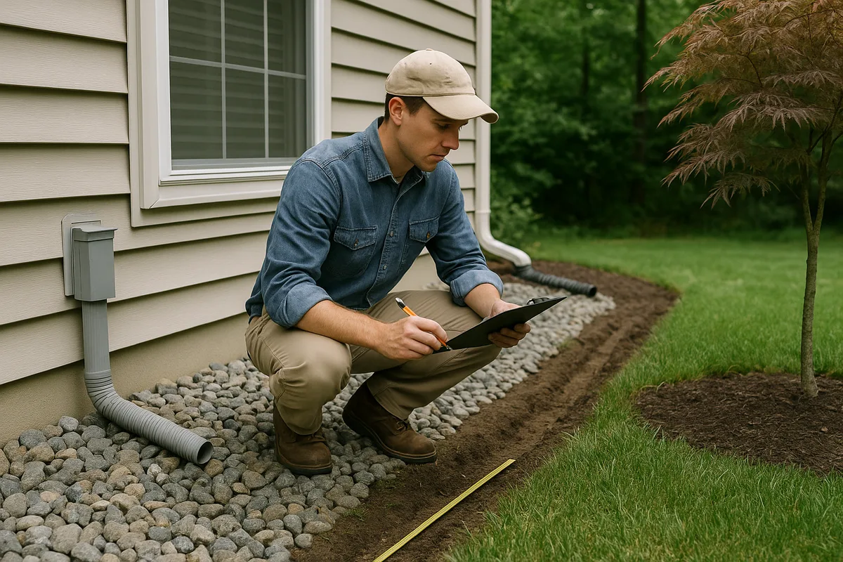
Developing Scopes of Work That Reflect Real Site Conditions
Every drainage or grading project begins with a document that defines what will be done, how it will be done, and what the expected outcome will be. That document — the scope of work — is the single most important artifact in the entire project lifecycle. When it accurately reflects real site conditions, the project runs smoothly, budgets hold, and the finished result performs as intended. When it doesn't, the consequences cascade: change orders pile up, timelines slip, contractors and homeowners clash, and the drainage solution itself may underperform or fail entirely.
The problem is that most scopes of work for residential drainage and grading projects are developed from incomplete information. A contractor walks the property, makes visual observations, perhaps takes a few measurements, and then writes a scope based on assumptions about what's happening beneath the surface and beyond the property line. Those assumptions are where projects go wrong. Developing a drainage scope that reflects real site conditions requires a fundamentally different approach — one grounded in topographic data, soil analysis, hydrologic context, and a clear-eyed assessment of what the site is actually doing with water.
This article lays out a comprehensive framework for writing scopes of work that hold up against reality. Whether you're a homeowner evaluating a contractor's proposal, a contractor refining your own process, or an inspector reviewing project plans, understanding what separates a strong project scope from a weak one will save time, money, and frustration.
Why Most Drainage Scopes Fall Short
The residential construction and renovation industry has a well-documented problem with scope accuracy. Studies from the Construction Industry Institute have consistently found that poor scope definition is the leading cause of cost overruns and project failure. In drainage work specifically, the problem is compounded by the fact that water behavior is invisible until it becomes a crisis. You can't see subsurface flow paths, seasonal water table fluctuations, or the way a neighbor's regrading project three years ago redirected runoff onto your lot — not from a single site visit on a dry afternoon.
The typical contractor scope writing process for residential drainage goes something like this: the homeowner reports a problem (wet basement, standing water in the yard, erosion along a slope), the contractor visits the site, observes the symptoms, and proposes a solution based on experience and pattern recognition. "You need a French drain along the foundation" or "We'll regrade this section and install a catch basin." The scope is written around the proposed solution rather than around a thorough diagnosis of the problem.
This solution-first approach works when the site conditions are simple and the contractor's experience happens to match the situation. But residential drainage is rarely simple. Every property exists within a larger hydrologic context — its topographic position relative to surrounding parcels, the soil types and their infiltration rates, the impervious surface coverage upstream, the capacity of any municipal stormwater infrastructure downstream, and the historical grading changes that have occurred over decades. A scope that ignores this context is a scope built on assumptions, and assumptions are the raw material of change orders.
Another common failure mode is the overly vague scope. Statements like "improve drainage in the backyard" or "address water intrusion issues" leave enormous room for interpretation. What does "improve" mean in measurable terms? What constitutes "addressing" the issue — eliminating it entirely, reducing its frequency, or simply redirecting it to a less problematic location? Without specificity, neither the homeowner nor the contractor has a clear definition of success, and disputes become almost inevitable.
The Foundation of a Strong Scope: Site Intelligence
A scope of services for drainage work should be built on a foundation of site intelligence — verified, objective data about what the site is, what it does with water, and how it connects to the landscape around it. This intelligence comes from multiple sources, and the more of them you incorporate, the more resilient your scope becomes.
Topographic Data and Elevation Modeling
The starting point for any drainage scope is understanding where water goes. Water follows gravity, and gravity follows topography. A high-resolution elevation model of the property and its surroundings reveals the flow paths, collection points, ridgelines, and low points that define the site's drainage behavior. This isn't something you can reliably determine by eye, especially on properties with subtle grades (which describes most residential lots).
Professional surveys provide the highest accuracy, but they're not always in the budget for smaller projects. Publicly available elevation data from the USGS 3D Elevation Program can provide a useful starting point for understanding the broader topographic context — where the property sits within its watershed, which direction regional drainage flows, and whether the lot is in a topographic position that collects or sheds water. For site-specific analysis, higher-resolution data is essential, and this is where tools like drone-derived photogrammetry or LiDAR-based property assessments add tremendous value.
The key insight from topographic analysis isn't just "which way does the slope go" — it's identifying the drainage divides that determine which areas of the property (and neighboring properties) contribute runoff to the problem area. A scope that addresses only the symptomatic location without accounting for the contributing drainage area is a scope that's likely to undersize the solution.
Soil Characterization
Soil type determines how much water infiltrates versus how much runs off the surface, and it profoundly affects the design and feasibility of subsurface drainage systems. Clay-heavy soils in Hydrologic Soil Group D behave completely differently from sandy loam soils in Group A, and the scope of work must reflect this.
The NRCS Web Soil Survey provides mapped soil data for most of the United States, including hydrologic soil group classifications, drainage class ratings, depth to water table estimates, and permeability rates. This data should be referenced during scope development to validate (or challenge) assumptions about how the soil will behave. For example, a French drain scope written for a property with Group D soils needs to account for the fact that the surrounding soil won't absorb water from the drain — the system needs a positive outlet, and the scope must include provisions for that outlet's construction and connection.
Beyond mapped data, site-specific soil conditions often diverge from survey maps, especially on properties that have been previously developed. Fill soil, compacted subgrades, buried debris, and disturbed soil horizons are common on residential lots and can dramatically alter drainage behavior. A thorough scope acknowledges these possibilities and includes provisions for on-site soil assessment — even if it's as simple as a few test holes during the early phase of work.
Hydrologic Context and Stormwater Infrastructure
No residential property exists in isolation. Water that arrives on a lot comes from somewhere, and water that leaves a lot goes somewhere. A complete drainage scope accounts for both the upstream sources and the downstream discharge points.
Upstream considerations include neighboring properties, roadways, and any impervious surfaces that direct runoff toward the project site. If a neighbor's driveway or roof drainage system discharges toward the property, the scope must account for that volume — not just the rainfall that lands directly on the lot. Downstream considerations include the available discharge points: municipal storm sewers, roadside ditches, natural drainage courses, or on-site infiltration. The scope must specify where the collected water will go and confirm that the discharge point has adequate capacity and legal authorization to receive the flow.
Many residential drainage projects fail because the scope specifies collection and conveyance but is silent on discharge. "Install 150 linear feet of 4-inch perforated pipe" is a collection specification, not a drainage solution. Where does the pipe daylight? Does the discharge point have adequate fall? Is there an easement or right-of-way issue? These questions must be answered in the scope, not discovered during construction.
Anatomy of a Well-Written Drainage Scope
A scope of work for drainage and grading should be structured to eliminate ambiguity, establish measurable success criteria, and provide enough detail that any qualified contractor could execute the work and arrive at the same result. Here's what that structure looks like in practice.
Problem Statement and Objectives
The scope should begin with a clear statement of the problem being solved, grounded in observed and measured conditions rather than assumptions. Instead of "the backyard floods," a well-written problem statement reads: "The northwest quadrant of the rear yard collects surface runoff from approximately 3,200 square feet of contributing drainage area, including the rear roof slope and the adjacent lot to the north. Standing water persists for 24-48 hours following rainfall events of 0.5 inches or greater, as reported by the homeowner and consistent with the topographic low point identified at elevation 842.3 feet."
The objectives should be equally specific: "Eliminate standing water accumulation in the identified low point for rainfall events up to and including the 10-year, 24-hour storm event (approximately 4.2 inches in this location). Redirect collected runoff to the existing municipal storm inlet at the southeast property corner via subsurface conveyance."
This level of specificity does three things. First, it gives the contractor a clear design target. Second, it gives the homeowner a clear expectation of what "success" looks like (and what it doesn't — this scope doesn't promise zero water during a 100-year storm). Third, it creates an objective standard against which the completed work can be evaluated.
Existing Conditions Documentation
The scope should document the existing conditions that informed the design, including:
- Topographic data: Source, resolution, and key elevations referenced in the scope
- Soil conditions: Mapped soil type, hydrologic group, and any site-specific observations
- Existing drainage infrastructure: Location and condition of any existing pipes, swales, catch basins, downspout connections, or subsurface systems
- Vegetation and ground cover: Turf, mulch beds, impervious surfaces, tree root zones that may affect excavation
- Utilities: Known locations of underground utilities that may constrain the work
- Access constraints: Fencing, structures, slopes, or other features that limit equipment access
Documenting existing conditions in the scope serves a critical function: it establishes the baseline assumptions on which the scope was built. If conditions encountered during construction differ from what was documented, both parties have a clear reference point for evaluating whether a change order is warranted.
Technical Specifications
The technical heart of the scope defines what will be installed, to what standards, and with what materials. For drainage work, this typically includes:
- Grading specifications: Finished grade elevations or slopes expressed as percentages (e.g., "regrade to achieve minimum 2% slope away from the foundation for a distance of 10 feet"), with reference to a benchmark elevation
- Pipe specifications: Material (corrugated HDPE, smooth-wall PVC, etc.), diameter, perforation pattern (if applicable), slope (minimum 1% for solid pipe, 0.5% for perforated pipe in gravel bed), and connection details
- Aggregate specifications: Type, gradation, and depth of drainage stone (e.g., "#57 washed stone, 12-inch depth surrounding perforated pipe")
- Filter fabric specifications: Woven vs. non-woven, flow rate, and placement instructions
- Inlet and outlet structures: Type, size, grate specification, and connection details for catch basins, area drains, pop-up emitters, or daylight outlets
- Erosion control measures: Silt fence, erosion blanket, or stabilization seeding required during and after construction
- Compaction requirements: Density targets for backfill in graded areas (typically 90-95% Standard Proctor for residential grading)
Each specification should reference an industry standard where applicable (ASTM, AASHTO, or manufacturer specifications) to eliminate ambiguity about material quality.
Scope Boundaries and Exclusions
Equally important as defining what's included is defining what's excluded. A well-written project scope explicitly states its boundaries:
- Horizontal limits: The physical area of the property where work will occur, ideally shown on a site plan
- Depth limits: Maximum excavation depth anticipated, with provisions for what happens if obstructions are encountered
- Permit responsibilities: Who obtains required permits (grading permits, stormwater permits, utility locate requests)
- Restoration scope: What surfaces will be restored and to what condition (e.g., "rough grade and seed disturbed turf areas" vs. "install sod to match existing lawn")
- Exclusions: Items specifically not included, such as structural foundation repairs, roof gutter modifications, landscaping beyond basic restoration, or work on neighboring properties
The exclusions section is where many disputes originate. A homeowner may assume that a drainage project includes reconnecting downspouts, regrading landscape beds, or replacing a patio that was removed for access. If these items aren't in the scope, they need to be explicitly listed as exclusions.
Common Scope Gaps That Lead to Project Failures
Understanding where scopes typically fail is as important as knowing how to write them well. These are the gaps we see most frequently in residential drainage and grading scopes, and each one represents a risk that can be mitigated with better site intelligence.
Ignoring Off-Site Contributions
The most common and most consequential scope gap is failing to account for water that originates off the property. A drainage system sized only for the on-site contributing area will be undersized if significant runoff enters from adjacent lots, roadways, or uphill areas. This is especially prevalent in subdivisions where lot grading has changed over time, creating unintended flow paths between properties.
A thorough scope development process examines the topography beyond the property lines to identify off-site contributing areas and estimate their runoff contribution. This doesn't require surveying the neighbor's yard — regional elevation data and visual observation of flow evidence (erosion patterns, sediment deposits, staining on fences or walls) can provide sufficient information to account for off-site flows in the design.
Underestimating Soil Variability
Soil maps show general soil types based on landscape position and parent material, but actual soil conditions on a developed residential lot can vary dramatically over short distances. Fill soil brought in during original construction, compaction from equipment traffic, buried construction debris, and previous excavation and backfill operations all create localized conditions that differ from the mapped soil type.
A scope that specifies a subsurface infiltration system based on mapped soil permeability rates — without verifying those rates on site — is a scope that may need to be redesigned mid-project. The better approach is to include a site verification phase in the scope: "Contractor shall perform percolation testing at the proposed infiltration location prior to finalizing system design. If measured infiltration rate is less than 0.5 inches per hour, contractor shall submit a revised design for owner approval before proceeding."
Failing to Address the Discharge Point
As noted earlier, many drainage scopes specify the collection and conveyance system in detail but are vague or silent about where the water goes. This is a critical gap because the discharge point often determines the feasibility of the entire system. If the only available discharge point is a municipal storm sewer at a higher elevation than the proposed drain, the system won't work without a pump — and a pump adds cost, complexity, and maintenance requirements that should be in the scope from the beginning.
The scope should specify the discharge location, confirm its adequacy (capacity, elevation, legal access), and describe the connection details. If the discharge point is on a neighboring property or within a public right-of-way, the scope should identify any easements or permits required.
Omitting Maintenance Requirements
A drainage system is not a build-and-forget installation. Catch basins need to be cleaned, pipe outlets need to be kept clear, and graded surfaces need to be maintained to preserve their designed slopes. A scope that doesn't address post-construction maintenance sets the homeowner up for system degradation and eventual failure.
While maintenance is technically outside the construction scope, the scope of services should include a maintenance plan or at minimum a list of maintenance requirements that the homeowner must follow to keep the system performing as designed. This protects both parties: the homeowner knows what's expected, and the contractor has documentation that the system's performance depends on proper maintenance.
Neglecting Seasonal and Storm-Frequency Variability
Drainage problems are often intermittent and seasonal. A scope developed from a single site visit during dry weather may miss critical information about how the site behaves during wet seasons, snowmelt periods, or high-water-table conditions. Conversely, a scope developed during an unusually wet period may overestimate the typical problem severity and lead to an over-engineered (and over-priced) solution.
The best scopes acknowledge this variability explicitly. They reference design storm frequencies (e.g., the 10-year or 25-year storm event), seasonal water table data, and historical precipitation patterns to establish a design basis that accounts for the range of conditions the system will face. Precipitation frequency data from NOAA Atlas 14 provides the statistical basis for design storm selection and should be referenced in any scope that specifies system capacity.
The Role of Technology in Scope Development
Advances in geospatial technology have transformed the quality of site intelligence available for drainage scope development. What once required expensive professional surveys can now be supplemented (though not always replaced) with technology-driven assessment tools.
Remote Sensing and Elevation Data
LiDAR-derived elevation models, drone photogrammetry, and satellite-based terrain analysis can provide detailed topographic information for scope development without setting foot on the property. These tools are particularly valuable for identifying drainage patterns across multiple properties, understanding watershed-scale flow paths, and detecting subtle grade changes that are invisible to the naked eye.
At Low Point Labs, we leverage high-resolution elevation data to create drainage intelligence reports that map flow paths, identify collection points, delineate contributing drainage areas, and quantify slopes — all before a contractor writes the first line of a scope. This pre-scope intelligence dramatically improves the accuracy of the resulting scope of work because it replaces assumptions with measurements.
GIS-Based Site Analysis
Geographic Information Systems (GIS) allow multiple data layers to be combined and analyzed together: topography, soil types, flood zones, impervious surfaces, utility locations, and property boundaries. This integrated analysis reveals relationships that aren't apparent from any single data source. For example, overlaying soil data with topographic flow paths might reveal that the primary flow path crosses a band of poorly drained clay soil — information that directly affects the design and scope of a drainage solution.
Open-source GIS platforms like QGIS make this kind of analysis accessible to smaller firms and even sophisticated homeowners, though interpreting the results still requires expertise in hydrology and drainage engineering.
Digital Documentation and Scope Management
Digital tools also improve the scope document itself. Photo documentation with GPS coordinates, annotated site plans, and 3D terrain visualizations can be embedded in or attached to the scope to eliminate ambiguity about locations, extents, and existing conditions. A scope that says "install catch basin at low point in rear yard" is far less precise than a scope that includes a georeferenced site plan showing the exact location, the contributing drainage area, and the proposed pipe route to the discharge point.
How Homeowners Should Evaluate a Contractor's Scope
If you're a homeowner receiving proposals for drainage work, the scope of work is the most important section of the document — more important than the price. A low price attached to a vague or inaccurate scope is not a bargain; it's a guarantee of conflict. Here's what to look for when evaluating a contractor scope writing quality.
Specificity and Measurability
Every element of the scope should be specific enough to verify. "Improve grading" is not verifiable. "Regrade to achieve 2% minimum slope away from foundation for 10 feet, transitioning to 1% slope to the property line" is verifiable with a level and a tape measure. Look for specific materials, dimensions, slopes, elevations, and quantities throughout the scope.
Evidence of Site Investigation
Does the scope reference actual site conditions, or does it read like a generic template? A quality scope mentions specific features of your property — the location of downspouts, the direction of existing slopes, the soil type, the location of utilities, the condition of existing drainage features. If the scope could apply to any property in your zip code without modification, it wasn't written from adequate site investigation.
Design Basis and Performance Standard
What storm event is the system designed to handle? What is the expected performance after construction? A scope that doesn't answer these questions leaves the definition of "success" entirely subjective. You want to see a clear statement of what the system will do and under what conditions — and equally, what conditions exceed the design capacity.
Contingency Provisions
Good scopes acknowledge uncertainty. What happens if rock is encountered during excavation? What if the soil conditions differ from expectations? What if an unmarked utility is discovered? A scope that includes contingency provisions — typically expressed as unit prices for additional work or a defined process for evaluating and approving changes — protects both parties from the disruption of unexpected conditions.
Warranty and Maintenance Terms
What warranty does the contractor provide on the completed work? What maintenance is required to keep the warranty valid? These terms should be in the scope or in a referenced warranty document. A contractor who warrants their drainage work for a meaningful period (one to two years minimum) is a contractor who has confidence in their scope and design.
Building Better Scopes Through Better Data
The through-line of everything discussed in this article is that scope of work quality is directly proportional to the quality of the site data behind it. A scope built on visual observation and experience-based assumptions will be adequate for simple, straightforward projects — but residential drainage is frequently neither simple nor straightforward. Hidden flow paths, variable soils, off-site contributions, undersized discharge points, and seasonal variability create complexity that demands data-driven scope development.
This is the core mission of Low Point Labs: providing the topographic drainage intelligence that makes better scopes possible. Our assessments deliver the elevation data, flow path analysis, contributing area delineation, and low-point identification that form the foundation of an accurate, resilient drainage scope. When contractors build their scopes on our data, they write better scopes. When homeowners bring our reports to contractor meetings, they ask better questions and get better proposals.
The cost of a thorough site assessment is a fraction of the cost of a single change order — and an even smaller fraction of the cost of a drainage system that doesn't solve the problem. If you're planning a drainage or grading project, or if you've received a scope that you're not sure adequately reflects your site's conditions, start with the data. Explore Low Point Labs' drainage assessment services to build your project on a foundation of real site intelligence, not assumptions.
See Drainage Intelligence in Practice
Talk with our team or request an invitation to the platform.
Frequently Asked Questions
A drainage scope of work should include a clear problem statement, existing conditions documentation, technical specifications for materials and installation, grading targets with specific slopes and elevations, discharge point details, scope boundaries and exclusions, and a maintenance plan. Every element should be specific enough to measure and verify.
A scope is too vague if it uses general language like "improve drainage" or "address water issues" without specifying measurable outcomes, material types, quantities, slopes, or design storm capacity. If the scope could apply to any property without modification, it likely wasn't developed from adequate site investigation.
Most drainage project cost overruns result from poor scope definition based on incomplete site data. When the scope doesn't account for actual soil conditions, off-site water contributions, utility conflicts, or discharge point limitations, these issues are discovered during construction and require costly change orders to address.
At minimum, you need topographic elevation data showing slopes and flow paths, soil type and drainage classification, identification of contributing drainage areas (including off-site sources), existing drainage infrastructure condition, utility locations, and discharge point capacity and elevation. The more data you have, the more accurate the scope will be.
Yes. Every drainage scope should reference a design storm frequency, such as the 10-year or 25-year, 24-hour storm event. This establishes a clear performance standard and helps the homeowner understand that the system has defined capacity limits. Without this specification, there's no objective way to evaluate whether the system is performing as designed.
Invest in thorough site assessment before the scope is written, including topographic analysis, soil investigation, and discharge point verification. Include contingency provisions in the scope for foreseeable unknowns like rock encounters or soil variability. The more site intelligence that goes into the scope upfront, the fewer surprises emerge during construction.
Related Articles

The Contractor's Guide to Writing an Ironclad Scope of Work for Drainage
How to Avoid Over-Engineering (or Under-Engineering) Drainage Solutions