A City Built on Fill, Shaped by Ice, and Tested by Water
Boston is one of the few American cities where the ground beneath your feet may not have existed two centuries ago. Roughly a third of modern Boston sits on artificial fill — land that was literally manufactured by dumping gravel, soil, and refuse into tidal flats, marshes, and shallow harbor waters between the 1820s and early 1900s. Back Bay, the South End, much of East Boston, the Seaport District, parts of Charlestown, and significant portions of South Boston were all created this way. The drainage implications are enormous and immediate: fill soils behave unpredictably, compacting unevenly over time, trapping water in pockets, and sometimes sitting directly atop buried organic layers that decompose and settle. If you own property in these neighborhoods, your drainage challenges are fundamentally different from those facing a homeowner in West Roxbury or Roslindale, where glacial till and ledge dominate the subsurface.
This geological split — natural glacial terrain versus engineered fill — is the defining feature of drainage in Boston. Layer on top of it a humid continental climate that delivers 47 inches of precipitation with no dry season, a coastline exposed to nor'easters and rising sea levels, an aging combined sewer system that still serves large portions of the city, and some of the highest groundwater tables of any major U.S. city, and you have a drainage environment that demands serious attention from every property owner.
This guide is written specifically for Boston. Not Massachusetts generally — Boston, with its particular soils, its specific neighborhoods, its municipal stormwater regulations, and its unique history of land-making. Whether you're dealing with a flooded basement in Dorchester, standing water in a Jamaica Plain backyard, or trying to understand your flood zone designation in East Boston, this is your resource.
Boston's Subsurface: Two Cities Underground
Understanding drainage in Boston requires understanding that the city has two fundamentally different geological profiles, often separated by just a few blocks.
The Fill Neighborhoods
Back Bay, the South End, the Seaport District (South Boston Waterfront), much of East Boston, portions of South Boston, Charlestown's waterfront edges, and the Fenway area all sit on fill. This fill was placed over former tidal flats, mudflats, and marshland. Beneath the fill — typically 15 to 40 feet of it — lie layers of organic marine clay, peat, and Boston Blue Clay, a stiff glaciomarine deposit that is notoriously impermeable.
The drainage consequences are severe:
- Perched water tables. Fill soils often contain layers of varying permeability. Water infiltrates through sandy fill, hits a clay or organic layer, and pools. Basements in Back Bay and the South End frequently experience seepage not from surface water but from this perched groundwater.
- Ongoing settlement. The organic layers beneath the fill continue to compress. This creates low spots in yards, driveways, and foundations that didn't exist when the property was built. Settlement is uneven, meaning water collects in unpredictable locations.
- Wooden pile foundations at risk. Thousands of buildings in Back Bay, the South End, and the Fenway rest on wooden piles driven into the fill and underlying clay. These piles must remain submerged in groundwater to avoid rotting. The Boston Groundwater Trust and city agencies monitor groundwater levels precisely because drainage alterations — even well-intentioned ones — can lower the water table and destroy these foundations. This is a drainage consideration unique to Boston: in these neighborhoods, you cannot simply "drain more" without potentially undermining your own building.
The Glacial Terrain Neighborhoods
West Roxbury, Roslindale, Hyde Park, parts of Jamaica Plain, Brighton, and the hilly sections of Dorchester and Mattapan sit on natural glacial terrain. Here, the subsurface is a mix of glacial till (a dense, poorly sorted mixture of clay, silt, sand, gravel, and boulders compacted by the Laurentide Ice Sheet) and occasional pockets of glacial outwash (well-sorted sand and gravel deposited by meltwater streams).
As the statewide Massachusetts drainage guide explains, glacial till across the state behaves almost like concrete when compacted — it resists infiltration, sheds water laterally, and creates surface runoff problems even on relatively gentle slopes. Boston's till neighborhoods experience:
- Surface ponding on flat lots. Till doesn't absorb water quickly. After a heavy rain, water sits on the surface for hours or days.
- Lateral seepage into basements. Water moves horizontally along the till surface until it hits a foundation wall. This is the most common cause of basement water intrusion in Roslindale and West Roxbury.
- Ledge encounters. Bedrock (primarily Cambridge Argillite and Roxbury Puddingstone, a distinctive local conglomerate) is close to the surface in many of Boston's hills. Digging drainage trenches or French drains can hit ledge at 2 to 4 feet, dramatically increasing project costs and limiting options.
Soil Investigation Is Non-Negotiable
Because Boston's subsurface varies so dramatically — sometimes within a single block — any drainage project should begin with understanding what's actually beneath your property. The USDA Web Soil Survey provides mapped soil data for Boston, but the fill neighborhoods are often mapped generically as "Urban land" with limited detail. For properties on fill, a geotechnical investigation or at minimum a consultation with a drainage professional who understands Boston's fill history is essential before designing any solution.
Climate and Precipitation: Why Boston Gets Hit Hard
Boston's 47 inches of annual precipitation is spread remarkably evenly across all twelve months, with slight peaks in March and November. There is no dry season — no period when the ground has time to fully dry out and recover drainage capacity. This matters because saturated soils drain progressively slower. By late winter, after months of rain, snow, and freeze-thaw cycles, even the better-draining sandy soils in Boston are often at or near saturation.
Nor'easters and Coastal Storms
Boston's coastal exposure makes it vulnerable to nor'easters that can deliver 3 to 6 inches of rain in 24 to 48 hours, often combined with storm surge and high tides. The National Weather Service issues flood warnings for the Boston metro area multiple times per year. These events overwhelm drainage systems designed for average conditions.
The Seaport District, East Boston, and portions of Charlestown and South Boston face compound flooding during nor'easters: rainfall saturates the ground and overwhelms storm drains while simultaneously storm surge pushes harbor water inland. The city's Climate Ready Boston initiative has identified these neighborhoods as facing the most severe future flood risk, with projections from NOAA showing sea level rise of 1.5 to 3 feet by 2070 that will make today's rare flood events routine.
Freeze-Thaw Cycles
Boston typically experiences 30 to 50 freeze-thaw cycles per winter. Each cycle does measurable damage to drainage infrastructure:
- Frost heave shifts pipes, displaces channel drains, and cracks foundation walls, creating new water entry points.
- Ice dams in gutters and downspout connections prevent roof water from reaching the ground drainage system, causing it to back up into soffits and walls.
- Frozen ground becomes temporarily impermeable, turning even sandy soils into runoff generators. A February rain on frozen ground behaves like a rain on pavement.
Snowmelt Compounding
Boston averages 49 inches of snowfall annually, but individual storms can deliver far more — the city has received over 100 inches in single winters. Snowmelt doesn't follow the same patterns as rainfall. Snow piled against foundations by shoveling or plowing creates concentrated melt zones that deliver water directly to the most vulnerable point of a building. Property owners who clear snow away from foundations during winter are performing one of the most effective drainage interventions available.
Boston's Stormwater Regulations and Permits
Boston's stormwater regulatory environment is shaped by the city's combined sewer system, its MS4 permit obligations, and Massachusetts state law. Property owners need to understand several layers of regulation.
The Combined Sewer System
Approximately 40% of Boston is served by a combined sewer system (CSS) where stormwater and sanitary sewage flow through the same pipes. During heavy rain, this system overflows, discharging untreated sewage into Boston Harbor and the Charles River. The Massachusetts Water Resources Authority (MWRA) has invested billions to reduce combined sewer overflows (CSOs), but the fundamental problem remains: every gallon of stormwater that enters the combined system during a storm increases the risk of overflow.
This has direct implications for property owners. The city increasingly requires new development and significant renovations to manage stormwater on-site rather than directing it into the combined system. The EPA oversees Boston's compliance with Clean Water Act requirements related to CSOs, and the trend is unmistakably toward stricter on-site stormwater management.
Boston's Stormwater Management Standards
The Boston Water and Sewer Commission (BWSC) administers stormwater regulations for the city. Key requirements include:
- Site Plan Review. Any project that disturbs more than 500 square feet of land or increases impervious surface area requires BWSC review. This threshold is low — a new driveway, patio, or garage addition can trigger it.
- Stormwater Management Plan. Projects that trigger review must demonstrate that post-development stormwater runoff does not exceed pre-development levels. In practice, this often means installing infiltration systems, detention basins, or permeable surfaces.
- Illicit Discharge Detection and Elimination (IDDE). It is illegal to discharge anything other than clean stormwater into the city's storm drain system. Sump pumps that discharge laundry water, pool chemicals, or other non-stormwater flows are violations.
- Construction Site Erosion Control. Any construction project must implement erosion and sediment controls during construction. This applies even to residential projects.
Massachusetts Wetlands Protection Act
Boston contains numerous wetland resource areas, particularly along the Neponset River corridor in Dorchester, Mattapan, and Hyde Park, and along the Muddy River in the Fenway and Brookline border. Any work within 100 feet of a wetland or 200 feet of a perennial stream requires filing a Notice of Intent with the Boston Conservation Commission. This can affect drainage projects that seem purely residential — if your backyard abuts a wetland buffer zone, even installing a French drain may require a permit.
The Army Corps of Engineers has jurisdiction over larger wetland impacts under Section 404 of the Clean Water Act, though most residential drainage projects fall under state and local jurisdiction.
Flood Zone Regulations
Suffolk County's FEMA flood maps designate significant portions of Boston as Special Flood Hazard Areas (SFHAs). The most heavily affected neighborhoods include:
- East Boston: Large areas along the waterfront in Zones AE and VE (coastal high-hazard)
- South Boston / Seaport: Expanding flood zones reflecting storm surge risk
- Charlestown: Waterfront areas along the Mystic River and Inner Harbor
- Dorchester: Areas along the Neponset River and Tenean Beach
- Back Bay / Fenway: Low-lying areas near the Charles River
Properties in these zones face mandatory flood insurance requirements if they carry a federally backed mortgage. FloodSmart.gov provides information on the National Flood Insurance Program, and FEMA maintains the official Flood Insurance Rate Maps (FIRMs) that determine zone designations. It's worth noting that FEMA maps are often criticized as outdated — Boston's maps don't fully account for projected sea level rise, meaning properties currently outside flood zones may face future flood risk that isn't reflected in their current designation.
Disclosure Requirements
Massachusetts law requires sellers to disclose known material defects, which includes known water intrusion, flooding, and drainage problems. The state does not use a standardized seller's disclosure form mandated by statute, but most real estate transactions use a voluntary disclosure form where sellers attest to knowledge of basement water, flooding history, and drainage issues. Failure to disclose known problems can result in legal liability. HUD requires flood zone disclosure for properties with federally related mortgages.
For buyers, this means you cannot rely solely on seller disclosures to understand drainage risk. An independent drainage assessment — before closing — is the only way to understand what you're buying.
Diagnosing Drainage Problems on Your Boston Property
Before spending money on solutions, you need to understand what's actually happening with water on your property. Here's a systematic approach tailored to Boston's conditions.
Step 1: Observe During Rain
The single most valuable diagnostic step is watching your property during a moderate to heavy rainstorm. Go outside (safely) and observe:
- Where does water flow? Follow the surface water paths. Does water sheet across your yard toward your foundation? Does it pool in specific low spots? Does it flow from a neighbor's property onto yours?
- Where does water collect? Note any areas where water stands for more than 30 minutes after rain stops. In Boston's till soils, some standing water is normal, but water that persists for hours indicates a grading or soil problem.
- How do your gutters and downspouts perform? Are gutters overflowing? Are downspouts depositing water right at the foundation? Boston's older housing stock frequently has undersized gutters and downspouts that were adequate for the original roof but not for additions or re-roofing that changed water flow patterns.
- Does water enter your basement? Note where: through the floor, through wall cracks, through the joint where the floor meets the wall (the cove joint), or through window wells. The entry point tells you a lot about the source.
Step 2: Inspect the Grading
Walk your property with a 4-foot level or use a smartphone level app. The ground should slope away from your foundation at a minimum grade of 2% (roughly 1 inch of drop per 4 feet of horizontal distance) for at least the first 6 to 10 feet from the foundation. In Boston, grading problems are extremely common because:
- Settlement in fill neighborhoods creates reverse grades that direct water toward foundations.
- Mature landscaping — tree roots, decades of mulch buildup, garden bed amendments — raises the soil level against foundations while leaving the surrounding grade unchanged.
- Frost heave gradually shifts soil and hardscape, disrupting original grading.
- Abutting properties on Boston's characteristically small urban lots may direct water onto your lot with no buffer.
Step 3: Check Your Gutters and Downspouts
Boston's tree canopy — particularly the mature oaks, maples, and elms in neighborhoods like Jamaica Plain, Roslindale, and West Roxbury — generates enormous volumes of leaves and debris that clog gutters. Inspect gutters for:
- Blockages at downspout connections
- Sagging sections that hold standing water
- Downspouts that terminate at the foundation rather than extending at least 4 to 6 feet away (10 feet is better)
- Downspouts that connect to underground pipes — in Boston, many of these underground connections lead to the city's combined sewer system, which may be illegal depending on when the connection was made
Step 4: Investigate Your Basement
Boston's basement water intrusion typically falls into predictable patterns:
- Water at the cove joint (floor-wall junction): Usually indicates hydrostatic pressure from a high water table or poor exterior drainage. Extremely common in Back Bay, South End, and Fenway.
- Water through wall cracks: Often caused by lateral pressure from saturated soil against the foundation, exacerbated by freeze-thaw cycles. Common in all neighborhoods.
- Water through the floor slab: Can indicate a rising water table pushing water up through the slab. In fill neighborhoods, this can be seasonal or tide-influenced.
- Efflorescence (white mineral deposits) on walls: Indicates moisture is migrating through the masonry even if you don't see active water. This is a warning sign.
Step 5: Check Sump Pump Operation
If your Boston home has a sump pump — and many should — test it by pouring water into the pit until the float activates. Verify:
- The pump turns on and evacuates water quickly
- The discharge pipe extends well away from the foundation and doesn't recirculate water back to the pit
- You have a battery backup system (power outages during nor'easters are common)
- The check valve is functioning (prevents discharged water from flowing back into the pit)
Step 6: Review Available Data
Before hiring anyone, gather information:
- FEMA flood maps at FEMA.gov to determine your flood zone designation
- Soil data from the Web Soil Survey for your property's mapped soil type
- Topographic data from USGS to understand your property's position in the local watershed
- City of Boston drainage infrastructure maps from BWSC, which show the location of storm drains, combined sewers, and catch basins near your property
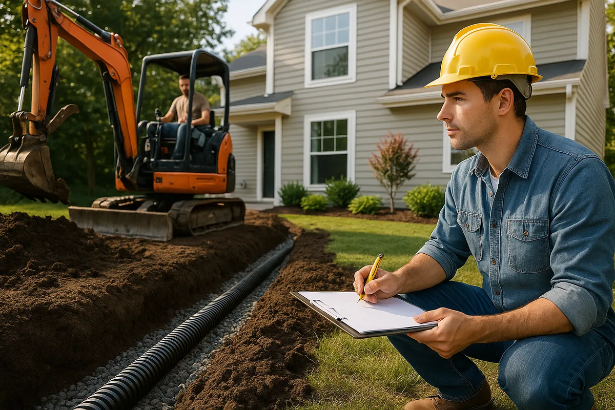
Common Drainage Solutions for Boston Properties
Every drainage solution must be matched to the specific conditions on your property. What works in West Roxbury's glacial till won't necessarily work in Back Bay's fill, and vice versa. Here are the most common solutions deployed in Boston, with specific local considerations.
Regrading
What it is: Reshaping the ground surface to direct water away from the foundation and toward appropriate discharge points.
Boston-specific considerations: Regrading is the most cost-effective first step for properties in the glacial till neighborhoods. In fill neighborhoods, regrading alone is often insufficient because the problem is subsurface water, not surface flow. On Boston's tight urban lots — many are 25 to 40 feet wide — there's often limited space to create effective grades without affecting neighboring properties. Massachusetts law prohibits directing increased stormwater flow onto an abutting property, so regrading must be designed to manage water on your own lot or direct it to the public right-of-way or storm drain system.
Typical Boston cost: $1,500 to $5,000 for a standard residential lot, more if access is difficult (common in Boston's dense neighborhoods where equipment access to backyards is limited by narrow side yards or no side yards at all).
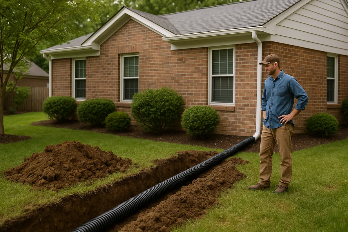
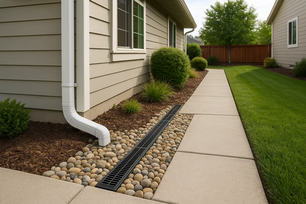
French Drains
What it is: A trench filled with gravel and a perforated pipe that collects subsurface water and redirects it to a discharge point.
Boston-specific considerations: French drains are widely used in Boston but require careful design:
- In glacial till, French drains work well because they intercept the lateral water flow that moves along the till surface. They should be installed at the depth where water is migrating — typically 18 to 36 inches.
- In fill neighborhoods, French drains can be effective but must be designed with awareness of the groundwater table. Lowering the water table around wooden pile foundations can cause catastrophic structural damage. If your building rests on wooden piles, consult a structural engineer before installing any subsurface drainage.
- Ledge (shallow bedrock) is encountered frequently in hilly neighborhoods like Beacon Hill (which is natural terrain, not fill), Mission Hill, and parts of Brighton. Hitting ledge means the trench can't go deeper without expensive rock removal.
- Discharge is a critical consideration. French drains must discharge somewhere — to a storm drain, a dry well, or daylight at a lower elevation. In Boston's dense urban environment, finding a legal and practical discharge point can be the hardest part of the project. NDS Pro provides design resources for residential drainage systems including French drain configurations.
Typical Boston cost: $25 to $60 per linear foot installed, depending on depth, soil conditions, and access. A typical residential French drain system runs $3,000 to $12,000.
Interior Drainage Systems
What it is: A perimeter drain channel installed inside the basement along the base of the foundation walls, connected to a sump pump.
Boston-specific considerations: Interior drainage systems are extremely common in Boston because many properties — particularly in the fill neighborhoods and older triple-deckers throughout Dorchester, Roxbury, and Mattapan — have chronic basement water that can't be fully addressed from the exterior due to:
- Zero-lot-line construction with no access to exterior foundation walls
- Shared party walls in row houses (Back Bay, South End, Beacon Hill)
- Hydrostatic pressure from high groundwater that can't be eliminated
Interior systems don't stop water from reaching the foundation — they manage it after it arrives. They're a management strategy, not a cure. But in many Boston situations, they're the most practical option.
Typical Boston cost: $5,000 to $15,000 for a full perimeter system with sump pump, depending on basement size and conditions. Boston contractors typically charge 10-20% more than suburban contractors due to access challenges and disposal costs.
Dry Wells and Infiltration Systems
What it is: Underground chambers or gravel-filled pits that receive stormwater and allow it to slowly infiltrate into the surrounding soil.
Boston-specific considerations: Dry wells work well in areas with sandy or gravelly soils — parts of Dorchester near the coast, some areas of Hyde Park, and pockets of outwash sand scattered throughout the glacial terrain. They do NOT work well in:
- Dense glacial till (most of West Roxbury, Roslindale, Brighton)
- Areas with high groundwater tables (Back Bay, South End, Fenway, Seaport)
- Fill soils with poor or unpredictable permeability
A percolation test is essential before installing a dry well in Boston. Don't assume your soil will accept water — test it. The Low Impact Development Center provides guidance on infiltration system design that is applicable to Boston's variable soils.
Typical Boston cost: $1,500 to $5,000 per dry well, depending on size and soil conditions.
Rain Gardens and Bioretention
What it is: Shallow, planted depressions designed to capture and infiltrate stormwater runoff.
Boston-specific considerations: Rain gardens are increasingly popular in Boston and are actively encouraged by the city's green infrastructure initiatives. They work best on properties with:
- Adequate space (at least 100 square feet for a functional rain garden)
- Soils with reasonable infiltration rates
- A location at least 10 feet from the foundation
In Boston's till neighborhoods, rain gardens may need an underdrain (a perforated pipe beneath the garden that carries excess water to a discharge point) because the native soil won't infiltrate fast enough. The American Society of Landscape Architects provides design resources for residential bioretention, and Boston's own Green Infrastructure guidelines offer city-specific recommendations.
University-backed resources through the Cooperative Extension System can help homeowners design rain gardens appropriate for New England's climate and soils.
Typical Boston cost: $1,500 to $6,000 for a professionally installed rain garden, less if you do the planting yourself.
Sump Pump Systems
What it is: An electric pump installed in a pit (sump) in the basement floor that activates when water rises to a set level, pumping it to an exterior discharge point.
Boston-specific considerations: Sump pumps are essential infrastructure for many Boston homes, not optional accessories. Key considerations:
- Battery backup is mandatory, not optional. Boston experiences power outages during nor'easters — exactly when your sump pump is most needed. A battery backup or water-powered backup pump is critical. Some Boston homeowners install whole-house generators specifically to protect sump pump operation.
- Discharge location matters. BWSC prohibits sump pump discharge into the sanitary sewer system. Discharge must go to the storm drain system, to the ground surface with adequate grading away from the building, or to an on-site infiltration system.
- Pump capacity must match the water volume. Boston's high groundwater conditions in fill neighborhoods can require pumps running continuously during wet seasons. Undersized pumps burn out. A 1/3 HP pump is minimum; 1/2 HP is standard for Boston conditions.
Typical Boston cost: $1,200 to $3,500 for a primary pump with battery backup, professionally installed.
Permeable Paving
What it is: Paving materials (permeable pavers, porous asphalt, pervious concrete) that allow water to pass through to the ground beneath.
Boston-specific considerations: Permeable paving is particularly valuable in Boston because the city has a high percentage of impervious surface — driveways, patios, sidewalks, and parking areas that generate runoff. Replacing conventional paving with permeable alternatives can significantly reduce runoff volume. However:
- Permeable paving requires maintenance — regular vacuuming or power washing to prevent the pores from clogging with sediment and debris. Boston's sand-heavy winter road treatments accelerate clogging.
- In areas with high groundwater or poor-draining subsoils, permeable paving needs an underdrain system to function.
- Freeze-thaw durability is a concern. Not all permeable paving products perform well through 30+ freeze-thaw cycles per year. Specify products rated for cold climates.
Typical Boston cost: $12 to $25 per square foot for permeable pavers, $8 to $15 for porous asphalt, compared to $4 to $8 for conventional asphalt.
Neighborhood-Specific Drainage Challenges
Back Bay and the South End
These iconic brownstone neighborhoods share a common challenge: they were built on fill over the former Back Bay tidal flats, and many buildings rest on wooden pile foundations. Drainage work here requires a delicate balance — managing water intrusion without lowering the groundwater table. The Boston Groundwater Trust monitors observation wells throughout these neighborhoods and can provide groundwater level data for specific locations. Any drainage contractor working in Back Bay or the South End should be aware of the wooden pile issue and should consult groundwater data before designing a system.
Row house construction with shared party walls means exterior drainage access is typically limited to the front and rear of the building. Interior drainage systems are the most common solution.
East Boston
East Boston faces the most severe coastal flood risk of any Boston neighborhood. Large areas are in FEMA Zone AE and VE, and the neighborhood has experienced significant flooding during recent nor'easters. Properties here face compound risk: coastal storm surge, rainfall-driven flooding, and an aging infrastructure system. FEMA's preparedness resources recommend that property owners in high-risk coastal zones develop flood action plans and maintain flood insurance even if not currently required.
East Boston's fill areas along the waterfront have drainage characteristics similar to the South End, while the higher-elevation areas (Eagle Hill, Orient Heights) sit on glacial drumlins with better natural drainage but steep slopes that generate fast-moving runoff.
Dorchester and Mattapan
Boston's largest neighborhood by area, Dorchester encompasses enormous geological variety. The Neponset River corridor along the southern edge includes extensive wetlands and flood-prone areas. The drumlin hills (Savin Hill, Jones Hill, Meeting House Hill) have steep slopes with glacial till that generates heavy runoff during storms. The lower-lying areas between the hills tend to collect water.
Dorchester's housing stock — predominantly triple-deckers and two-family homes built in the early 1900s — often has minimal original drainage infrastructure. Many of these buildings have fieldstone or rubble foundations that are inherently more permeable to water than modern poured concrete.
The American Rivers organization has highlighted urban rivers like the Neponset as critical for both flood management and ecological health, and the Neponset River Watershed Association works actively on stormwater management in this corridor.
Jamaica Plain and Roslindale
These neighborhoods sit on glacial terrain with significant topographic relief. The Stony Brook corridor — now largely buried in culverts — runs through Jamaica Plain and was historically one of Boston's most flood-prone waterways. The buried stream still causes drainage problems: during heavy rain, the culvert system can surcharge, causing flooding in the areas above it.
Roslindale's residential streets, particularly in the lower-lying areas near the Roslindale Village commercial district, experience chronic street flooding during heavy rain events. Properties here typically sit on dense glacial till with poor infiltration.
West Roxbury and Hyde Park
These southwestern neighborhoods have the most suburban character in Boston, with larger lots and more green space. The Charles River forms the western boundary of West Roxbury, and properties near the river face fluvial (river) flooding risk distinct from the coastal flooding that threatens the harbor neighborhoods.
Hyde Park's Neponset River corridor includes areas with significant flood risk. The Mother Brook, an artificial channel dating to the 1600s that connects the Charles River to the Neponset River, adds hydraulic complexity to the area.
Glacial till dominates the subsurface in both neighborhoods, and ledge is frequently encountered at shallow depth, particularly on the higher ground. Drainage projects here commonly require ledge assessment before design.
Seasonal Drainage Considerations in Boston
Spring (March–May)
Spring is Boston's most critical drainage season. Snowmelt combines with spring rainfall on ground that is often still partially frozen or fully saturated from winter. March is historically one of Boston's wettest months. This is when most basement flooding occurs and when drainage system failures become apparent.
Spring action items:
- Inspect and clean gutters after snowmelt exposes winter debris
- Check sump pump operation before the heaviest rains arrive
- Walk your property during the first significant spring rainstorm and note any new water patterns
- Clear any winter debris from catch basins, channel drains, and yard drains on your property
Summer (June–August)
Boston's summers bring intense thunderstorms that can deliver 1 to 3 inches of rain in an hour. These high-intensity, short-duration events overwhelm drainage systems designed for steady moderate rain. The city's combined sewer system is most likely to overflow during summer thunderstorms.
Summer action items:
- Ensure downspout extensions are in place and not displaced by lawn mowing
- Monitor any new landscaping or grading work for settlement
- Check that window well covers are in place and functioning
Fall (September–November)
Fall brings the remnants of tropical systems (Boston has been affected by the remnants of several hurricanes and tropical storms in recent years) and the beginning of nor'easter season. Leaf fall clogs gutters rapidly — Boston's mature urban canopy generates enormous leaf volume.
Fall action items:
- Clean gutters at least twice during leaf fall (October and late November)
- Inspect and service sump pump before winter
- Install battery backup for sump pump if not already present
- Ensure all drainage system outlets are clear
Winter (December–February)
Freeze-thaw cycles, snow loading, and ice formation dominate winter drainage concerns.
Winter action items:
- Keep snow cleared at least 3 feet from the foundation on all sides
- Monitor for ice dams on the roof and take action if they form
- Do NOT stack snow against basement window wells
- If your sump pump discharge line runs above grade, ensure it's not frozen — a frozen discharge line turns your sump pump into a recirculation system that accomplishes nothing
- Consider heat tape on discharge lines in exposed locations
Costs and Contractor Considerations in the Boston Market
The Boston Premium
Drainage work in Boston costs more than in suburban or rural Massachusetts for several reasons:
- Access. Boston's dense urban fabric means many properties have no vehicle access to the backyard. Materials and equipment must be carried through the building or over fences, adding labor time.
- Disposal. Excavated soil from fill neighborhoods may contain contaminants (the fill itself often included industrial waste, ash, and other materials common in 19th-century fill). Contaminated soil disposal can cost $50 to $150 per ton compared to $15 to $30 for clean fill.
- Permitting. BWSC permits, Conservation Commission filings, and historic district reviews (in Back Bay, Beacon Hill, and the South End) add time and cost.
- Parking and logistics. Contractor vehicles need parking, which in Boston often means paying for meters, obtaining temporary parking permits, or absorbing the cost of double-parking tickets.
- Skilled labor costs. Boston's construction labor market is expensive. Union prevailing wages apply to some categories of work, and even non-union contractors charge rates reflecting the high cost of living.
Typical Project Costs (Boston, 2025-2026)
| Project | Typical Cost Range |
|---|---|
| Regrading (standard lot) | $1,500 – $5,000 |
| French drain (exterior) | $3,000 – $12,000 |
| Interior perimeter drain + sump pump | $5,000 – $15,000 |
| Sump pump installation (with backup) | $1,200 – $3,500 |
| Dry well (single) | $1,500 – $5,000 |
| Rain garden (professional install) | $1,500 – $6,000 |
| Permeable paver driveway | $8,000 – $25,000 |
| Complete exterior drainage system | $8,000 – $25,000 |
| Foundation waterproofing (exterior) | $10,000 – $30,000+ |
These ranges reflect Boston-specific pricing and can vary significantly based on access, soil conditions, and project complexity.
Choosing a Contractor
Boston's drainage contractor market ranges from excellent specialists to general contractors who treat drainage as an afterthought. When selecting a contractor:
- Verify licensing. Massachusetts requires a Home Improvement Contractor (HIC) registration for residential work over $1,000. Verify registration with the state.
- Demand Boston experience. A contractor who works primarily in the suburbs may not understand the fill/till distinction, the wooden pile foundation issue, or the BWSC permitting process. Ask specifically about projects they've completed in your neighborhood.
- Get a written scope. The scope should specify trench depths, pipe sizes and materials, aggregate specifications, discharge locations, and restoration details. "Install French drain" is not a scope — it's a concept.
- Understand the warranty. Most reputable drainage contractors offer a 1 to 5-year warranty on workmanship. Understand what's covered and what's not.
- Check for insurance. General liability and workers' compensation insurance are essential. Boston's tight lot conditions mean work often occurs close to neighboring properties, and damage to a neighbor's property or landscaping is a real risk.
When to Get Professional Help
Some drainage problems can be addressed with DIY measures — extending downspouts, regrading small areas, clearing gutters. But professional help is warranted when:
- Water is entering your basement through the floor or cove joint (indicates subsurface water pressure)
- Your property is in a fill neighborhood and you're considering any subsurface drainage work
- You're within 100 feet of a wetland resource area
- Your building rests on wooden pile foundations
- You've tried basic measures (grading, gutters, downspout extensions) and still have water problems
- You're buying a property and want to understand drainage risk before closing
Professional drainage assessments in Boston typically cost $300 to $800 and are worth every dollar compared to the cost of a failed DIY drainage project or an undisclosed water problem discovered after purchase.
If your property has experienced flood damage, the Small Business Administration offers disaster loans that can help cover repair and mitigation costs, and these loans are available to homeowners, not just businesses.
The Intersection of Drainage and Property Value in Boston
In Boston's competitive real estate market, drainage problems directly impact property value. Basement water intrusion, foundation damage from poor drainage, and flood zone designations all affect what buyers will pay and what lenders will finance.
The Water Environment Federation has documented the broader economic impacts of stormwater management failures on property values, and in a market like Boston — where the median single-family home price exceeds $700,000 — even a modest percentage reduction in value represents tens of thousands of dollars.
For sellers, addressing drainage problems before listing eliminates a major negotiation point and disclosure liability. For buyers, understanding drainage conditions before purchasing prevents costly surprises. For current homeowners, proactive drainage management protects what is likely your largest financial asset.
Climate Change and Future Drainage Risk in Boston
Boston is one of the most climate-vulnerable cities on the East Coast. The city's Climate Ready Boston reports, informed by data from NOAA's coastal management resources, project:
- Sea level rise of 1.5 to 3+ feet by 2070, which will expand flood zones significantly and increase the frequency and severity of coastal flooding
- Increased precipitation intensity — not necessarily more total rain, but more rain falling in shorter periods, overwhelming drainage systems designed for historical conditions
- More frequent extreme storms — the nor'easters and remnant tropical systems that test Boston's drainage will become more intense
These projections mean that a property that doesn't flood today may flood in 10 or 20 years. Drainage investments made now should account for future conditions, not just current ones. Designing for a 10-year storm when you should be designing for a 25-year or 50-year storm is a false economy.
The infrastructure engineering community, represented by organizations like the American Society of Civil Engineers, increasingly advocates for climate-resilient design standards that account for projected future conditions rather than historical averages.
Getting Ahead of the Water: Your Next Steps
Drainage in Boston is not a problem you can ignore and hope resolves itself. The city's geology, climate, density, and aging infrastructure create conditions where water will find every weakness in your property's defenses. But drainage problems are also solvable — with the right information, the right approach, and the right timing.
Start with observation. Watch your property during rain. Inspect your basement during and after storms. Check your grading, your gutters, your downspouts. Gather data from FEMA flood maps and soil surveys. Understand which geological Boston your property sits on — fill or glacial terrain — because that single fact shapes every drainage decision you'll make.
Then get specific. A generic "waterproofing" solution sold door-to-door is not what you need. You need a drainage strategy designed for your specific property, your specific soil, your specific water sources, and your specific neighborhood.
Get a Drainage Intelligence Report™ for Your Boston Property
Low Point Labs' Drainage Intelligence Report™ provides the detailed, property-specific drainage analysis that Boston homeowners, buyers, and real estate professionals need. Our reports assess your property's topography, soil conditions, grading, flood risk, and infrastructure to identify current drainage vulnerabilities and recommend specific, prioritized solutions.
Whether you're buying a brownstone in the South End, maintaining a triple-decker in Dorchester, or protecting a single-family home in West Roxbury, a Drainage Intelligence Report™ gives you the information you need to make smart decisions about water on your property. Don't wait for the next nor'easter to discover what your drainage system can't handle. Get the data now.
Read more in our statewide drainage guide or explore the US Drainage Guide.
Frequently Asked Questions
Subscribe to generate reports on demand. Cancel anytime.