The State Where Glaciers Designed the Drainage
Massachusetts sits on a landscape that was literally sculpted by ice. The Laurentide Ice Sheet retreated from this region roughly 15,000 years ago, and in doing so, it left behind one of the most geologically complex drainage environments in the United States. Drive thirty minutes in any direction in Massachusetts and you can cross from compacted glacial till that behaves like concrete to loose, sandy outwash plains that drain almost too quickly — and then into a pocket of marine clay that holds water like a bathtub. This isn't gradual variation. It's abrupt, neighborhood-by-neighborhood, sometimes lot-by-lot.
What makes Massachusetts particularly challenging for property owners is the collision of this glacial geology with a humid continental climate that delivers roughly 47 inches of precipitation annually, spread across every month of the year. There is no dry season. Add in the state's aggressive freeze-thaw cycles — Boston averages around 90 days per year below freezing — and you have a drainage environment where water is constantly moving, constantly freezing, constantly expanding, and constantly finding new pathways into basements, crawl spaces, and foundations.
The Commonwealth also has some of the oldest housing stock in the nation. A significant percentage of homes predate modern drainage standards, modern waterproofing, and in many cases, modern municipal stormwater infrastructure. When you combine ancient geology, relentless precipitation, aging homes, and a regulatory environment that has grown increasingly stringent about stormwater management, you get a state where drainage intelligence isn't a luxury — it's a necessity.
Massachusetts Geology and Soil: A Drainage Puzzle Thousands of Years in the Making
Glacial Till: The Dominant Challenge
The most widespread soil parent material across Massachusetts is glacial till — an unsorted mixture of clay, silt, sand, gravel, and boulders deposited directly by the ice sheet. Till blankets the uplands across most of the state, from the Berkshires to the coastal drumlins of Boston Harbor. What makes till so problematic for drainage is its variability. A single property can have a layer of relatively permeable sandy till overlying a dense, compacted hardpan of lodgement till that is virtually impervious to water.
This layered structure creates what hydrologists call a perched water table — water infiltrates through the upper soil until it hits the dense till layer, then moves laterally, often emerging as seeps on hillsides or pooling against foundations. If you've ever wondered why your neighbor's basement is bone dry while yours floods every spring, the answer is almost certainly a localized variation in till composition that you can't see from the surface.
You can investigate your property's specific soil characteristics using the USDA Web Soil Survey, which provides detailed soil maps for every parcel in Massachusetts. Look for soil drainage class ratings — they range from "excessively drained" to "very poorly drained" — and pay close attention to the depth-to-restrictive-layer measurement, which tells you how far down water can penetrate before hitting an impermeable barrier.
Sandy Outwash and Glacial Lake Deposits
In contrast to the till-covered uplands, Massachusetts has extensive areas of sandy outwash — material deposited by glacial meltwater streams. Cape Cod, Martha's Vineyard, Nantucket, and much of the Connecticut River Valley sit on deep sand and gravel deposits that drain rapidly. Properties on these soils rarely have surface ponding problems, but they face different challenges: septic system contamination of groundwater, erosion during heavy rain events, and the inability to retain moisture for landscaping.
The Connecticut River Valley also contains deposits of glacial lake clays — fine-grained sediments that settled in proglacial lakes like Lake Hitchcock, which once stretched from central Connecticut into Vermont. These clay deposits, found around Springfield, Northampton, Hadley, and Deerfield, are among the most poorly drained soils in the state. They shrink and swell with moisture changes, can cause foundation movement, and create severe surface drainage problems. The USDA Natural Resources Conservation Service classifies many of these soils as hydric, meaning they are saturated long enough during the growing season to develop anaerobic conditions.
Coastal Marine Clays and Fill
The Greater Boston area, the North Shore, and the South Shore sit on a complex mixture of glacial deposits overlain in low-lying areas by marine clay — fine-grained sediment deposited when post-glacial sea levels were higher than today. Boston Blue Clay, as it's locally known, is notorious in the engineering world. It's soft, compressible, and has extremely low permeability. Entire neighborhoods in Boston — Back Bay, the Seaport District, parts of East Boston, Charlestown, and South Boston — were built on fill placed over this clay or over former tidal flats.
Properties in these areas face a double drainage challenge: the fill material may drain reasonably well near the surface, but the underlying clay prevents downward percolation, creating saturated conditions that can compromise foundations, particularly the wooden piles that support many older buildings. The City of Boston's groundwater monitoring program has documented alarming drops in groundwater levels in some fill neighborhoods, which causes wooden piles to rot when exposed to air — a problem that is, paradoxically, made worse by overly efficient drainage that draws the water table down.
Bedrock Considerations
Massachusetts bedrock is generally deep enough that it doesn't directly affect residential drainage in most locations, but there are notable exceptions. In the hilly terrain of the Berkshires, parts of Worcester County, and the rocky North Shore, bedrock can be within a few feet of the surface. Shallow bedrock creates the same perched-water-table effect as dense till — water can't penetrate downward, so it moves laterally. Properties with shallow bedrock often need specialized drainage solutions because you can't simply dig deeper to install conventional systems. The US Geological Survey provides bedrock geology maps for Massachusetts that can help property owners understand their subsurface conditions.
Climate and Precipitation: Why Massachusetts Never Dries Out
Year-Round Moisture
Massachusetts receives approximately 47 inches of precipitation annually, distributed remarkably evenly across all twelve months. Unlike states with distinct wet and dry seasons, Massachusetts drainage systems never get a break. March and April bring snowmelt combined with spring rains. Summer brings intense convective thunderstorms. Fall brings remnants of tropical systems. Winter brings nor'easters and ice storms. The National Oceanic and Atmospheric Administration classifies Massachusetts as having one of the most consistently wet climates in the continental United States.
This year-round moisture loading means that soil moisture levels in Massachusetts rarely drop to the point where the ground can absorb a significant rainfall event without producing runoff. By late winter, after months of rain, snow, and frozen ground conditions, soils across most of the state are at or near saturation. This is why the spring flooding season — typically March through May — is so severe. It's not just the spring rain; it's the cumulative moisture from the entire preceding winter.
Nor'easters and Extreme Precipitation Events
Nor'easters are the signature weather hazard for Massachusetts drainage. These large, slow-moving coastal storms can deliver 3 to 6 inches of rain over 24 to 48 hours, with some events producing significantly more. The October 2021 nor'easter dropped over 5 inches of rain across eastern Massachusetts in a single day, overwhelming stormwater systems across dozens of communities. Climate data from the National Weather Service shows that the frequency of extreme precipitation events — defined as the top 1% of daily rainfall totals — has increased by more than 50% in the Northeast since the 1950s.
This intensification trend is critically important for Massachusetts property owners because much of the state's stormwater infrastructure was designed for historical rainfall patterns. Culverts, storm drains, and detention basins sized for a 2-inch design storm are increasingly being overwhelmed by 3- and 4-inch events. The result is more frequent flooding in areas that historically stayed dry.
The Freeze-Thaw Factor
Massachusetts experiences approximately 90 to 120 freeze-thaw cycles per year, depending on location and elevation. These cycles have profound effects on drainage:
- Frost heave lifts and shifts drainage pipes, breaking connections and changing grades
- Frozen ground becomes impervious, converting even well-drained soils into temporary hardpan
- Ice dams in gutters and at grade transitions block normal drainage pathways
- Frost depth in Massachusetts ranges from 36 to 48 inches, which determines how deep drainage infrastructure must be installed to function year-round
The practical implication is that drainage solutions in Massachusetts must be designed for freeze-thaw durability. Flexible pipe connections, proper burial depth below the frost line, and systems that can handle sudden high-volume flow when frozen ground thaws are all essential considerations that don't apply in warmer climates.
Coastal Flooding and Sea Level Rise
Massachusetts has over 1,500 miles of coastline, and coastal communities from Salisbury to Provincetown to Westport face increasing flood risk from sea level rise, storm surge, and tidal flooding. The NOAA Office for Coastal Management projects that sea levels along the Massachusetts coast could rise by 1 to 4 feet by 2070, depending on emission scenarios. Communities like Scituate, Hull, Marshfield, Revere, and parts of Boston already experience regular tidal flooding during astronomical high tides combined with onshore winds — events that didn't produce flooding a generation ago.
For property owners in coastal areas, drainage is increasingly complicated by the fact that the receiving waters — the ocean, tidal rivers, and coastal marshes — are rising. Gravity-based drainage systems that once functioned reliably now back up during high tides. Some communities are already installing tide gates and backflow preventers on stormwater outfalls, but many individual properties remain vulnerable.
The Current Regulatory Landscape
Massachusetts Stormwater Standards
Massachusetts has one of the more comprehensive stormwater regulatory frameworks in the country, administered primarily through the Massachusetts Department of Environmental Protection (MassDEP). The Massachusetts Stormwater Handbook, updated in recent years, establishes ten stormwater management standards that apply to most land-disturbing activities. These standards require that new development and redevelopment:
- Not create new untreated discharges to wetlands or waterways
- Remove at least 80% of total suspended solids from stormwater
- Manage peak discharge rates so post-development runoff doesn't exceed pre-development rates
- Recharge groundwater to the maximum extent practicable
- Protect and maintain stormwater management systems in perpetuity
For residential property owners, these standards primarily come into play during renovations, additions, or new construction that disturb more than a threshold area of land — typically 1 acre under federal NPDES Phase II requirements, but many municipalities have lower thresholds. The Environmental Protection Agency administers the federal Clean Water Act framework that underlies Massachusetts's stormwater program.
The Wetlands Protection Act
Massachusetts has one of the strongest wetlands protection laws in the nation — the Wetlands Protection Act (M.G.L. Chapter 131, Section 40) — which regulates work within 100 feet of wetlands, within 200 feet of perennial rivers and streams, and within floodplains. If your property is within these buffer zones, virtually any drainage work — including regrading, installing French drains, or modifying downspout discharge locations — requires a filing with your local Conservation Commission.
This is a critical point that many Massachusetts homeowners learn the hard way. Unlike most states, where you can install drainage improvements on your own property without permits as long as you don't discharge to a public system, Massachusetts's wetland buffer zones capture a huge number of residential properties. The state's dense network of streams, ponds, and wetlands means that a significant percentage of residential lots — particularly in suburban and rural communities — fall within regulated areas.
Before undertaking any drainage work, check with your local Conservation Commission to determine whether your property is within a buffer zone. Many communities now have GIS mapping tools on their websites that show wetland boundaries and buffer zones.
Title 5: Septic Systems and Drainage Interactions
Massachusetts Title 5 (310 CMR 15.000) governs on-site septic systems, and its requirements have significant implications for drainage. Title 5 mandates minimum setbacks between septic system components and drainage structures, requires specific soil percolation rates for leaching fields, and establishes groundwater separation distances. In areas with high water tables — common across much of the state — Title 5 compliance can severely constrain where drainage improvements can be installed.
The interaction between drainage and septic systems is a particularly acute concern in communities without municipal sewer service, including much of Cape Cod, the Islands, and many suburban and rural towns. Improving drainage to address a wet basement can inadvertently direct more water toward a septic leaching field, causing it to fail. Conversely, a failing septic system can saturate surrounding soils and create drainage problems on adjacent properties.
Municipal Stormwater Permits (MS4)
Most Massachusetts municipalities operate under the EPA's Municipal Separate Storm Sewer System (MS4) permit, which was significantly updated in 2016 and is now in full implementation. Under the MS4 permit, municipalities must reduce stormwater pollution, manage post-construction runoff, and implement illicit discharge detection programs. This has led many communities to adopt local stormwater bylaws or ordinances that impose requirements on residential properties beyond what state law requires.
Some municipalities — including many in the Charles River and Mystic River watersheds — now require stormwater management plans for any project that creates more than a few hundred square feet of new impervious surface. This means that even a driveway expansion or patio installation may trigger stormwater review. Check your municipality's specific requirements before starting any project that changes how water moves on your property.
Disclosure Requirements
Massachusetts real estate disclosure law requires sellers to disclose known material defects, which includes known drainage problems, flooding history, and water intrusion. The standard Massachusetts property disclosure form asks specific questions about water in basements, drainage problems, and flood zone status. Failure to disclose known drainage issues can expose sellers to significant liability.
For buyers, this makes pre-purchase drainage assessment critically important. Sellers may not always fully understand or accurately characterize drainage conditions, and some drainage problems are intermittent — they only manifest during specific storm events or seasonal conditions. A Drainage Intelligence Report™ provides objective, data-driven assessment of drainage conditions that goes far beyond what a standard home inspection covers.
Regional Drainage Profiles Across Massachusetts
Greater Boston and the Metro West Corridor
The Greater Boston area presents perhaps the most complex drainage environment in the state. The urban core sits on a mixture of fill, marine clay, and glacial deposits, with an aging combined sewer system that handles both sanitary sewage and stormwater. During heavy rain events, the system overflows, discharging untreated sewage into Boston Harbor and the Charles River — a problem that the Massachusetts Water Resources Authority (MWRA) has spent billions addressing but has not fully eliminated.
Suburban communities in the Metro West corridor — Framingham, Natick, Wellesley, Needham, Newton, Waltham — sit on glacial till and outwash deposits along the Charles River watershed. These communities have experienced significant development pressure over the past several decades, converting permeable surfaces to impervious ones and increasing stormwater runoff volumes. The Charles River, which drains a 308-square-mile watershed, has been the subject of extensive flood control efforts by the US Army Corps of Engineers, including the innovative Natural Valley Storage program that preserves upstream wetlands to attenuate flood peaks.
Common drainage issues in this region include:
- Basement water intrusion through foundation walls and floor slabs, particularly in homes built before 1970
- Sump pump dependency, with many homes running pumps continuously during wet seasons
- Backyard ponding due to compacted till subsoils and inadequate surface grading
- Retaining wall failures caused by hydrostatic pressure from saturated soils
The North Shore
Communities from Lynn to Newburyport sit on a mix of glacial till, marine clay, and rocky terrain. The North Shore's topography is generally more rugged than the South Shore, with steeper slopes and shallower bedrock. This creates fast-moving surface runoff during storms and frequent erosion problems.
Salem, Beverly, Gloucester, and Rockport have particularly challenging drainage conditions because of their dense, historic development patterns built on rocky terrain with minimal stormwater infrastructure. Many properties in these communities have no formal drainage system at all — water simply runs downhill across the surface, and when it encounters a building, it finds a way in.
The Ipswich River watershed, which supplies drinking water to multiple North Shore communities, is one of the most stressed watersheds in the state. Low summer base flows — exacerbated by lawn irrigation withdrawals — have led to water use restrictions that affect how property owners can manage their landscapes.
The South Shore and Plymouth County
The South Shore from Quincy to Plymouth sits on a transitional zone between the glacial till of the Boston Basin and the sandy outwash of southeastern Massachusetts. Communities like Scituate, Marshfield, and Duxbury face severe coastal flooding, with Scituate in particular experiencing repeated catastrophic flooding during nor'easters. FEMA has identified extensive Special Flood Hazard Areas along this coastline, and flood insurance through the National Flood Insurance Program is essential for many property owners.
Inland South Shore communities — Braintree, Weymouth, Hingham, Norwell — deal primarily with glacial till drainage issues, compounded by relatively flat topography in many areas. The North and South Rivers watershed has experienced significant flooding in recent years, with some communities investing in major culvert and bridge upgrades to handle increased stormwater flows.
Cape Cod and the Islands
Cape Cod's drainage environment is fundamentally different from the rest of Massachusetts. The Cape sits on a massive glacial outwash plain composed primarily of sand and gravel, with very high permeability. Surface drainage problems are relatively uncommon — water infiltrates quickly. However, the Cape's drainage challenges are primarily below the surface.
The Cape Cod aquifer, which is the sole source of drinking water for the region, sits close to the surface in many areas. The combination of a high water table, sandy soils, and dense residential development with on-site septic systems has created a severe nitrogen pollution crisis in Cape Cod's coastal embayments. The Towns of Falmouth, Chatham, Orleans, and others are spending hundreds of millions of dollars on wastewater infrastructure to address this problem.
For individual property owners on the Cape, drainage concerns center on:
- High water table conditions, particularly in low-lying areas near kettle ponds and coastal marshes
- Erosion during intense rainfall on sandy soils with minimal vegetative cover
- Saltwater intrusion into wells, exacerbated by sea level rise
- Flooding in low-lying areas near tidal inlets and marshes
Martha's Vineyard and Nantucket share similar sandy-soil characteristics but face additional challenges from their island geography, limited infrastructure, and extreme exposure to coastal storms.
Central Massachusetts and the Worcester Hills
Worcester, the state's second-largest city, sits in hilly terrain at the headwaters of the Blackstone River watershed. The Worcester Hills are characterized by dense glacial till over bedrock, steep slopes, and a climate that is slightly colder and wetter than the coast. Worcester receives about 49 inches of precipitation annually and averages over 60 inches of snowfall.
Drainage challenges in the Worcester area are driven by the combination of steep topography and impervious till soils. Water moves fast across the surface during storms, creating erosion problems on slopes and flooding in low-lying areas along the Blackstone River and its tributaries. Many older neighborhoods in Worcester, Shrewsbury, Grafton, and Millbury were built in areas that are now recognized as flood-prone.
The Blackstone River watershed, which extends from Worcester to Narragansett Bay in Rhode Island, has been the subject of significant restoration and flood management efforts. The American Rivers organization has highlighted the Blackstone as a priority watershed for dam removal and floodplain restoration.
The Connecticut River Valley (Pioneer Valley)
The Pioneer Valley — Springfield, Holyoke, Northampton, Amherst, Greenfield — sits in the broad Connecticut River floodplain, underlain by glacial lake clays and alluvial deposits. This region has some of the most poorly drained soils in Massachusetts, with expansive clay deposits that can cause foundation heaving and severe surface ponding.
The Connecticut River itself is the largest river in New England, and its floodplain in Massachusetts is extensive. Communities along the river have experienced major flood events, and FEMA flood maps show wide Special Flood Hazard Areas along the main stem and its tributaries, including the Westfield River, Deerfield River, and Mill River. Flood preparedness resources from Ready.gov are particularly relevant for property owners in this region.
The clay soils of the Pioneer Valley require specific drainage approaches. Standard French drains can clog quickly in clay environments unless properly designed with appropriate filter fabric and aggregate. Surface grading is often more effective than subsurface drainage in these soils, because the clay is so impervious that even properly installed subsurface systems may not intercept enough water to make a meaningful difference.
The Berkshires
Western Massachusetts — the Berkshire Hills and the Taconic Range — has a distinctly different drainage character from the rest of the state. Higher elevations (Mount Greylock reaches 3,491 feet), steeper slopes, shallower bedrock, and colder temperatures create a drainage environment more similar to northern New England than to eastern Massachusetts.
The Berkshires receive more precipitation than the rest of the state — some locations average over 50 inches annually — and retain snowpack longer into the spring. Rapid snowmelt events in March and April can produce significant flooding along the Housatonic River and its tributaries. The Housatonic watershed also carries a legacy of industrial contamination, including PCBs from the General Electric plant in Pittsfield, which affects how drainage and groundwater are managed in parts of the watershed.
Drainage challenges in the Berkshires include:
- Shallow bedrock limiting subsurface drainage options
- Steep slope runoff and erosion
- Spring freshet flooding along major rivers
- Frost penetration depths exceeding 48 inches in some locations
Diagnosing Drainage Problems on Your Massachusetts Property
Visual Assessment During and After Rain
The single most valuable diagnostic step any Massachusetts property owner can take is to observe their property during and immediately after a significant rain event — ideally 1 inch or more over a few hours. Walk the property and note:
- Where water ponds: Any area where water stands for more than 24 hours after rain stops indicates a drainage deficiency. Pay particular attention to areas within 10 feet of the foundation.
- Where water flows: Follow the surface flow paths. Does water sheet across the lawn toward the house? Does it concentrate in channels? Where does it leave the property?
- Downspout discharge: Where does gutter water go? If downspouts discharge within 6 feet of the foundation, this is almost certainly contributing to basement moisture.
- Neighbor's runoff: Does water from adjacent properties flow onto yours? This is common on Massachusetts lots, which tend to be smaller than national averages.
- Sump pump discharge: If you have a sump pump, where does it discharge? Many Massachusetts homes discharge sump water onto the surface near the foundation, where it simply re-infiltrates and cycles back to the sump — an expensive and futile loop.
Basement and Foundation Inspection
Massachusetts basements are among the wettest in the nation. The combination of high water tables, impervious till soils, and old construction techniques means that some degree of basement moisture is almost universal. However, there's a critical distinction between manageable moisture and a serious drainage problem:
- Efflorescence (white mineral deposits on concrete or masonry walls) indicates water is migrating through the wall. This is common and not necessarily alarming, but it confirms that moisture is present.
- Active water seepage through cracks, joints, or the wall-floor junction indicates hydrostatic pressure — water is being pushed through the foundation by the weight of saturated soil. This requires drainage intervention.
- Standing water after rain events indicates a serious drainage failure that needs immediate attention.
- Musty odors without visible water suggest chronic high humidity, which can indicate a water table issue or inadequate ventilation.
Check your foundation walls from the outside as well. Look for soil that slopes toward the foundation rather than away from it. Over time, backfill around foundations settles, creating a "moat" that directs water toward the walls. This is the single most common drainage deficiency in Massachusetts, and it's often the easiest to fix.
Soil Testing
Understanding your soil is fundamental to diagnosing and solving drainage problems. You can perform a simple percolation test by digging a hole 12 inches deep and 12 inches in diameter, filling it with water, letting it drain completely, then filling it again and timing how long it takes to drain. In well-drained soils, the water should drop at least 1 inch per hour. In poorly drained Massachusetts till soils, you may see rates of less than 0.5 inches per hour.
For more detailed information, consult the Web Soil Survey and enter your property address. The soil report will tell you the soil series, drainage class, depth to water table, and depth to restrictive layers. This information is invaluable for designing drainage solutions.
Checking FEMA Flood Zone Status
Every Massachusetts property owner should know their FEMA flood zone designation. You can look up your property on FEMA's website, which provides access to Flood Insurance Rate Maps (FIRMs). Zone A and Zone AE designations indicate Special Flood Hazard Areas with a 1% annual chance of flooding (the so-called "100-year flood"). Zone X (shaded) indicates moderate risk. Zone X (unshaded) indicates minimal risk.
However, FEMA maps in Massachusetts are in various stages of currency. Some communities have recently updated maps, while others are working with maps that are decades old and don't reflect current development patterns, climate conditions, or infrastructure changes. Don't rely solely on FEMA maps to assess your flood risk — use them as one data point among several.
Common Drainage Solutions for Massachusetts Properties
Regrading and Surface Drainage
The most fundamental and often most effective drainage solution is regrading — reshaping the ground surface so that water flows away from structures. The standard recommendation is a minimum slope of 6 inches of fall over the first 10 feet from the foundation, with positive drainage maintained across the entire lot to a suitable discharge point.
In Massachusetts, regrading is complicated by several factors:
- Rocky soils: Glacial till is full of cobbles and boulders that make grading difficult and expensive
- Mature trees: Massachusetts lots tend to be heavily wooded, and root zones limit where you can regrade without killing valuable trees
- Lot size: Massachusetts residential lots, particularly in older suburbs and towns, are often small — 10,000 to 20,000 square feet — with limited room to create adequate slopes
- Wetland buffers: If your property is within 100 feet of a wetland, regrading may require a Conservation Commission filing
Despite these challenges, regrading remains the first line of defense. Even modest improvements — filling settled areas around the foundation, extending downspout discharge points, creating shallow surface swales — can dramatically reduce water intrusion.
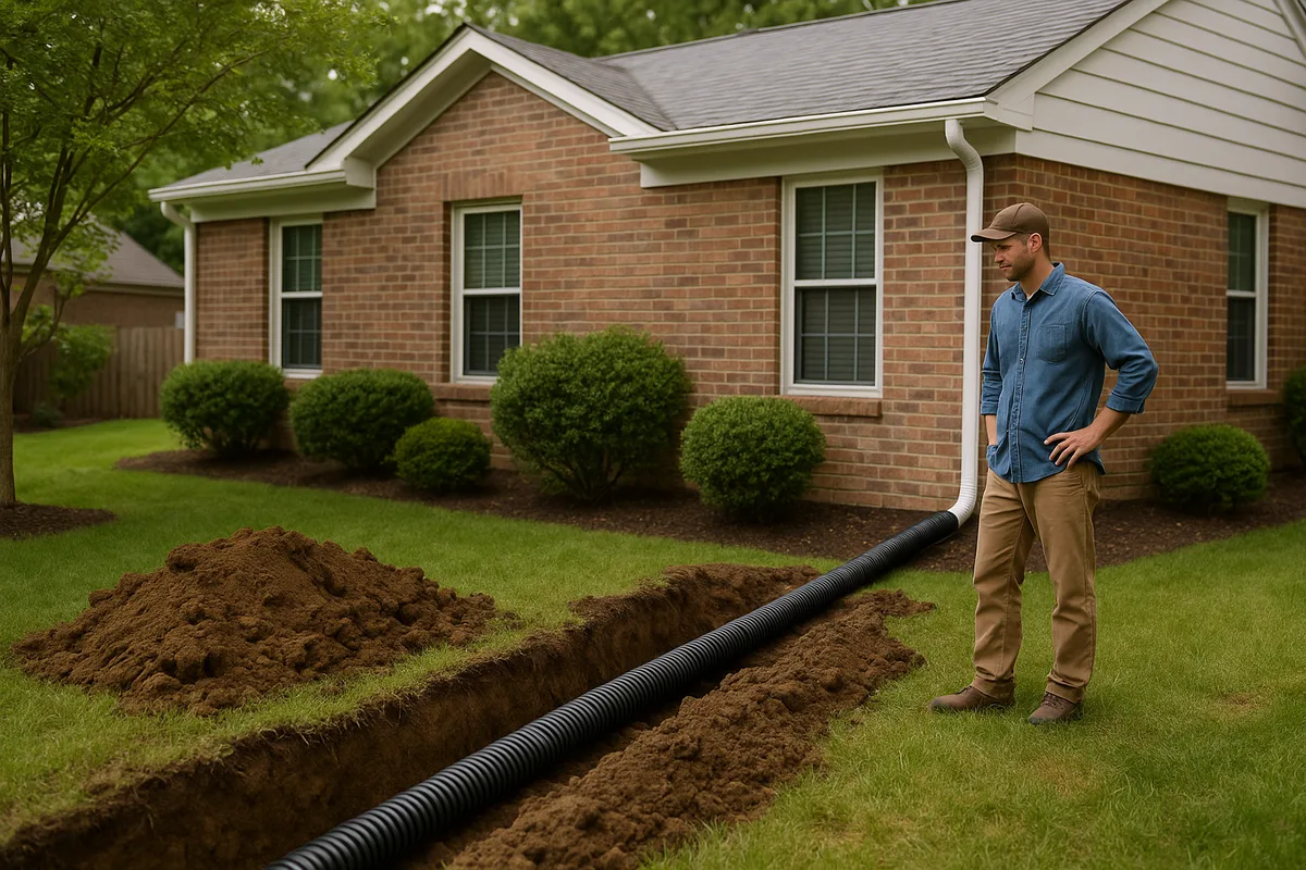
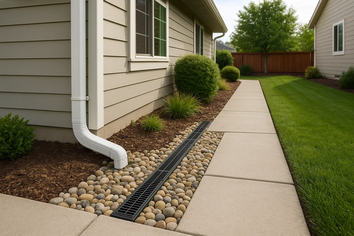
French Drains and Curtain Drains
French drains (subsurface perforated pipe in a gravel trench) are the workhorse of Massachusetts residential drainage. They're used to intercept groundwater moving laterally through the soil and redirect it to a suitable discharge point. A curtain drain is a specific type of French drain installed uphill of a structure to intercept water before it reaches the foundation.
Key design considerations for Massachusetts:
- Pipe depth: Must be below the frost line (36-48 inches) if the drain needs to function during winter and early spring, which is when it's needed most
- Filter fabric: Essential in Massachusetts's silty till soils, which will clog pipe perforations and fill gravel voids within a few years if not properly filtered
- Pipe material: Rigid PVC or HDPE is strongly preferred over corrugated flexible pipe, which is prone to crushing under frozen soil loads and sagging in rocky trenches
- Discharge point: Must comply with local stormwater regulations. Many municipalities prohibit direct discharge to storm drains or require treatment before discharge
- Slope: Minimum 1% grade (1 foot of fall per 100 feet of length) for reliable flow
Resources from NDS Pro provide detailed design guidance for residential French drain systems, including pipe sizing, aggregate specifications, and filter fabric selection.
Interior Drainage Systems and Sump Pumps
For homes with chronic basement water intrusion that can't be fully addressed by exterior drainage improvements, interior perimeter drainage systems are a common Massachusetts solution. These systems involve cutting a channel around the interior perimeter of the basement floor, installing perforated pipe in a gravel bed, and directing water to a sump pit with an automatic pump.
Sump pumps are ubiquitous in Massachusetts basements. If you're buying a home in Massachusetts and it has a sump pump, that's not a red flag — it's simply an indication that the water table is high enough to require active management. The red flag is a home that should have a sump pump but doesn't, or a sump pump that runs continuously, which may indicate an undersized system or an unresolved exterior drainage problem.
Critical sump pump considerations for Massachusetts:
- Battery backup: Essential. Massachusetts nor'easters frequently cause power outages lasting hours or days, and power outages correlate exactly with the heavy rain events when you need the pump most
- Discharge location: Sump discharge must be piped well away from the foundation — at least 20 feet — and must not discharge onto neighboring properties or into the sanitary sewer
- Freeze protection: Discharge pipes that run near the surface can freeze in winter. Insulated or buried discharge lines are recommended
- Redundancy: In high-water-table areas, consider a dual-pump system with pumps at different elevations in the pit
Dry Wells and Infiltration Systems
Dry wells — underground chambers that collect stormwater and allow it to slowly infiltrate into the surrounding soil — are an increasingly popular solution in Massachusetts, particularly for managing roof runoff. Massachusetts stormwater standards encourage groundwater recharge, and dry wells are one of the simplest ways to achieve it.
However, dry wells only work in soils with adequate permeability. In dense glacial till or clay soils, a dry well will simply fill up and overflow, providing no benefit. Before installing a dry well, perform a percolation test at the proposed depth. If the infiltration rate is less than 1 inch per hour, a dry well is unlikely to be effective.
Dry wells must also be set back from foundations (typically at least 10 feet), septic systems (per Title 5 requirements), and property lines. In areas with contaminated groundwater or near drinking water wells, dry wells may be restricted or prohibited.
The Low Impact Development Center provides design guidance for infiltration practices, including dry wells, rain gardens, and permeable pavement, that are applicable to Massachusetts conditions.
Rain Gardens and Bioretention
Rain gardens — shallow, planted depressions designed to capture and infiltrate stormwater — are an excellent solution for Massachusetts properties with moderately permeable soils. They're aesthetically attractive, provide wildlife habitat, and can be designed to handle the runoff from a typical residential roof or driveway.
For Massachusetts rain gardens, plant selection is critical. Native species adapted to periodic inundation and the state's freeze-thaw cycles perform best. Switchgrass, blue flag iris, swamp milkweed, winterberry holly, and red twig dogwood are all excellent choices. The Cooperative Extension System offers region-specific guidance on rain garden design and plant selection.
Rain gardens in Massachusetts should be designed with an underdrain — a perforated pipe beneath the planting bed that provides an overflow pathway — because the state's soils are often too slow-draining to handle large storm events through infiltration alone.
Landscape Grading and Swales
Swales — shallow, vegetated channels that convey stormwater across the landscape — are effective solutions for managing overland flow on Massachusetts properties. They're particularly useful for intercepting runoff from uphill neighbors or directing water around structures to a suitable discharge point.
Design considerations specific to Massachusetts include:
- Vegetation: Grass-lined swales work well in summer but may be less effective during the dormant season when grass isn't actively growing. Consider reinforcing the channel with erosion control fabric or stone in areas of concentrated flow.
- Grade: Swales need sufficient slope to convey water (minimum 1-2%) but not so much that they cause erosion (generally less than 5% unless armored with stone)
- Capacity: Size swales for at least a 10-year storm event. In Massachusetts, this means handling approximately 3 inches of rain in 24 hours.
Landscape architects registered through organizations like the American Society of Landscape Architects can design grading and swale systems that are both functional and attractive.
Costs of Drainage Solutions in Massachusetts
Massachusetts drainage work tends to be more expensive than the national average due to the state's high labor costs, rocky soils that make excavation difficult, and regulatory compliance requirements. Here are approximate cost ranges as of 2026:
| Solution | Typical Cost Range |
|---|---|
| Regrading around foundation | $1,500 - $5,000 |
| French drain (exterior, per linear foot) | $50 - $100 |
| Curtain drain (100-foot run) | $5,000 - $12,000 |
| Interior perimeter drain with sump | $8,000 - $15,000 |
| Sump pump installation (new) | $1,200 - $3,000 |
| Sump pump battery backup | $500 - $1,500 |
| Dry well (single unit) | $2,000 - $5,000 |
| Rain garden (200 sq ft) | $1,500 - $4,000 |
| Downspout extensions and regrading | $500 - $2,000 |
| Full exterior waterproofing | $15,000 - $40,000 |
These costs can increase significantly in areas with rocky soils, shallow bedrock, or wetland permitting requirements. Properties in the Berkshires and Worcester Hills, where ledge is common, may see excavation costs 50-100% higher than properties on sandy or loamy soils.
If drainage problems have caused property damage, the Small Business Administration offers disaster loans that can be used for drainage improvements following federally declared disasters, which have become more frequent in Massachusetts.
Seasonal Drainage Calendar for Massachusetts
Spring (March - May): The Critical Season
Spring is when Massachusetts drainage systems face their greatest test. Snowmelt, frozen ground thawing, rising water tables, and spring rains all converge. This is when most basement flooding occurs and when drainage deficiencies become most apparent.
Action items:
- Inspect sump pump operation before the spring thaw
- Clear debris from gutters, downspouts, and surface drainage channels
- Check that downspout extensions are in place and directing water away from the foundation
- Walk the property during the first major spring rain to identify problem areas
- Schedule drainage repairs for late spring when the ground has thawed and dried enough to work
Summer (June - August): Assessment and Repair Season
Summer is the optimal time for drainage construction in Massachusetts. Soils are at their driest (relatively speaking), excavation is easier, and contractors are available. Summer thunderstorms can be intense but are typically short-duration events.
Action items:
- Schedule major drainage projects for installation
- Install rain gardens and bioretention features (plants establish best with summer warmth)
- Repair or replace damaged drainage infrastructure identified in spring
- Monitor for erosion during intense thunderstorms
Fall (September - November): Preparation Season
Fall is the time to prepare drainage systems for the coming winter and spring. Tropical storm remnants can produce heavy rainfall in September and October — Hurricane and post-tropical storm events have caused significant flooding in Massachusetts in recent years.
Action items:
- Clean gutters after leaf fall (this is critical — clogged gutters are the number one cause of preventable water intrusion in Massachusetts)
- Verify sump pump function and test battery backup
- Ensure all drainage outlets are clear and flowing
- Grade any settled areas around the foundation before the ground freezes
Winter (December - February): Monitoring Season
Winter drainage work is generally not possible in Massachusetts due to frozen ground, but monitoring is essential.
Action items:
- Monitor for ice dams on the roof, which can force water into wall cavities and attics
- Keep sump pump discharge pipes clear of ice
- After mid-winter thaws, check the basement for water intrusion
- Document any flooding or drainage issues for spring remediation planning
When to Get Professional Help
While many drainage improvements can be handled by capable homeowners — regrading, extending downspouts, cleaning gutters, installing simple surface swales — several situations warrant professional involvement:
- Chronic basement flooding that persists despite basic improvements like regrading and downspout management. This likely indicates a groundwater problem that requires subsurface drainage design.
- Foundation cracking or movement that may be related to hydrostatic pressure or frost heave. This requires a structural engineer's assessment before any drainage work begins.
- Properties within wetland buffer zones where Conservation Commission permitting is required. A wetland scientist or environmental consultant can navigate the permitting process.
- Septic system interactions where drainage improvements might affect Title 5 compliance. A licensed septic system designer should be consulted.
- Multi-property drainage disputes where water from neighboring properties is causing damage. These situations often require a civil engineer's analysis and sometimes legal intervention.
- Coastal flooding where solutions may involve elevation, flood barriers, or coordination with municipal infrastructure. The Water Environment Federation and organizations like the National Association of Flood and Stormwater Management Agencies provide resources on community-scale flood management approaches.
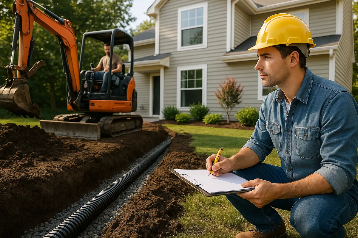
When hiring a drainage contractor in Massachusetts, verify that they hold a Massachusetts Home Improvement Contractor (HIC) registration, carry adequate liability insurance, and can provide references for similar work in your soil type and geographic area. Drainage solutions that work perfectly in sandy Cape Cod soils may be completely wrong for glacial till in Worcester — experience in your specific area matters.
Engineers involved in drainage design should be licensed Professional Engineers (PEs) in the Commonwealth of Massachusetts. For projects involving civil engineering design standards, the American Society of Civil Engineers provides technical standards and resources that Massachusetts engineers follow.
The Hidden Cost of Ignoring Drainage
Massachusetts property values are among the highest in the nation, and drainage problems directly erode those values. A wet basement, a yard that floods, or a foundation showing signs of water damage can reduce a home's market value by 10-25%, depending on severity. More importantly, unaddressed drainage problems get worse over time, not better. Water is patient and persistent — it will find every crack, every gap, every path of least resistance.
The structural consequences of chronic moisture exposure in Massachusetts are severe. Wooden structural members rot. Concrete spalls as embedded rebar corrodes. Mold colonizes damp surfaces and can create health hazards. Foundation walls bow inward under sustained hydrostatic pressure. Frost heave lifts and cracks foundations that lack adequate drainage. Every year of deferred maintenance makes the eventual repair more expensive.
Get a Drainage Intelligence Report™ for Your Massachusetts Property
Understanding your property's drainage is not something you can fully accomplish with a visual inspection or a Google search. The interaction of Massachusetts's glacial geology, variable soils, intense precipitation, freeze-thaw cycles, and complex regulations creates a drainage environment that requires systematic, data-driven analysis.
A Drainage Intelligence Report™ from Low Point Labs provides exactly that. Using topographic data, soil analysis, precipitation modeling, regulatory mapping, and property-specific assessment, we deliver a comprehensive picture of how water interacts with your property — where it comes from, where it goes, where it's causing problems, and what you can do about it.
Whether you're buying a home in Brookline, managing a wet basement in Worcester, dealing with coastal flooding in Scituate, or planning a renovation in Northampton, a Drainage Intelligence Report™ gives you the information you need to make smart decisions about the most consequential infrastructure on your property — the infrastructure that manages water.
Order your Drainage Intelligence Report™ today and stop guessing about what's happening beneath your Massachusetts property.
Explore our US Drainage Guide for a national perspective on residential drainage.
Frequently Asked Questions
Subscribe to generate reports on demand. Cancel anytime.