The City Built on Dissolving Rock
Nashville sits in the heart of the Central Basin of Tennessee, a geological bowl carved from Ordovician-age limestone that has been slowly dissolving for hundreds of millions of years. This isn't abstract geology — it's the reason your basement leaks, your yard holds water for days after a rainstorm, and sinkholes occasionally swallow chunks of parking lots in Antioch and South Nashville. Davidson County receives an average of 52 inches of rain annually, and that water interacts with a landscape defined by two forces that work against property owners simultaneously: limestone clay soils that refuse to let water percolate downward quickly, and a karst bedrock beneath those soils that channels water unpredictably through underground voids and conduits.
The result is a city where drainage problems are not the exception — they're the baseline condition. From the low-lying flood corridors along Mill Creek and Whites Creek to the hillside developments of Bellevue and Green Hills where runoff accelerates downslope, Nashville presents a uniquely challenging drainage environment. And with the city's population growing by roughly 100 people per day over the past decade, impervious surface coverage has expanded dramatically, intensifying stormwater runoff volumes in watersheds that were already stressed.
This guide is built specifically for Nashville property owners, buyers, and real estate professionals who need to understand how water moves across and beneath their land — and what to do about it.
Nashville's Drainage Landscape: Soil, Rock, and Topography
The Limestone Clay Problem
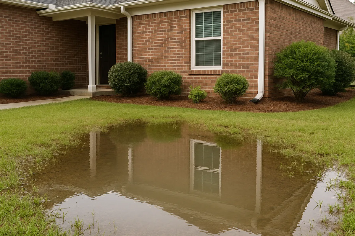
Nashville's dominant soil types create a drainage paradox. The surface soils across most of Davidson County consist of limestone-derived clay and silt loam — heavy, fine-textured soils that expand when wet and shrink when dry. In neighborhoods like Donelson, Hermitage, and Madison, you'll find deep deposits of Maury silt loam and Mimosa silty clay loam, both of which are classified as moderately well-drained to somewhat poorly drained by the USDA Web Soil Survey. These soils have infiltration rates that can drop below 0.2 inches per hour when saturated — meaning that during Nashville's frequent heavy rain events, the ground essentially becomes a bathtub.
The red clay subsoils found in areas like Bordeaux, Joelton, and parts of West Nashville are even more problematic. These B-horizon clays can have permeability rates below 0.06 inches per hour, creating a near-impermeable layer that perches water above it. If your yard stays soggy for 48 to 72 hours after a rain event, you're almost certainly dealing with this clay layer sitting within a few feet of the surface.
The USDA Natural Resources Conservation Service classifies much of Davidson County's soil as Hydrologic Soil Group C or D — the two categories with the highest runoff potential. This means that even in areas with decent surface grading, the soil itself generates significant overland flow during storms.
Karst Beneath the Surface
Beneath Nashville's clay soils lies the real wildcard: Ordovician limestone bedrock riddled with solution features. The Central Basin's karst geology means that bedrock isn't a solid, predictable foundation — it's a Swiss cheese of voids, fractures, sinkholes, and underground drainage channels. The U.S. Geological Survey has extensively mapped karst features across Middle Tennessee, and Davidson County contains thousands of documented sinkholes, with concentrations in South Nashville, Antioch, and along the Harpeth River corridor.
For property owners, karst creates two opposing drainage challenges:
Surface ponding over intact limestone: Where the limestone is relatively unfractured and sits close to the surface (common in areas like Sylvan Park, The Nations, and parts of East Nashville), water can't penetrate downward and pools on the surface.
Sudden subsurface drainage into voids: Where fractures and solution channels are present, water can disappear rapidly underground — sometimes creating new sinkholes when the clay overburden collapses into an expanding void. This is particularly common in the Cane Ridge, Una, and Priest Lake areas.
Both scenarios create problems. Surface ponding damages foundations and landscapes. Subsurface drainage into karst features can undermine structural support and contaminate groundwater.
Nashville's Topography: Ridges, Valleys, and Flood Corridors
Nashville's topography is deceptively hilly. The city sits in a broad basin, but within that basin, the terrain undulates significantly — ridgetops in areas like Oak Hill and Forest Hills sit 200 feet or more above the creek valleys that wind through the city. This elevation change means that properties on slopes face rapid runoff issues, while properties in valleys and along creek corridors face flooding from upstream accumulation.
The major drainage corridors in Davidson County include:
- Mill Creek — Running through Antioch and South Nashville, this watershed has experienced some of the most severe flooding in the city. The May 2010 flood event devastated this corridor and led to significant regulatory changes.
- Whites Creek — Draining the northern portion of the county through Bordeaux and Whites Creek community.
- Richland Creek — Running through Sylvan Park, Charlotte Park, and West Nashville.
- Sevenmile Creek — Flowing through the commercial and residential areas of South Nashville near the airport.
- Browns Creek — Draining portions of Woodbine and South Nashville.
- Harpeth River — Affecting the western edge of the county in Bellevue.
Properties within these watersheds — even those not directly on a creek bank — can experience significant drainage problems because the entire watershed funnels water toward these corridors. Understanding which watershed your property sits in is the first step toward understanding your drainage risk.
Climate Patterns and Rainfall Intensity
Nashville's humid subtropical climate delivers moisture year-round, but the pattern matters more than the annual total. The National Weather Service data for Nashville shows that the city's heaviest rainfall months are March through May, with a secondary peak in December and January. Summer thunderstorms can be individually intense but tend to be shorter in duration.
What has changed dramatically in recent years is rainfall intensity. Nashville has experienced a measurable increase in the frequency of extreme precipitation events — storms that deliver 2 or more inches of rain in a few hours. According to NOAA precipitation analysis, the amount of rain falling in the heaviest 1% of events in the Southeast has increased by roughly 27% since the mid-20th century. For Nashville's clay soils and aging stormwater infrastructure, this trend is devastating.
The practical impact: a drainage system designed to handle a 2-year storm event (roughly 3.3 inches over 24 hours in Nashville) may be overwhelmed multiple times per year as storms increasingly deliver that volume in 2-3 hours instead of 24. If your yard floods during intense storms but handles gentle, all-day rains without issue, you're seeing the effect of intensity exceeding your soil's infiltration capacity and your property's conveyance capacity.
Seasonal Drainage Patterns in Nashville
Nashville property owners should understand how drainage problems shift through the year:
- Late Winter / Early Spring (February–April): The highest-risk period. Soils are already saturated from winter rains, vegetation is dormant and not transpiring moisture, and the heaviest rainfall events of the year arrive. This is when basement flooding, yard ponding, and creek flooding peak.
- Late Spring / Early Summer (May–June): Soils begin drying as temperatures rise and vegetation greens up, but intense thunderstorms can still overwhelm saturated ground. The transition period can be deceptive — a dry week followed by a 3-inch thunderstorm catches property owners off guard.
- Summer (July–September): Clay soils dry and crack, which can temporarily improve surface drainage but creates new problems. Shrink-swell cycles stress foundations, and when heavy rain does arrive, the cracked clay initially absorbs water rapidly through the cracks before swelling shut and reverting to impermeability.
- Fall (October–November): Typically the driest period. This is the ideal window for drainage construction projects — soils are workable, and contractors have more availability.
- Early Winter (December–January): Rain returns, often as prolonged frontal systems. Soils re-saturate, and any drainage deficiencies that went unnoticed during the dry fall become apparent.
Metro Nashville's Stormwater Regulations and Permit Requirements
Nashville's stormwater regulatory environment is among the most comprehensive in the Southeast, shaped significantly by the catastrophic flooding of May 2010. Metro Water Services (MWS) administers the stormwater program through the Metro Nashville Department of Water and Stormwater, and the regulations affect everything from major commercial developments to individual residential lot grading.
Key Regulatory Requirements
Stormwater Management Permits: Any land disturbance activity affecting 20,000 square feet or more requires a Stormwater Management Permit from Metro Nashville. This includes grading, filling, excavating, and construction activities. The permit requires a stormwater management plan demonstrating that post-development runoff will not exceed pre-development levels for the 2-year and 25-year storm events.
Grading Permits: Even smaller projects may require a grading permit if they involve changes to the natural drainage pattern of a property. If you're re-grading your yard, building a retaining wall, or installing a significant drainage system, check with Metro Codes to determine whether a permit is required.
Floodplain Regulations: Nashville's floodplain regulations are stricter than the federal minimum standards set by FEMA. Metro Nashville requires a 1-foot freeboard above the base flood elevation for new construction, and the city has adopted higher regulatory standards for development within the floodway and floodplain. Properties within FEMA-designated flood zones are subject to additional restrictions on fill, grading, and construction.
Stormwater User Fee: Every property in Davidson County pays a stormwater user fee based on the amount of impervious surface on the property. Single-family residential properties pay a flat monthly fee, while commercial properties pay based on measured impervious area. This fee funds Metro Nashville's stormwater infrastructure maintenance, flood mitigation projects, and water quality programs.
Buffer Zones: Metro Nashville requires vegetated buffer zones along streams and waterways. The width of the required buffer depends on the watershed and the drainage area upstream. In most cases, the buffer is 30 feet from the top of the stream bank, but it can be wider in environmentally sensitive areas. Property owners cannot clear vegetation, build structures, or significantly alter grading within these buffers without special approval.
The Environmental Protection Agency oversees Nashville's Municipal Separate Storm Sewer System (MS4) permit, which requires the city to manage stormwater quality and quantity to protect waterways like the Cumberland River and its tributaries.
Flood Zone Designations in Davidson County
Understanding your property's flood zone designation is critical for insurance, construction, and resale purposes. Davidson County's Flood Insurance Rate Maps (FIRMs), administered through FEMA, designate several zone types:
- Zone AE: Areas with a 1% annual chance of flooding (the "100-year floodplain") where base flood elevations have been determined. Large portions of the Mill Creek, Whites Creek, Richland Creek, and Harpeth River corridors fall in Zone AE. Properties here with federally backed mortgages are required to carry flood insurance.
- Zone X (Shaded): Areas with a 0.2% annual chance of flooding (the "500-year floodplain"). Many Nashville neighborhoods sit in this zone, including portions of Bellevue, Madison, and Donelson. Flood insurance is not required but is strongly recommended.
- Zone X (Unshaded): Areas outside the 500-year floodplain. While these areas have lower statistical flood risk, Nashville's 2010 event demonstrated that devastating flooding can occur well outside mapped flood zones.
After the 2010 flood, FEMA undertook a comprehensive remapping effort for Davidson County, and updated FIRMs have expanded flood zone boundaries in many areas. Property owners should verify their current flood zone status through Metro Nashville's flood zone lookup tool or through FloodSmart.gov, which provides flood insurance information and risk assessment resources.
Disclosure Requirements for Real Estate Transactions
Tennessee law requires sellers to disclose known material defects, including drainage problems and flooding history. The Tennessee Residential Property Disclosure form includes specific questions about water intrusion, flooding, and drainage issues. Sellers who have experienced basement flooding, yard ponding, or any water-related damage are legally obligated to disclose this information.
For buyers, this disclosure requirement underscores the importance of independent drainage assessment. A seller may not be aware of drainage conditions that haven't yet manifested as visible problems — for instance, a property with poor grading that hasn't experienced a major rain event during the seller's ownership. The Department of Housing and Urban Development provides additional guidance on flood disclosure requirements for properties in designated flood zones.
Diagnosing Drainage Problems on Your Nashville Property
Before spending money on solutions, you need to understand exactly what's happening with water on your property. Here's a systematic approach to drainage assessment that any Nashville homeowner can perform.
Step 1: Observe During Rain
The single most valuable diagnostic step is watching your property during a moderate to heavy rain event. Go outside (safely) during a storm and observe:
- Where does water flow? Follow the path of surface runoff from the highest point of your property to the lowest. Does it flow away from your foundation or toward it?
- Where does water pool? Note any areas where water collects and stands. Mark these spots — they indicate low points in your grading.
- How does water leave your property? Does it sheet-flow across the surface to a street, swale, or storm drain? Does it infiltrate into the soil? Does it flow onto a neighbor's property?
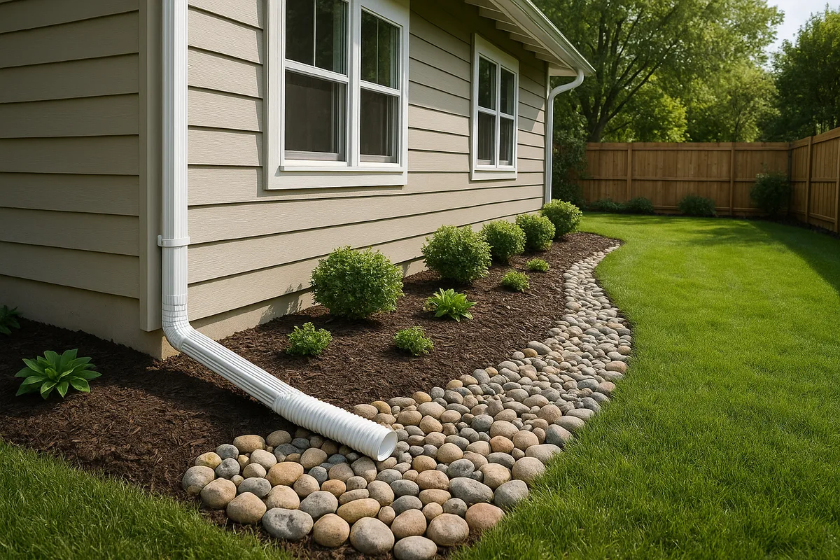
- How do your downspouts perform? Are they discharging water at least 6 feet from the foundation? Is the discharge point causing erosion or ponding?
- How long does standing water persist? Check ponding areas 24, 48, and 72 hours after rain stops. Water that persists beyond 48 hours indicates a significant drainage deficiency.
Step 2: Inspect Your Foundation Grading
The International Residential Code requires a minimum of 6 inches of fall in the first 10 feet away from a foundation. In Nashville's clay soils, you should aim for more — 8 to 12 inches of fall in the first 10 feet is preferable. Use a 10-foot straight board and a level to check the grade at multiple points around your foundation.
Common grading failures in Nashville properties include:
- Settled backfill: When homes are built, the excavated soil around the foundation is backfilled and compacted, but Nashville's clay soils continue to settle for years. This creates a trough around the foundation that funnels water directly to the walls.
- Mulch and landscape bed buildup: Over time, mulch and soil amendments in foundation beds can raise the grade against the house while creating a dam that traps water against the foundation.
- Negative grading from erosion: On Nashville's hilly lots, erosion can gradually flatten or reverse the grade away from a foundation, particularly on the downhill side of a home.
Step 3: Evaluate Your Gutter and Downspout System
Nashville homes receive roughly 32,000 gallons of rainwater per 1,000 square feet of roof area annually. If your gutters are undersized, clogged, or your downspouts discharge too close to the foundation, that volume becomes a direct assault on your foundation and crawl space.
Check for:
- Gutters overflowing during moderate rain (indicating undersized gutters or clogged downspouts)
- Downspouts terminating at the foundation or splashing against the house
- Underground downspout extensions that may be clogged or collapsed
- Missing splash blocks or eroded discharge areas
Step 4: Check for Interior Water Intrusion Signs
Inside your home, look for evidence of water problems:
- Basement or crawl space: Staining on walls, efflorescence (white mineral deposits), musty odors, standing water, or visible moisture on surfaces
- Foundation walls: Horizontal cracks (indicating hydrostatic pressure), stair-step cracks in brick or block, or bowing walls
- Floors: Uneven floors can indicate foundation settlement driven by moisture-related soil movement — extremely common in Nashville's shrink-swell clay
Step 5: Assess Your Property in the Broader Context
Your drainage problem may not originate on your property. In Nashville's densely developed neighborhoods, upstream properties, road runoff, and regional drainage patterns all affect individual lots. Consider:
- Is your property at the bottom of a hill or in a natural drainage swale?
- Has a neighbor's recent construction (new driveway, patio, addition) redirected water toward your property?
- Is there a storm drain or drainage easement on or near your property, and is it functioning?
- What watershed are you in, and are there known flooding issues in your area?
Common Drainage Solutions for Nashville Properties
The right drainage solution depends entirely on the specific problem, the soil conditions, the topography, and the regulatory constraints on your property. Here are the most common approaches used in Nashville, with practical guidance on when each is appropriate.
Grading and Resloping
When to use it: When the fundamental problem is that the ground surface directs water toward the foundation or into low spots instead of away from them.
How it works in Nashville: Grading corrections involve adding or redistributing soil to create positive drainage away from structures. In Nashville's clay soils, the imported fill material matters enormously. Using clay fill to regrade creates a surface that sheds water but doesn't allow infiltration — which may solve a foundation problem but create a ponding problem elsewhere. A blend of topsoil and clay, properly compacted in lifts, typically provides the best balance.
Nashville-specific considerations: On hillside lots common in Green Hills, Oak Hill, Bellevue, and Crieve Hall, regrading must account for slope stability. Nashville's clay soils are prone to slope failure when saturated, and aggressive regrading on slopes steeper than 3:1 (horizontal to vertical) can create landslide risk. Retaining walls may be necessary to create terraced grades on steep lots.
Typical cost in Nashville: $1,500–$5,000 for foundation regrading on a typical residential lot; $5,000–$15,000+ for comprehensive lot regrading involving significant soil import.
French Drains
When to use it: When subsurface water needs to be intercepted and redirected — for example, when groundwater or subsurface flow is migrating toward a foundation or saturating a yard area.
How it works: A French drain is a trench filled with gravel and containing a perforated pipe, designed to collect subsurface water and convey it to a discharge point. The pipe is wrapped in filter fabric to prevent soil migration into the gravel, and the trench is typically 12–24 inches wide and 18–36 inches deep.
Nashville-specific considerations: French drains in Nashville's clay soils face a unique challenge: the clay itself generates very little lateral subsurface flow because it's so impermeable. A French drain installed in clay may not intercept much water unless it's placed at the interface between the topsoil and the clay subsoil, where perched water accumulates. Additionally, the filter fabric must be selected carefully — Nashville's fine clay particles can clog standard filter fabrics within a few years. Use a non-woven geotextile rated for fine-grained soils.
Another critical consideration: discharge. A French drain must have a positive-gravity outlet. In flat areas of Nashville like Donelson and Madison, finding adequate fall for discharge can be challenging. Discharging into the Metro Nashville storm sewer system requires permission and may require a connection permit.
Products from companies like NDS offer residential-grade French drain systems with pre-assembled components that can simplify installation, though professional installation is recommended in Nashville's challenging soil conditions.
Typical cost in Nashville: $25–$50 per linear foot installed, depending on depth and soil conditions. A typical residential French drain system runs $3,000–$8,000.
Surface Drains and Channel Drains
When to use it: When surface water needs to be captured and conveyed — for example, at the base of a driveway, along a patio edge, or in a yard low spot where water ponds.
How it works: Surface drains (catch basins) and channel drains (linear trench drains) collect surface water through grated openings and convey it through solid pipe to a discharge point.
Nashville-specific considerations: Surface drain systems are often the most effective solution for Nashville properties because the primary drainage problem is surface runoff on impermeable clay, not subsurface water. A well-designed surface drain system with catch basins at strategic low points, connected by solid 4-inch or 6-inch PVC pipe discharging to the street or a suitable outlet, can resolve most residential ponding issues.
The key design consideration is pipe sizing. Nashville's intense rainfall events can overwhelm undersized pipe. For most residential applications, 4-inch pipe is adequate for individual downspout connections, but trunk lines collecting from multiple sources should be 6-inch minimum.
Typical cost in Nashville: $1,500–$5,000 for a basic catch basin and pipe system; $5,000–$12,000 for a comprehensive surface drainage system.
Dry Wells and Infiltration Systems
When to use it: When you need to manage stormwater volume on-site and don't have a convenient discharge point — common on interior lots in Nashville subdivisions.
How it works: A dry well is an underground chamber (typically a large perforated barrel or a manufactured infiltration unit) surrounded by gravel, designed to receive stormwater and allow it to slowly infiltrate into the surrounding soil.
Nashville-specific considerations: Dry wells have limited effectiveness in Nashville's clay soils because the surrounding clay infiltrates water so slowly. A dry well that works beautifully in sandy soil may fill up and overflow in Nashville's clay after a moderate rain event. If you're considering a dry well, the soil's infiltration rate must be tested — not assumed. A percolation test at the proposed installation depth is essential.
Dry wells can work in Nashville when they're oversized to account for slow infiltration, when they're installed in a zone where the soil has better permeability (such as a gravel lens or weathered limestone zone), or when they're used as overflow storage for a primary drainage system rather than as the sole solution.
Where karst features are present, dry wells require special caution. Directing concentrated stormwater into a dry well that connects to a karst void can accelerate sinkhole development. Consult with a geotechnical engineer before installing infiltration systems in areas with known karst activity.
Typical cost in Nashville: $1,500–$4,000 per dry well installed.
Sump Pump Systems
When to use it: When water is entering a basement or crawl space and gravity drainage is not possible — common in Nashville's lower-lying areas and in homes with basements below the water table.
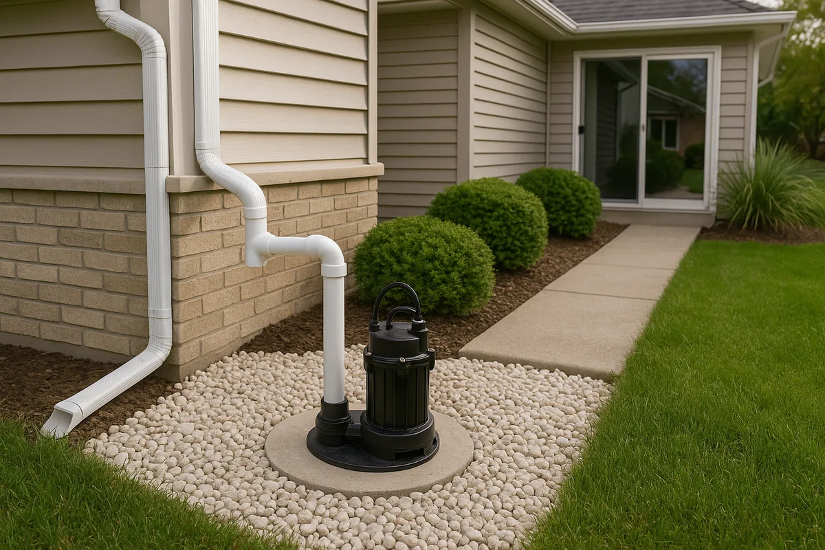
How it works: A sump pump system collects water in a pit (sump) below the lowest floor level and pumps it to a discharge point outside and away from the foundation. Interior perimeter drains (sometimes called "waterproofing systems") channel water from around the foundation walls to the sump pit.
Nashville-specific considerations: Many Nashville homes built in the 1950s through 1980s have basements that were constructed without adequate exterior waterproofing or drainage. In neighborhoods like Inglewood, Lockeland Springs, and parts of Bellevue, basement water intrusion is extremely common. A sump pump system is often the most practical retrofit solution because exterior excavation and waterproofing can cost $15,000–$30,000 or more.
Critical design elements for Nashville sump systems include battery backup (Nashville's storms frequently cause power outages) and a discharge line that extends well away from the foundation — at least 10 feet, and preferably to the street or a drainage easement. Discharging a sump pump 3 feet from the foundation, as is distressingly common, simply recycles the water back into the problem area.
Typical cost in Nashville: $2,500–$6,000 for a basic sump pump installation; $8,000–$15,000 for an interior perimeter drain and sump system.
Rain Gardens and Bioretention
For property owners interested in managing stormwater sustainably, rain gardens and bioretention areas offer an approach that aligns with Nashville's push toward green infrastructure. The Low Impact Development Center provides design guidance for residential bioretention systems that can be adapted to Nashville's soil and climate conditions.
A rain garden in Nashville must be designed with an engineered soil mix — typically 60% sand, 20% compost, and 20% topsoil — because the native clay soil won't infiltrate water fast enough to function as bioretention media. The garden should be sized to capture the first inch of rainfall from its contributing drainage area and should include an underdrain connected to the storm drainage system for overflow.
The American Society of Landscape Architects provides resources on integrating stormwater management into residential landscape design, which can be particularly valuable for Nashville homeowners looking to address drainage while improving curb appeal.
Typical cost in Nashville: $2,000–$6,000 for a professionally designed and installed residential rain garden.
Crawl Space Encapsulation and Moisture Management
Many Nashville homes — particularly ranch-style homes from the 1960s and 1970s in areas like Madison, Goodlettsville, and Antioch — have vented crawl spaces that trap moisture. Nashville's humid climate means that summer air entering a crawl space through foundation vents actually adds moisture rather than removing it, because the warm, humid air condenses on the cooler crawl space surfaces.
Crawl space encapsulation involves sealing the crawl space from exterior air, installing a heavy vapor barrier over the ground and walls, and conditioning the space with a dehumidifier or conditioned air supply. While not a drainage solution per se, encapsulation addresses the moisture symptoms that often accompany drainage problems and can be a critical component of a comprehensive moisture management strategy.
Typical cost in Nashville: $5,000–$15,000 depending on crawl space size and existing conditions.
Neighborhood-Specific Drainage Challenges
Nashville's drainage problems vary significantly by neighborhood due to differences in topography, soil, development patterns, and proximity to waterways.
Antioch and Southeast Nashville
This area sits in the Mill Creek watershed and has some of the highest flood risk in Davidson County. The combination of relatively flat terrain along Mill Creek, dense suburban development with extensive impervious surfaces, and karst geology creates a triple threat. Many subdivisions built in the 1980s and 1990s were developed with detention basins that are now undersized for current rainfall intensity patterns. Sinkhole activity is also a concern — the karst geology in this area is active, and property owners should be alert to signs of developing sinkholes including circular depressions, cracks in the ground, and leaning fence posts or trees.
Bellevue and West Nashville
Bellevue's proximity to the Harpeth River creates significant flood risk for properties along the river corridor and its tributaries. The hilly terrain in this area generates rapid runoff that can overwhelm drainage systems during intense storms. Hillside erosion is a common problem, particularly on lots that were cleared of vegetation during construction. The clay soils on Bellevue's slopes are prone to shallow landslides when saturated — a problem that typically manifests as retaining wall failures, driveway cracking, and foundation settlement.
East Nashville and Inglewood
These established neighborhoods feature older homes, many with basements, on lots with mature trees and aging infrastructure. The drainage challenges here tend to be foundation-related: settled grading around foundations, deteriorated clay tile drain systems from original construction, and basement water intrusion. The topography varies from relatively flat near the Cumberland River to rolling hills further east, and properties in the lower areas can experience both surface flooding and rising groundwater during major rain events.
The Nations, Sylvan Park, and Charlotte Park
These rapidly gentrifying neighborhoods sit in the Richland Creek watershed. The area has experienced enormous infill development, with new construction replacing smaller homes on lots that were originally graded for different building footprints. This infill development frequently creates drainage conflicts — a new, larger home with more roof area and more impervious surface generates more runoff, which often flows onto neighboring properties. Richland Creek itself has a history of flash flooding, and properties near the creek corridor should verify their flood zone status.
Green Hills and Oak Hill
These affluent neighborhoods sit on some of Nashville's highest terrain, which might suggest minimal drainage risk. However, the steep slopes generate intense runoff during storms, and the properties at the base of these slopes — particularly along the Sugartree Creek and Brown Creek corridors — receive concentrated flow from large uphill drainage areas. Hillside lots in these areas frequently require retaining walls and engineered drainage systems to manage slope runoff and prevent erosion.
Madison and Goodlettsville
The northern portion of Davidson County along the Whites Creek and Manskers Creek corridors has experienced significant flooding. Many homes in this area were built in the 1960s and 1970s on lots with minimal drainage infrastructure. The flat to gently rolling terrain, combined with clay soils and aging storm sewers, creates persistent ponding and flooding issues. Properties near Whites Creek should carefully evaluate their flood zone status, as FEMA map updates have expanded flood boundaries in this area.
Costs and Contractor Considerations in the Nashville Market
Nashville's construction market remains competitive, and drainage contractors are in high demand — particularly in the spring when problems become acute. Here are practical considerations for hiring drainage work in the Nashville area.
Getting Accurate Estimates
For any drainage project, get a minimum of three written estimates from licensed contractors. Each estimate should include:
- A site assessment describing the specific problem and proposed solution
- Detailed scope of work including materials, dimensions, and discharge points
- Permit requirements and who is responsible for obtaining them
- A warranty on both materials and workmanship
- A timeline for completion
Be wary of contractors who propose solutions without first diagnosing the problem. A contractor who walks your property for 10 minutes and quotes a French drain may be selling you a solution that doesn't address your actual issue.
Typical Project Costs in Nashville (2026)
| Project | Typical Cost Range |
|---|---|
| Foundation regrading | $1,500–$5,000 |
| Downspout extensions (underground) | $800–$2,500 |
| French drain (per linear foot) | $25–$50 |
| Surface drain system | $2,500–$8,000 |
| Sump pump installation | $2,500–$6,000 |
| Interior perimeter drain + sump | $8,000–$15,000 |
| Exterior foundation waterproofing | $15,000–$30,000 |
| Crawl space encapsulation | $5,000–$15,000 |
| Retaining wall (per linear foot) | $50–$150 |
| Rain garden (installed) | $2,000–$6,000 |
| Comprehensive lot drainage system | $10,000–$25,000 |
These costs reflect the Nashville market as of early 2026 and can vary based on site access, soil conditions, and project complexity. Properties with significant rock (shallow limestone) will incur higher excavation costs.
Licensing and Insurance
Tennessee requires contractors performing work over $25,000 to hold a state contractor's license. For smaller drainage projects, verify that your contractor carries general liability insurance and workers' compensation coverage. Ask for a certificate of insurance and verify it's current.
For projects involving connection to the Metro Nashville storm sewer system, the contractor should be familiar with Metro Water Services requirements and should obtain any necessary permits before beginning work.
When to Involve an Engineer
Some drainage problems require engineering expertise beyond what a typical drainage contractor provides. Consider hiring a licensed civil or geotechnical engineer when:
- Your property has known or suspected karst features (sinkholes, depressions, or voids)
- You're experiencing foundation movement (cracks, settlement, heaving) related to moisture
- Your property is on a slope steeper than 4:1 and you're experiencing erosion or slope instability
- You need to design a system that will require a Metro Nashville stormwater permit
- You're in a FEMA-designated flood zone and planning construction or significant grading changes
The American Society of Civil Engineers maintains resources on finding qualified engineers, and Nashville has numerous firms specializing in geotechnical and stormwater engineering.
Flood Preparedness and Insurance
Every Nashville property owner should have a flood preparedness plan, regardless of flood zone designation. The 2010 flood demonstrated that catastrophic flooding can affect areas well outside mapped flood zones — thousands of Nashville homes that flooded in 2010 were not in any designated flood zone.
Flood Insurance
Standard homeowner's insurance does not cover flood damage. Flood insurance is available through the National Flood Insurance Program (NFIP) and through private insurers. Properties in Zone AE with federally backed mortgages are required to carry flood insurance, but any property owner can purchase a policy.
FloodSmart.gov provides information on flood insurance options, costs, and coverage. Policies typically have a 30-day waiting period before coverage begins, so don't wait until a storm is forecast to purchase a policy.
For properties that have experienced repetitive flood losses, the Small Business Administration offers disaster loans that can help fund flood mitigation improvements, and FEMA's Hazard Mitigation Grant Program has funded property buyouts and elevations in Nashville's most flood-prone areas.
Emergency Preparedness
Ready.gov provides comprehensive flood preparedness guidance, including emergency kit checklists and evacuation planning resources. Nashville-specific preparedness should include:
- Knowing your evacuation route from flood-prone areas
- Having a battery-powered weather radio (Nashville is in a region prone to both flooding and severe thunderstorms)
- Keeping important documents in waterproof containers above potential flood levels
- Having a plan for protecting or relocating vehicles during flood events
- Knowing how to shut off utilities (gas, electricity) if floodwaters threaten your home
When to Get Professional Help
Not every drainage problem requires professional intervention. Minor grading adjustments, downspout extensions, and surface drainage improvements are within the capability of a handy homeowner. However, seek professional help when:
- Water is entering your living space. Basement or crawl space water intrusion is a structural concern that requires proper diagnosis and repair.
- You see foundation cracks or movement. Structural damage from hydrostatic pressure or soil movement requires engineering assessment.
- You suspect sinkhole activity. Depressions, ground cracks, or sudden changes in drainage patterns in karst areas need geotechnical evaluation.
- Your drainage problem involves multiple properties. Disputes over water flow between neighboring properties are common in Nashville and may require survey, engineering, and potentially legal involvement.
- You're buying a property and have drainage concerns. A pre-purchase drainage assessment can identify problems that a standard home inspection may miss.
- You need to work within a flood zone or near a waterway. Regulatory requirements in these areas are complex and violations carry significant penalties.
The Water Environment Federation and National Association of Flood and Stormwater Management Agencies both provide educational resources on stormwater management that can help property owners understand the scope and complexity of drainage challenges.
The Value of Understanding Your Drainage Before It Becomes a Crisis
Most Nashville property owners don't think about drainage until water is in their basement or their yard is a swamp. By then, the damage is done — to the property, to the foundation, and to the wallet. The cost of reactive drainage repair is almost always higher than the cost of proactive assessment and prevention.
Nashville's combination of heavy clay soils, karst geology, intense rainfall, and rapid development creates a drainage environment where problems are not a matter of "if" but "when." Every property in Davidson County has a drainage story — the question is whether you know yours before it becomes an expensive surprise.
Get Your Nashville Drainage Intelligence Report™
A Low Point Labs Drainage Intelligence Report™ gives you a comprehensive, data-driven analysis of how water interacts with your specific Nashville property. Using topographic data, soil mapping, flood zone analysis, watershed modeling, and property-specific grading assessment, we identify current and potential drainage vulnerabilities — and provide actionable recommendations for addressing them.
Whether you're a homeowner concerned about water in your crawl space, a buyer evaluating a property in Antioch or Bellevue, a real estate agent advising clients on drainage risk, or a contractor scoping a drainage project, a Drainage Intelligence Report™ provides the foundation of knowledge you need to make informed decisions.
Nashville's water doesn't wait, and neither should you. Get your Drainage Intelligence Report™ today and understand your property's relationship with water — before the next storm makes it painfully clear.
Explore our US Drainage Guide for a national perspective.
Frequently Asked Questions
The Low Point Labs Drainage Intelligence™ platform is accessible via invitation-led onboarding.