A City Built Between River and Sea — Where Drainage Defines Everything
Jacksonville sprawls across 874 square miles of northeast Florida — the largest city by area in the contiguous United States — and nearly every one of those square miles has a complicated relationship with water. The St. Johns River, one of the few major rivers in North America that flows north, bisects the city and creates an enormous tidal influence that extends deep into residential neighborhoods. When a nor'easter pushes ocean water into the river's mouth at Mayport while a heavy rain event drops three inches in two hours over the Westside, the river can't drain. Water backs up through tributaries like McCoys Creek, Hogans Creek, and the Ortega River, flooding neighborhoods that sit miles from the coast.
This isn't a theoretical scenario — it's a recurring reality. Jacksonville's drainage challenges are uniquely layered: a high water table sitting on porous limestone and sand, massive tidal influence from both the Atlantic and the St. Johns, flat topography that gives water almost nowhere to go, and a development pattern that has paved over vast areas of natural absorption. The result is a city where a property can sit outside any FEMA flood zone, on well-drained sandy soil, and still experience chronic yard flooding because the stormwater infrastructure downstream is overwhelmed.
Understanding drainage in Jacksonville means understanding that water here doesn't behave the way it does in most American cities. It doesn't simply flow downhill to a storm drain and disappear. It interacts with tides, percolates through sand into a water table that may already be at capacity, and moves laterally through shallow aquifer layers in ways that can create wet conditions on your property even when it hasn't rained in days. This guide will give you the practical knowledge to assess, address, and manage drainage on your Jacksonville property.
Jacksonville's Drainage Landscape: Soil, Topography, and Water
The Soil Beneath Your Feet
Jacksonville's soils are dominated by three types that create distinct drainage behaviors depending on where in the city you live. The USDA Web Soil Survey provides parcel-level soil data for all of Duval County, and consulting it should be one of the first steps any property owner takes when investigating drainage.
Sandy soils cover the majority of Jacksonville's land area, particularly on the Beaches communities (Jacksonville Beach, Neptune Beach, Atlantic Beach), the Southside, and much of the Northside. These soils — classified in series like Tavares, St. Augustine, and Kershaw — drain rapidly under normal conditions. Water passes through them quickly, which is why many Jacksonville homeowners are surprised to find standing water on sandy lots. The issue is almost never the soil's inability to absorb water; it's that the water table beneath the sand is already high, leaving no vertical space for infiltration.
Muck and organic soils are found in low-lying areas near the St. Johns River and its tributaries, including portions of the Northside, areas around the Trout River, and sections of the Westside near the Ortega River basin. These soils are poorly drained, hold water tenaciously, and can remain saturated for weeks after rain events. Properties built on muck soils — common in subdivisions developed from the 1970s through the 2000s when wetland fill practices were more permissive — face chronic drainage problems that are extremely difficult to solve without engineered systems.
Limestone-influenced soils appear throughout Jacksonville, reflecting the broader karst geology that underlies all of northeast Florida. The limestone layer sits at varying depths — sometimes just a few feet below the surface in areas like the Arlington neighborhood and parts of Mandarin. This creates a dual problem: the limestone can act as a barrier to deep percolation when it's dense and unfractured, and it can create sinkholes and sudden subsidence when it's heavily dissolved. Either scenario complicates drainage system design.
The USGS maintains extensive data on Jacksonville's hydrogeology, including the behavior of the surficial aquifer system that directly affects residential drainage. In many parts of the city, the surficial aquifer — the uppermost layer of groundwater — sits within two to four feet of the surface during the wet season. In some neighborhoods near the river, it can rise to within inches of the surface.
Topography: Flat Doesn't Mean Simple
Jacksonville's topography is deceptively flat. Most of the city sits between 10 and 30 feet above sea level, with some areas along the river and coast sitting below 10 feet. The Trail Ridge, a subtle geological feature running through the western portions of the city, represents the highest ground in the area at around 50–75 feet, but even this "high ground" is modest.
The practical impact of this flatness is profound. Water needs gradient to flow, and Jacksonville often doesn't provide enough. A typical residential lot in a subdivision on the Southside might have only six inches of elevation change across its entire 100-foot depth. That's barely enough to move water away from a foundation, and it means that even minor grading errors during construction — a few inches of settled fill here, a slightly misaligned swale there — can create persistent ponding.
Neighborhoods built on former wetlands or low-lying areas face the worst topographic challenges. Parts of the Baymeadows corridor, sections of the Argyle Forest community on the Westside, and numerous subdivisions along the Intracoastal Waterway were developed on land that was naturally at or near water level. Fill material was brought in to raise building pads, but the surrounding areas often remain close to their original elevation, creating a bathtub effect where water collects around homes with nowhere to drain.
Climate: The Rain Patterns That Drive Drainage Failures
Jacksonville receives approximately 54 inches of rain annually, but the distribution is what matters for drainage. The National Weather Service data for Jacksonville International Airport shows that roughly 60% of annual rainfall occurs between June and September, with July and August alone accounting for nearly 16 inches. These summer months bring intense convective thunderstorms that can drop two to four inches in under an hour — far exceeding the design capacity of most residential drainage systems.
The city also faces significant rain from tropical systems. Jacksonville's position on the northeast Florida coast makes it vulnerable to both direct hurricane strikes and, more commonly, the heavy rain bands from systems passing through the Gulf or along the Atlantic coast. NOAA precipitation records show that Jacksonville has received more than 10 inches of rain in a single 24-hour period from tropical systems multiple times in recent decades.
The winter months bring a different drainage dynamic. Northeast Florida experiences periodic nor'easters that combine moderate rainfall with strong onshore winds. These events push tidal levels well above normal along the St. Johns River and Intracoastal Waterway, which prevents stormwater outfalls from draining. The combination of rain and tidal flooding is Jacksonville's most dangerous drainage scenario.
Flood Zones, Insurance, and What Your FEMA Map Really Means
Duval County has an extensive and complex flood zone map that every property owner should understand. FEMA designates flood zones based on the probability of flooding in any given year, and Jacksonville's map reflects the city's multiple flood sources: riverine flooding from the St. Johns and its tributaries, coastal flooding from the Atlantic, and tidal flooding from the Intracoastal Waterway.
Understanding Jacksonville's Flood Zone Designations
Zone AE covers areas along the St. Johns River, its tributaries (McCoys Creek, Hogans Creek, Pottsburg Creek, the Ortega River, the Trout River, and others), and the Intracoastal Waterway. Properties in Zone AE have a 1% annual chance of flooding (the so-called "100-year flood") and require flood insurance if they have a federally backed mortgage. Base Flood Elevations (BFEs) are established for these zones, and Jacksonville's building code requires new construction and substantial improvements to be elevated to or above the BFE.
Zone VE applies to coastal areas directly exposed to wave action, primarily along the Atlantic coast in the Beaches communities and at the mouth of the St. Johns River near Mayport. Zone VE carries the most stringent building requirements and the highest flood insurance premiums.
Zone X (shaded) represents the 500-year floodplain — areas with a 0.2% annual chance of flooding. Many Jacksonville neighborhoods fall into this category, including portions of Mandarin, San Marco, Riverside, and the Southside. While flood insurance isn't required in Zone X, it's often advisable. FloodSmart.gov provides tools to estimate flood insurance costs and understand coverage options.
Zone X (unshaded) indicates areas outside the 500-year floodplain. However — and this is critical for Jacksonville homeowners — being in an unshaded Zone X does not mean your property won't flood. FEMA flood maps reflect riverine and coastal flood risk but do not account for localized stormwater flooding caused by inadequate drainage infrastructure, high water tables, or poor lot grading. Some of Jacksonville's worst residential drainage problems occur on properties that FEMA considers low-risk.
The Disclosure Problem
Florida law requires sellers to disclose known material defects, which includes known flooding or drainage problems. However, there's no standardized drainage disclosure form, and the practical reality is that many sellers either don't understand their property's drainage issues or characterize them as minor. Duval County property records don't systematically track drainage complaints or stormwater system failures at the parcel level.
This creates a significant information gap for buyers. A property might have a history of yard flooding, foundation moisture issues, or stormwater infrastructure problems that don't appear in any standard report. This is precisely the gap that a professional Drainage Intelligence Report is designed to fill — more on that below.
Jacksonville's Stormwater Regulations and Permit Requirements
Jacksonville's stormwater management is governed by the City of Jacksonville's Environmental Quality Division and regulated under both local ordinances and the St. Johns River Water Management District (SJRWMD) rules. The city holds a Municipal Separate Storm Sewer System (MS4) permit under the EPA's Clean Water Act, which requires it to manage stormwater quality and quantity across the entire urban area.
What Property Owners Need to Know About Permits
For residential properties, the key regulatory thresholds are:
- Projects disturbing less than 1,000 square feet of soil generally don't require a stormwater permit, but must still comply with the city's grading standards and cannot direct water onto neighboring properties.
- Projects disturbing 1,000 to 5,000 square feet may require a minor stormwater permit depending on location and proximity to waterways or wetlands.
- Projects disturbing more than 5,000 square feet typically require a full stormwater management permit with an engineered plan showing how post-development runoff will be managed.
- Any work within a FEMA flood zone triggers additional review requirements and may require a floodplain development permit from the city's Building Inspection Division.
The SJRWMD also regulates activities that affect wetlands, surface waters, and groundwater. If your drainage project involves connecting to a ditch, canal, or waterway, or if it's near a jurisdictional wetland, you may need an Environmental Resource Permit (ERP) from the district. The Army Corps of Engineers may also have jurisdiction if federally protected wetlands are involved.
HOA and Community Drainage Responsibilities
Many Jacksonville subdivisions — particularly those built from the 1980s onward — have community stormwater management systems (retention ponds, swales, pipe networks) that are maintained by homeowners' associations. If you live in a community with an HOA, it's essential to understand whether your drainage problem is on your individual lot (your responsibility) or within the community stormwater system (the HOA's responsibility).
Common HOA-maintained drainage features in Jacksonville subdivisions include:
- Retention and detention ponds — These are designed to hold stormwater temporarily and release it slowly. When they're not properly maintained (vegetation overgrowth, sediment accumulation, damaged outfall structures), they can fail to perform, causing flooding in adjacent lots.
- Swale systems — Many Jacksonville subdivisions use roadside swales instead of curb-and-gutter systems. These swales must be maintained at proper grade to function. Homeowners who fill in or landscape over their front swales — a common practice — can cause drainage failures for themselves and their neighbors.
- Pipe networks and catch basins — Underground stormwater pipes connect catch basins to outfall points. Root intrusion, sediment blockage, and pipe collapse are common problems in systems more than 20 years old.
Diagnosing Drainage Problems on Your Jacksonville Property
Before spending money on solutions, you need to accurately diagnose what's happening with water on your property. Jacksonville's drainage problems fall into several categories, and each requires a different approach.
Step 1: Observe During Rain
The single most valuable diagnostic step is to go outside during a heavy rain and watch what happens. Not after the rain — during it. You need to see:
- Where water enters your property. Is it flowing from a neighbor's yard? From the street? Rising from below?
- Where water pools. Mark these spots with flags or stakes so you can find them later.
- Where water exits your property. Does it flow to a swale, a storm drain, a ditch? Or does it have no exit path?
- How long water stands after rain stops. In Jacksonville's sandy soils, surface water should infiltrate within a few hours under normal conditions. If it's standing for more than 12 hours, you have a drainage problem.
Step 2: Check Your Grading
Using a long level (a 4-foot level works well) and a tape measure, check the grade around your home's foundation. You should see:
- A minimum of 6 inches of fall in the first 10 feet away from the foundation on all sides. This is the International Building Code standard, and Jacksonville's code follows it.
- No low spots or reverse grades that direct water back toward the house.
- Properly graded swales between your home and your neighbors' homes, directing water to the front or rear of the property.
In Jacksonville, grading problems are extremely common because of how the soil behaves. Sandy fill used to build up home sites compacts and settles over time, especially in the first five to ten years after construction. This settlement can reverse grades that were correct when the home was built.
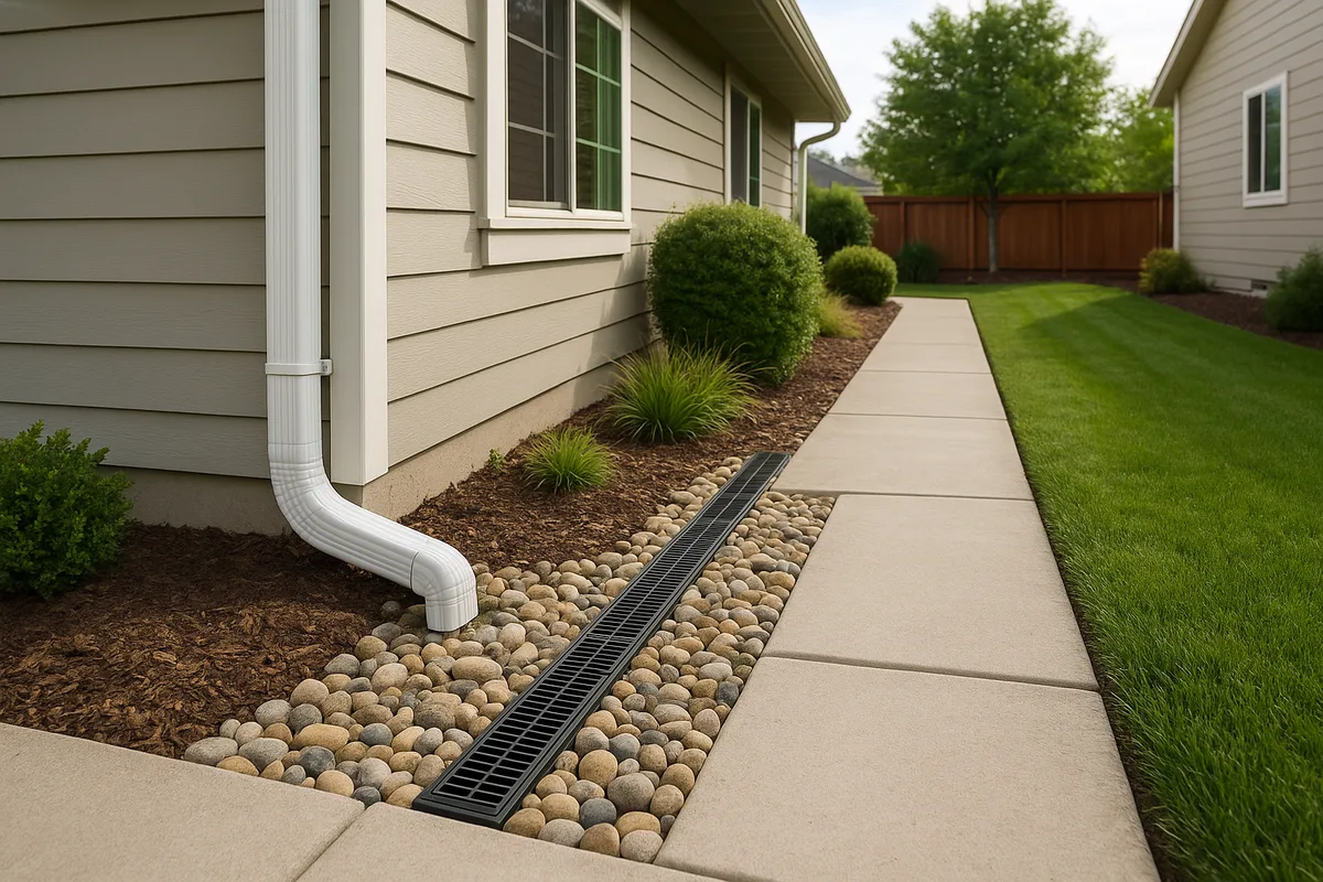
Step 3: Inspect Your Downspout Discharge
Walk around your home and check every downspout. In Jacksonville's heavy rain environment, each downspout on a typical home can discharge 500–1,000 gallons during a major storm. If those downspouts are dumping water directly at the foundation — or worse, into splash blocks that have settled and now direct water back toward the house — you've found a major contributor to your drainage problem.
Every downspout should discharge at least 6 feet from the foundation, and ideally should connect to an underground pipe that carries water to a positive outfall point (a swale, storm drain, or dry well).
Step 4: Investigate the Water Table
If you're seeing water seeping up from below rather than flowing across the surface, you may be dealing with a high water table condition. This is common in Jacksonville, particularly:
- In neighborhoods near the St. Johns River and its tributaries
- In the Beaches communities where the water table is influenced by ocean levels
- In low-lying areas on the Northside and Westside
- During the wet season (June–September) when the surficial aquifer is fully recharged
You can test your water table level by digging a hole 2–3 feet deep in your yard and observing whether water seeps in and how high it rises. If water appears within 18 inches of the surface, you have a high water table that will limit your drainage options.
The NRCS soil survey data for Duval County includes seasonal high water table estimates for every soil type, which can give you a baseline expectation.
Step 5: Check the Municipal System
Sometimes the problem isn't on your property at all — it's downstream. If the city storm drain or swale system that your property drains to is blocked, undersized, or failing, no amount of on-site drainage work will solve your problem.
Jacksonville residents can report stormwater drainage concerns through the city's 630-CITY (630-2489) service line or through the MyJax online portal. The city's stormwater maintenance division will investigate and, if the problem is within the public system, schedule repairs. However, response times vary significantly, and chronic system deficiencies may require capital improvement projects that take years to fund and construct.
Common Drainage Solutions for Jacksonville Properties
The right solution depends on your specific problem. Here's what works in Jacksonville's unique conditions — and what doesn't.
Regrading and Swale Restoration
Best for: Properties where settling has altered the original grades, homes where water pools near the foundation, lots where front or side swales have been filled in or flattened.
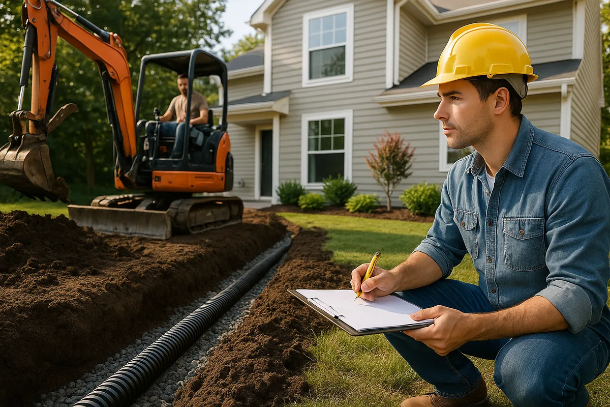
How it works: A grading contractor reshapes the soil around your home to restore proper drainage slopes. In Jacksonville, this typically involves bringing in clean fill sand to build up low areas and re-establishing swale profiles between properties.
Jacksonville-specific considerations:
- Use FDOT-specification clean fill sand, not topsoil or organic material, for building up grades. Organic material holds water — exactly what you don't want near a foundation.
- In many Jacksonville neighborhoods, the front swale is technically within the city's right-of-way, but the homeowner is responsible for maintaining it. Restoring a front swale may require coordination with the city to ensure it connects properly to the downstream system.
- Regrading must be done carefully around mature trees, which are protected by Jacksonville's tree ordinance. Significant grade changes within a tree's drip line can damage or kill it.
Typical cost in Jacksonville: $1,500–$5,000 for a typical residential regrading project. More complex projects involving significant fill or swale reconstruction can run $5,000–$12,000.
French Drains and Curtain Drains
Best for: Intercepting subsurface water flow, managing high water table conditions at the perimeter of a home, collecting water from saturated areas and redirecting it.
How it works: A trench is excavated, lined with filter fabric, filled with gravel, and fitted with a perforated pipe that collects water and carries it to an outfall point. French drains work by gravity, so they require a positive slope to an outlet.
Jacksonville-specific considerations:
- The high water table in many Jacksonville neighborhoods means French drains may need to be relatively shallow (12–18 inches) to stay above the water table. A French drain installed below the water table will simply fill with groundwater and provide no benefit.
- Sandy soils are ideal for French drain installation because they don't clog the filter fabric as quickly as clay soils. However, fine sand can migrate into the gravel over time if the fabric isn't properly installed.
- Finding a viable outfall point is often the biggest challenge. The drain needs somewhere to discharge — a swale, a storm drain, a retention area. If your property doesn't have a positive outfall, a French drain alone won't solve the problem.
- NDS manufactures a range of French drain components including channel drains, catch basins, and pipe fittings that are widely available at Jacksonville building supply stores.
Typical cost in Jacksonville: $25–$50 per linear foot installed, depending on depth and complexity. A typical residential French drain system runs $3,000–$8,000.
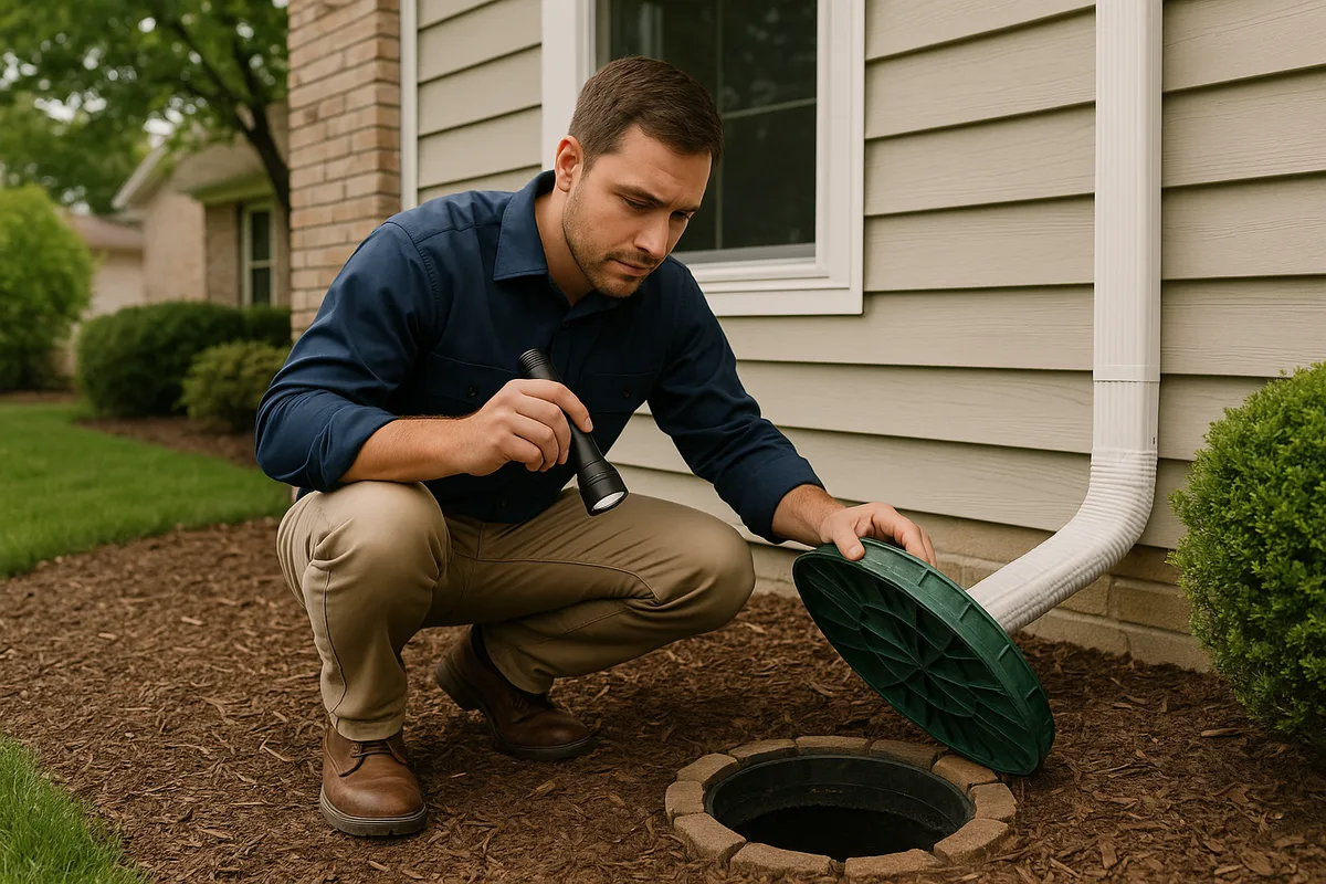
Dry Wells
Best for: Properties where there's no surface outfall point for drainage, areas with adequate soil permeability and sufficient depth to the water table, managing downspout discharge.
How it works: A dry well is an underground chamber (either a perforated barrel, a stack of concrete rings, or a manufactured plastic unit) that receives stormwater and allows it to slowly percolate into the surrounding soil.
Jacksonville-specific considerations:
- Dry wells work exceptionally well in Jacksonville's sandy soils — when the water table is deep enough. You need at least 3–4 feet of unsaturated soil below the bottom of the dry well for it to function. In areas with high water tables, dry wells may fill up and overflow during the wet season.
- Sizing is critical. A dry well receiving discharge from two or three downspouts during a heavy Jacksonville thunderstorm needs to be large enough to buffer the peak flow. Undersized dry wells are a common failure point.
- The city generally does not require permits for residential dry wells that serve only roof runoff, but check with the Building Inspection Division if your project is in a flood zone.
Typical cost in Jacksonville: $1,500–$4,000 per unit installed, depending on size and depth.
Sump Pump Systems
Best for: Properties with chronically high water tables, homes with below-grade spaces (uncommon in Jacksonville but present in some older neighborhoods), situations where gravity drainage isn't possible.
How it works: A sump basin is installed at the lowest point of the drainage problem area. Water collects in the basin and is pumped out through a discharge pipe to a suitable outfall point.
Jacksonville-specific considerations:
- Sump pumps are more common in Jacksonville than many people realize, particularly in neighborhoods like San Marco, Riverside, Avondale, and Ortega where older homes sit on lower ground near the river.
- Power reliability is a concern. Jacksonville experiences frequent thunderstorm-related power outages during the summer months — exactly when you need the pump most. A battery backup or generator-powered backup is essential.
- Discharge must go to an appropriate location. Pumping water onto a neighbor's property or into the street is not permitted and can result in code enforcement action.
Typical cost in Jacksonville: $2,000–$5,000 for a complete sump pump system with backup power.
Retention and Infiltration Features
Best for: Managing stormwater on larger lots, reducing runoff volume, meeting stormwater management requirements for additions or new impervious surfaces.
Jacksonville's flat terrain and sandy soils make the city well-suited for on-site stormwater retention features. These include:
- Rain gardens: Shallow, planted depressions designed to capture and infiltrate roof runoff and surface water. The American Society of Landscape Architects provides design guidance for residential rain gardens. In Jacksonville's sandy soils, rain gardens drain quickly and can be planted with native species like muhly grass, coontie, and blue flag iris.
- Bioswales: Vegetated channels that slow and filter stormwater as it moves across a property. These are particularly effective along property lines or between homes in Jacksonville subdivisions.
- Permeable pavement: Driveways and patios constructed with permeable pavers, porous concrete, or gravel-grid systems that allow water to infiltrate rather than run off. The Low Impact Development Center provides technical resources on permeable pavement design.
Typical cost in Jacksonville: Rain gardens: $1,000–$3,500. Bioswales: $15–$30 per linear foot. Permeable pavers: $12–$25 per square foot installed.
Raising the Building Pad
In extreme cases — particularly for properties that flood repeatedly due to their elevation relative to surrounding land or water bodies — the most effective solution may be to raise the structure. Jacksonville has an active elevation program for properties in repetitive loss areas, and FEMA's Hazard Mitigation Grant Program sometimes provides funding assistance.
This is a major project (typically $50,000–$150,000+ for a single-family home) but may be the only permanent solution for properties that sit below the base flood elevation.
Neighborhood-Specific Drainage Challenges
Jacksonville's size and geographic diversity mean that drainage challenges vary dramatically by area. Here's what property owners in specific parts of the city should know.
San Marco, Riverside, and Avondale
These historic neighborhoods sit on relatively low ground along the St. Johns River and its tributaries. Drainage challenges include:
- Tidal influence: The river's tidal range of 1–2 feet at downtown Jacksonville means that storm drain outfalls along the river can be submerged during high tide, preventing drainage during rain events.
- Aging infrastructure: Many stormwater pipes in these neighborhoods are 60–80+ years old and are undersized by modern standards. Brick and clay pipe systems are common and prone to root intrusion and collapse.
- Combined flooding: These areas experience both riverine flooding (from the St. Johns) and stormwater flooding (from inadequate drainage capacity), and the two often occur simultaneously during nor'easters and tropical events.
- Older home construction: Many homes in these neighborhoods lack modern moisture management features. Crawl spaces, if present, may sit close to the water table.
The Beaches (Jacksonville Beach, Neptune Beach, Atlantic Beach)
The barrier island communities face a unique set of drainage challenges:
- Extremely high water table: The freshwater lens beneath the barrier island sits very close to the surface, particularly on the west (Intracoastal) side.
- Saltwater influence: Coastal flooding and saltwater intrusion can affect both stormwater infrastructure and landscaping.
- Limited outfall options: Stormwater on the barrier island must drain either to the ocean (east) or the Intracoastal Waterway (west), and both are tidally influenced.
- Sandy soil paradox: The pure sand soils drain well vertically, but with the water table so high, there's often nowhere for the water to go.
Mandarin and the Southside
These suburban areas developed primarily from the 1970s through the 2000s and have their own characteristic issues:
- Subdivision-era drainage systems: Stormwater management in these areas relies heavily on retention ponds and swale systems that were designed for the original development density. As properties have been modified — patios added, pools installed, driveways expanded — impervious coverage has increased beyond what the original systems were designed to handle.
- Settling fill: Many subdivisions in these areas were built on filled wetlands or low-lying areas. Decades of settlement have altered grades throughout these communities.
- Pond maintenance failures: Retention ponds that haven't been properly maintained can lose 30–50% of their storage capacity to sediment accumulation, leading to increased flooding in surrounding properties.
The Westside and Argyle
Rapid development on Jacksonville's Westside has created significant drainage pressure:
- Conversion of natural drainage: Large-scale subdivision development has replaced natural drainage patterns with engineered systems that must be maintained to function.
- Clay lenses: While Jacksonville's soils are predominantly sandy, the Westside has areas with clay lenses — subsurface layers of clay that impede vertical drainage and create perched water table conditions.
- Downstream capacity: As development has expanded westward, the downstream receiving waters (tributaries of the St. Johns) have been asked to handle increasing volumes of stormwater, sometimes exceeding their capacity.
The Northside and Arlington
These areas present a mix of older development near the river and newer subdivisions further inland:
- Trout River flooding: Properties along the Trout River and its tributaries are subject to both riverine and tidal flooding.
- Limestone near the surface: Parts of Arlington have limestone relatively close to the surface, which can complicate excavation for drainage systems and create unpredictable water movement patterns.
- Aging infrastructure: Older Northside neighborhoods have stormwater systems dating to the 1950s and 1960s that are well past their design life.
Seasonal Drainage Considerations in Jacksonville
Managing drainage in Jacksonville requires understanding the seasonal cycle and planning accordingly.
Dry Season (November–April)
This is the optimal time for drainage construction and repair. The water table is at its lowest, soil conditions are workable, and you're less likely to have your project interrupted by heavy rain. Most Jacksonville drainage contractors have more availability during the winter months, and you may find better pricing.
Use the dry season to:
- Perform regrading work — Soil is easier to compact and shape when it's not saturated.
- Install French drains and dry wells — You can excavate deeper and see the actual water table level.
- Repair or replace downspout extensions — Get these in place before the summer rains begin.
- Clean and inspect retention ponds and swales — Vegetation is less aggressive in winter, making maintenance easier.
The Cooperative Extension System provides seasonal landscaping and drainage maintenance guidance applicable to northeast Florida's climate.
Wet Season (May–October)
This is when drainage problems reveal themselves — and when you need your systems to perform. During the wet season:
- Monitor your property during storms — Take photos and video of water behavior. This documentation is invaluable for diagnosing problems and for any future insurance claims or property disclosures.
- Keep swales and drain inlets clear — Debris from summer storms can block drainage pathways quickly. Check after every major storm.
- Test sump pump systems monthly — Don't wait for a flood to discover your pump has failed.
- Watch for erosion — Jacksonville's sandy soils are highly erodible during heavy rain. Erosion channels can develop quickly and undermine foundations, driveways, and retaining walls.
Hurricane Season (June–November)
Jacksonville's hurricane preparedness should include drainage-specific steps. Ready.gov provides comprehensive flood preparedness guidance, but Jacksonville homeowners should also:
- Clear all drainage pathways before a storm — Clean gutters, check downspout connections, clear swale inlets and catch basins.
- Know your flood zone and evacuation route — If you're in Zone AE or VE, understand your evacuation triggers.
- Document your property's pre-storm condition — Photos and video of your home and yard in dry conditions are essential for insurance claims.
- Have a sump pump backup plan — If you rely on a sump pump, ensure your battery backup is charged and you have a generator available.
If your property sustains flood or drainage damage from a declared disaster, the Small Business Administration offers low-interest disaster loans for homeowners to repair and improve their properties, including drainage system improvements.
Costs and Contractor Considerations in the Jacksonville Market
What to Expect to Pay
Drainage project costs in Jacksonville are influenced by the city's active construction market, sandy soil conditions (which generally make excavation easier and cheaper than in clay or rock areas), and the availability of fill material. Here's a summary of typical costs as of early 2026:
| Solution | Typical Cost Range | Notes |
|---|---|---|
| Regrading (foundation perimeter) | $1,500–$5,000 | Depends on area and fill volume |
| Swale restoration | $1,000–$4,000 | Per swale; may require survey |
| French drain system | $3,000–$8,000 | 50–150 linear feet typical |
| Dry well (single unit) | $1,500–$4,000 | Size and depth dependent |
| Downspout extensions (underground) | $1,200–$3,500 | For 4–6 downspouts |
| Sump pump system | $2,000–$5,000 | Including backup power |
| Rain garden | $1,000–$3,500 | Size and planting dependent |
| Permeable paver driveway | $8,000–$20,000+ | Full driveway replacement |
| Comprehensive drainage system | $8,000–$25,000+ | Multiple solutions combined |
Choosing a Contractor
The Jacksonville market has many general contractors who offer drainage services, but drainage work requires specific expertise. When selecting a contractor:
- Verify licensing. Florida requires contractors performing drainage work to hold appropriate licenses. A General Contractor (CGC) or Building Contractor (CBC) license covers most residential drainage work. Specialty plumbing licenses may be required for work connecting to municipal stormwater systems.
- Ask for drainage-specific references. A contractor who builds great decks may not understand the nuances of grading, pipe sizing, and water table management.
- Require a written scope of work that includes specific grades, pipe sizes, materials, and outfall locations. "We'll fix the drainage" is not an acceptable scope.
- Confirm they'll pull necessary permits. If your project requires a stormwater or floodplain permit, make sure the contractor handles this — or that you understand the process if you're managing it yourself.
- Get a warranty. Reputable drainage contractors in Jacksonville typically offer 1–2 year warranties on their work. Drainage systems should function correctly through at least one full wet season.
The American Society of Civil Engineers and the Water Environment Federation maintain professional standards for stormwater management that knowledgeable contractors should be familiar with.
When to Hire an Engineer
Some drainage problems are beyond the scope of a contractor and require a licensed Professional Engineer (PE) or a licensed landscape architect. Consider hiring an engineer when:
- Your property floods repeatedly despite previous drainage work.
- You need to modify or connect to the municipal stormwater system.
- Your project requires a stormwater management permit.
- You're dealing with a high water table condition that requires a dewatering or pump system design.
- You suspect a structural issue (foundation settlement, retaining wall failure) related to water.
- You're in a dispute with a neighbor or HOA about drainage responsibility.
Engineering fees for residential drainage projects in Jacksonville typically range from $2,000–$8,000 depending on complexity, and the investment often pays for itself by ensuring the solution actually works.
The Real Estate Angle: Drainage and Property Value in Jacksonville
Drainage problems directly affect property values in Jacksonville, and the market is becoming increasingly sophisticated about identifying them. Several factors are driving this:
- Insurance costs. Flood insurance premiums under FEMA's Risk Rating 2.0 methodology are now individually calculated based on a property's specific flood risk characteristics. Properties with poor drainage or in flood-prone areas can face premiums of $3,000–$10,000+ annually, which directly reduces the property's market value.
- Inspection awareness. Jacksonville home inspectors are increasingly attuned to drainage issues, and many now include grading and stormwater assessments as part of their standard inspection protocols.
- Buyer expectations. In a market where buyers have access to flood zone maps, elevation certificates, and historical flood data, drainage problems are harder to hide and more likely to result in price reductions or deal failures.
- Lender requirements. Properties in FEMA flood zones require flood insurance as a condition of financing, and some lenders are beginning to scrutinize drainage conditions even on properties outside mapped flood zones.
For sellers, addressing drainage problems before listing is almost always more cost-effective than negotiating price reductions after an inspection finding. For buyers, understanding a property's drainage before making an offer can save tens of thousands of dollars in unexpected repairs.
HUD requires certain disclosures related to flood risk for properties with FHA-insured mortgages, but the requirements don't cover the full spectrum of drainage issues that affect Jacksonville properties.
Protecting Your Jacksonville Property: A Practical Action Plan
Here's a step-by-step plan for Jacksonville property owners who want to get ahead of drainage problems:
Know your flood zone. Look up your property on the FEMA Flood Map Service Center. Understand what your designation means and whether you should carry flood insurance even if it's not required.
Check your soil type. Use the USDA Web Soil Survey to understand your property's soil drainage characteristics and seasonal high water table.
Walk your property during rain. Observe water flow patterns, pooling locations, and drainage pathways. Document everything with photos and video.
Inspect your grading. Check for proper slope away from the foundation on all sides. Look for settled areas, reverse grades, and compromised swales.
Evaluate your downspouts. Ensure every downspout discharges well away from the foundation and that the discharge point has positive drainage away from the house.
Check the community system. If you live in a subdivision with retention ponds, swales, or underground stormwater pipes, understand who maintains them and whether they're functioning properly.
Address problems in order of severity. Foundation-threatening drainage issues come first. Yard ponding that's merely inconvenient can wait.
Plan work for the dry season. Schedule drainage construction between November and April when conditions are optimal.
Get professional assessment for complex problems. If simple regrading and downspout management don't solve the issue, you likely need a professional drainage evaluation.
Maintain your systems. Drainage solutions require ongoing maintenance. Clean gutters, clear swale inlets, inspect French drain outlets, test sump pumps, and monitor retention pond levels on a regular schedule.
When a Professional Assessment Makes the Difference
Jacksonville's drainage environment is complex enough that many property owners — and even experienced contractors — struggle to accurately diagnose the root cause of water problems. A property might have multiple contributing factors: a high water table, inadequate grading, a failing community stormwater system, and tidal influence, all interacting to create a problem that no single solution can address.
This is where data-driven analysis becomes essential. Understanding the full picture — soil conditions, topography, water table behavior, upstream and downstream drainage infrastructure, flood zone status, and historical water patterns — requires integrating multiple data sources and interpreting them in the context of your specific property.
Get a Drainage Intelligence Report for Your Jacksonville Property
Low Point Labs' Drainage Intelligence Report™ provides exactly this kind of comprehensive, property-specific analysis for Jacksonville homeowners, buyers, sellers, and real estate professionals. Our reports integrate soil data, topographic analysis, flood zone mapping, stormwater infrastructure assessment, and local drainage patterns to give you a clear, actionable picture of your property's drainage condition.
Whether you're buying a home in Mandarin and want to understand the drainage before you close, selling a property in San Marco and need to address drainage concerns proactively, or living in a Westside subdivision and tired of a yard that floods every summer, a Drainage Intelligence Report gives you the information you need to make smart decisions.
Stop guessing about drainage. Start with data. Order your Drainage Intelligence Report for your Jacksonville property today.
Explore our US Drainage Guide for a national perspective.
Frequently Asked Questions
Subscribe to generate reports on demand. Cancel anytime.